Although its headwaters are buried under a mountain of debris, its length severed by the Long Island Railroad, its route constrained by the Civilian Conservation Corps, and its banks lined by the remnants of an abandoned shipyard, Gabler’s Creek is one of the most successful river conservation projects in New York City.
Running roughly 6,000 feet from its head near Northern Boulevard to its mouth in Udalls Cove, this diminutive stream travels through a bucolic backyard ravine in Little Neck, Queens, which has largely been saved from developers by several generations of local volunteers. Their successful battle to preserve their neighborhood’s waterfront, and to restore it to health, continues to be one of the most impressive community organizing efforts in the city. And yet, like Hook Creek and Bridge Creek, Gabler’s Creek remains a relatively unknown Queens waterway, flowing out of sight at the very edge of the city.
The fact that Gabler’s Creek even exists today is largely due to the work of the Udalls Cove Preservation Committee (UCPC), a small neighborhood organization founded in 1969 by the concerned residents of Douglaston and Little Neck. "A golf course had been planned, filling in the wetlands. That was the pivotal moment," says Walter Mugdan, who has been the president of the group since 2002. Their initial efforts helped to create the 30-acre Udalls Park Preserve, a protected area now jointly managed by the NYC Parks Department and the NY State Department of Environmental Conservation.
Gabler’s Creek remains a relatively unknown Queens waterway, flowing out of sight at the very edge of the city.
In recent years, the UCPC has continued to protect the preserve from overdevelopment, invasive species, erosion, flooding, and a host of other challenges. "Altogether, our organization has spent between $225,000 and $250,000 over the last 12 years on various large projects," says Mugdan. "For a tiny organization like ours, that’s pretty good."
Funded by grants and donations, these projects include planting over 1,000 new trees, removing more than a million pounds of concrete rubble, building and maintaining numerous new trail systems and foot bridges, and helping the city to identify and purchase the final few properties that would make Gabler’s Creek into a single, continuous public space. "This is a last little remnant of the natural world here," explains Mugdan, reflecting on the importance of the preserve. "It is hardly a pristine wilderness, but you make the best of what you’ve got."
Like many who grew up in this tight-knit community near the border of Nassau County, Gabler’s Creek was an important part of Mugdan’s youth. In spring, he would blaze new trails through its woods; in winter, he would ice skate on its pond; in the summer, he spent every day swimming in the nearby bays. "I grew up having it as my playground. I called myself a swamp rat," says Mugdan. "It was a fabulous place to grow up. A little bit of forest in the suburbs."
Throughout his adulthood, he has continued to engage with the vital role that nature can play in a community, and has worked for the past 41 years at the Environmental Protection Agency, where he is currently helping guide the restoration of the Gowanus Canal and the Newtown Creek, two Superfunded waterways in New York City.
The successful battle to restore Gabler's Creek to health is one of the most impressive community organizing efforts in the city.
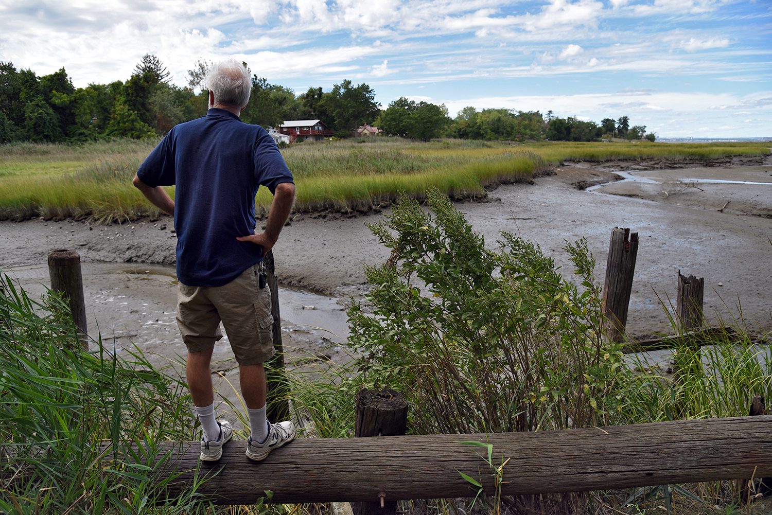
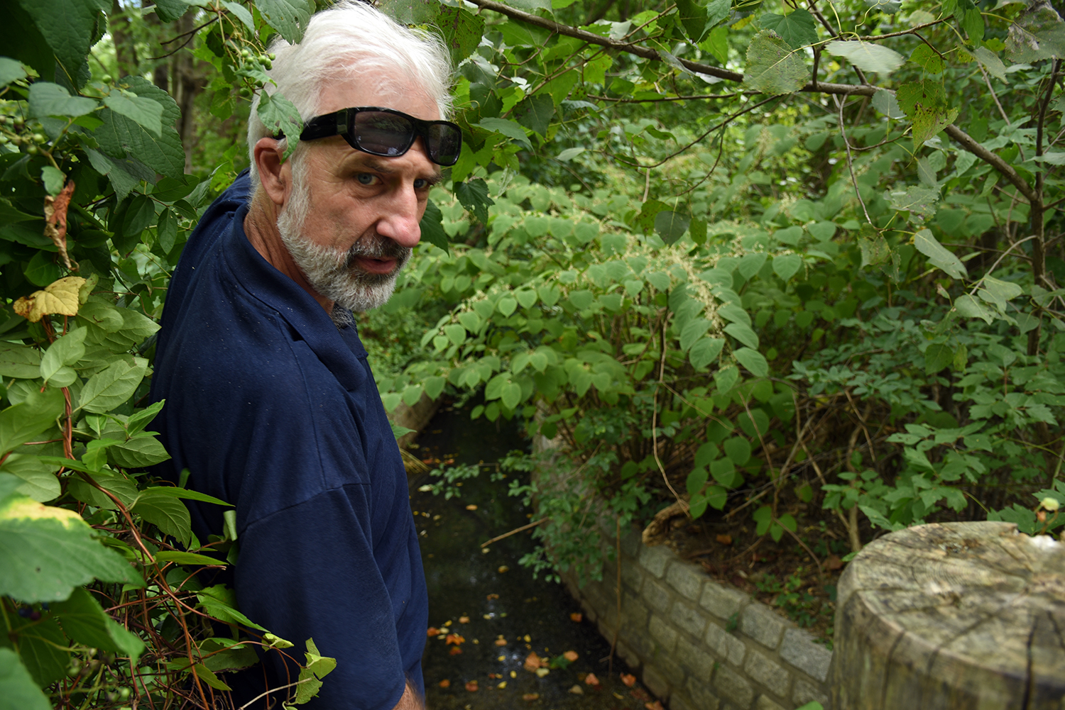
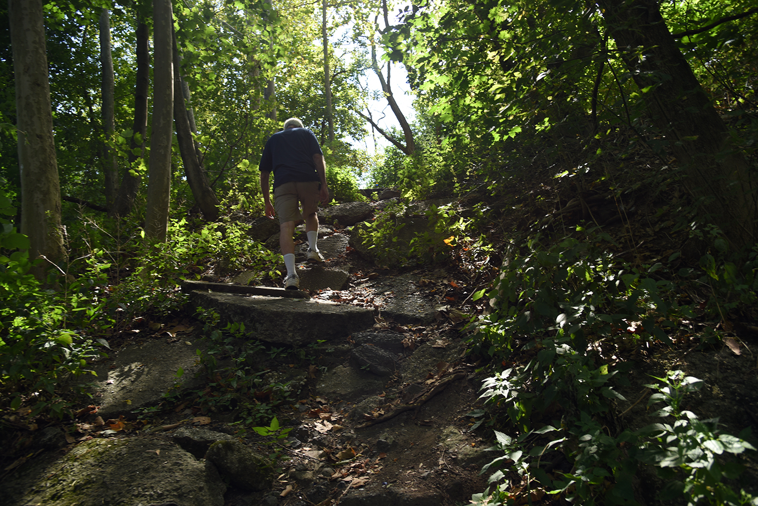
Though Mugdan is now nearing retirement age, he still retains his youthful enthusiasm for Gabler’s Creek, and a recent three-hour-long exploration of the stream involved scampering along pipelines, leaping onto old pilings, clambering up the sides of a rocky ravine, and pushing through thickets of invasive porcelain berry and kudzu. "This is what will keep me busy in my retirement … I’ve got all these little projects in mind," says Mugdan, looking out over his childhood stomping grounds. "I’ve got decades of work ahead of me."
The history of Gabler’s Creek extends far beyond the current generations that are working to preserve it. The landscape here, like nearby Alley Creek, was largely shaped by the terminal moraine, the edge of the glacier that covered this area during the last ice age, and humans didn’t arrive until about 4,000 years ago. The first written records of modern human habitation date back to at least the 1600s, when the Matinecock, a Native American tribe, settled the area.
A small community of Black oystermen also once lived and worked along the banks of the waterway, much like at Lemon Creek in Staten Island. "They would take their rowboats down Gabler’s Creek to do their oystering," says Mugdan. "They lived in the swampland and they had no inside running water. They had the bottomland, the land no one wanted." The last of their historic creekside cottages was torn down earlier this year, after hosting five generations of a single family. Despite the efforts of the UCPC, the land was sold to a private developer, who is planning to build a new multi-story structure in the heart of the preserve.
Although the Udalls Cove Preservation Committee has had a great deal of success in protecting Gabler’s Creek and the nearby wetlands, their work will never truly be finished. "There are always threats," says Mugdan. "It’s a never ending task to keep these vines from killing the trees ... The existing trails need to be constantly maintained ... We lost a lot of our older forest in the recent storms." As climate change and sea level rise continue to reshape the city’s coastline, it is clear that maintaining even this small pocket of nature will require the assistance of many generations still to come. But even today, the rewards from the struggles of past generations are something to behold. "This forest did not even exist 25 years ago," notes Mugdan, standing in a particularly lush section of the Udalls Park Preserve, now filled with birds, insects, flowers, and vines. "It could have been a city street."
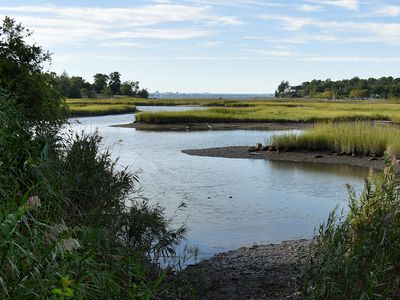
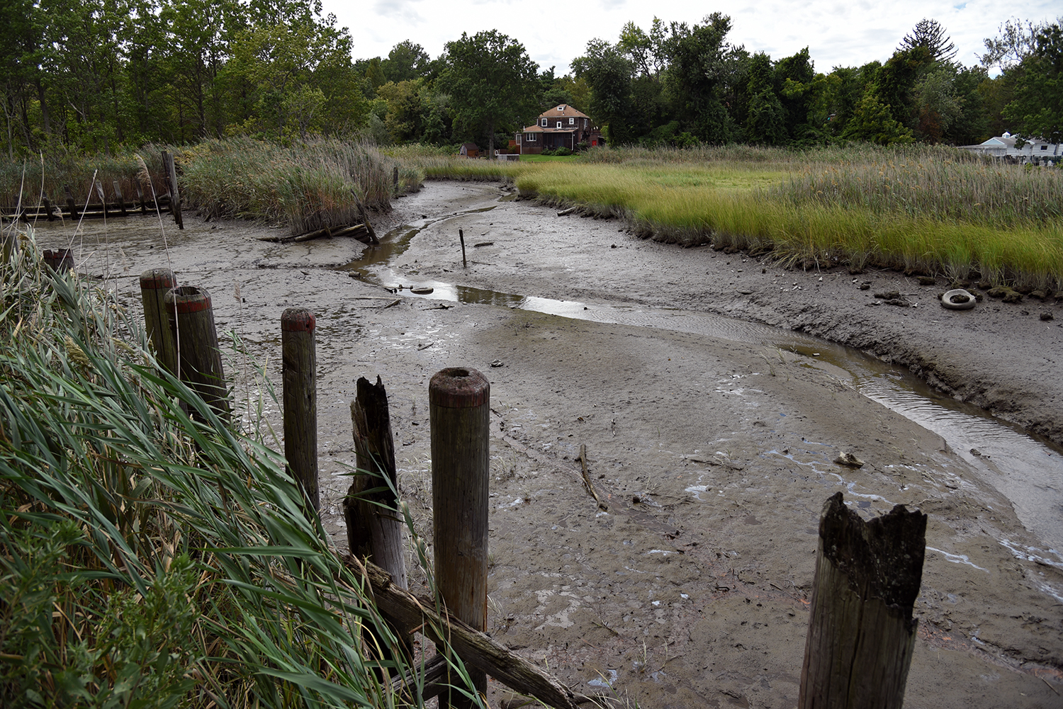
At Udalls Cove, near the mouth of Gabler’s Creek, a salt marsh provides an important habitat for birds and fish.
Looking out over the marshland from Osprey Landing, a section of the Udalls Park Preserve that has reclaimed a pile of debris dumped into the water. "We are standing on two acres of fill—asphalt, rubble," says Mugdan. A new system of trails was created here in 2012 through a forest that now grows on the landfill.
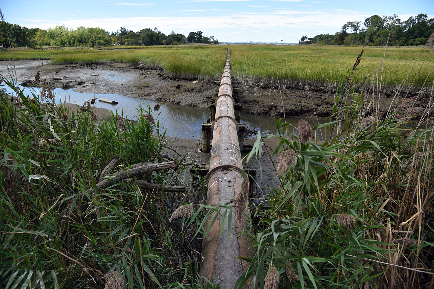
At the southeast side of Udalls Cove, a pipeline from Nassau County cuts through the marshland, pumping treated wastewater out into Little Neck Bay. "We’ve lost dozens of acres of wetland since I was a kid," says Mugdan.
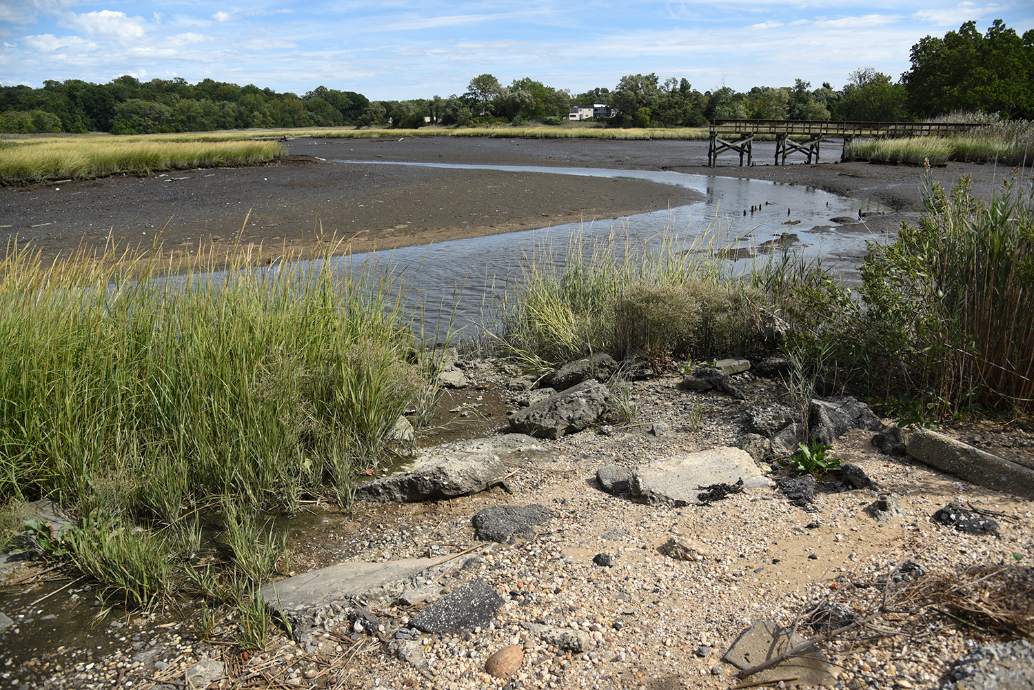
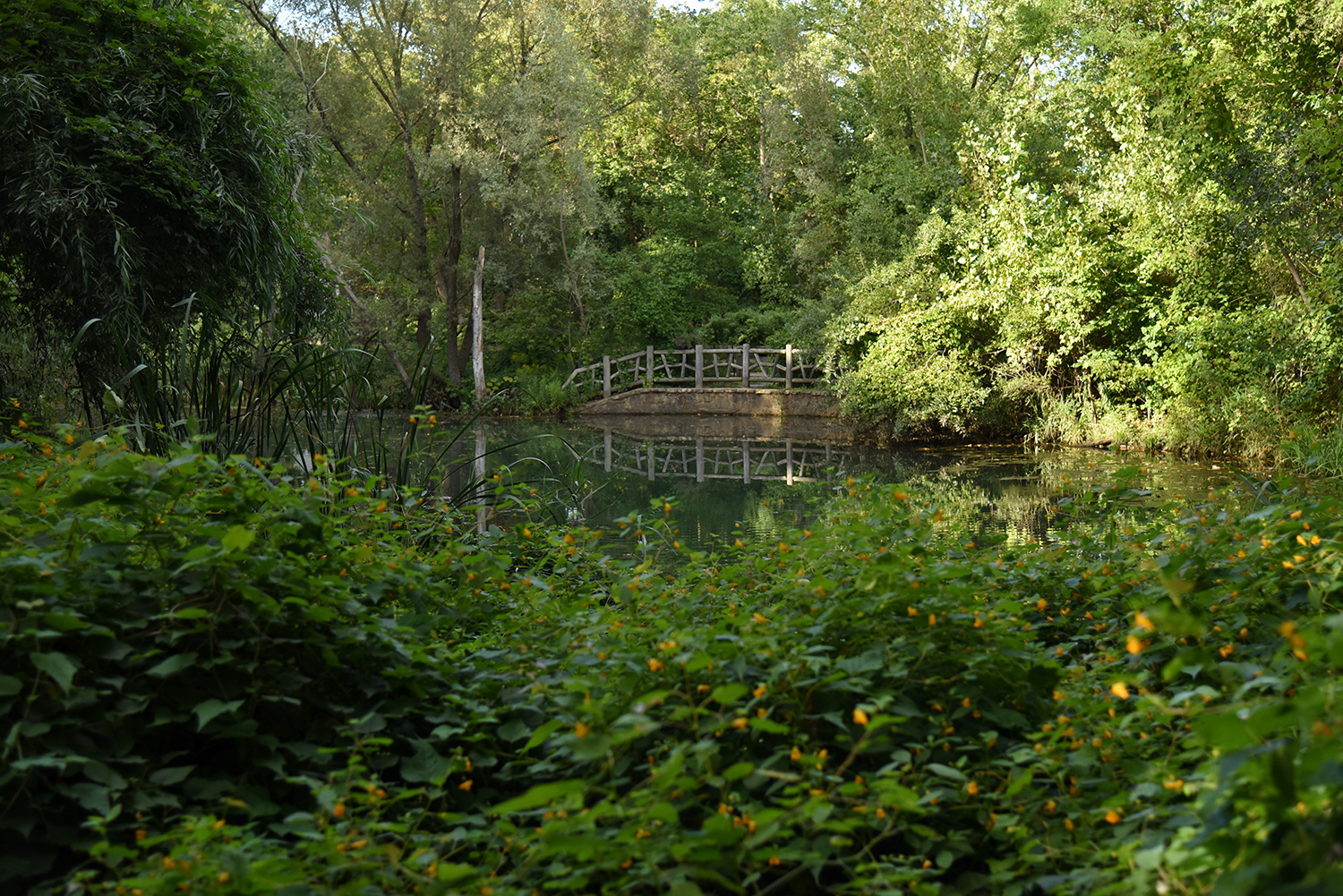
At the edge of the salt marsh, Gabler’s Creek flows by the remains of an old shipyard. "Up until the mid 1970s this was a commercial boat yard," says Mugdan. "This whole area was two big marinas." Today, the land is part of the Udalls Park Preserve, and laced with trails winding through a restored forest.
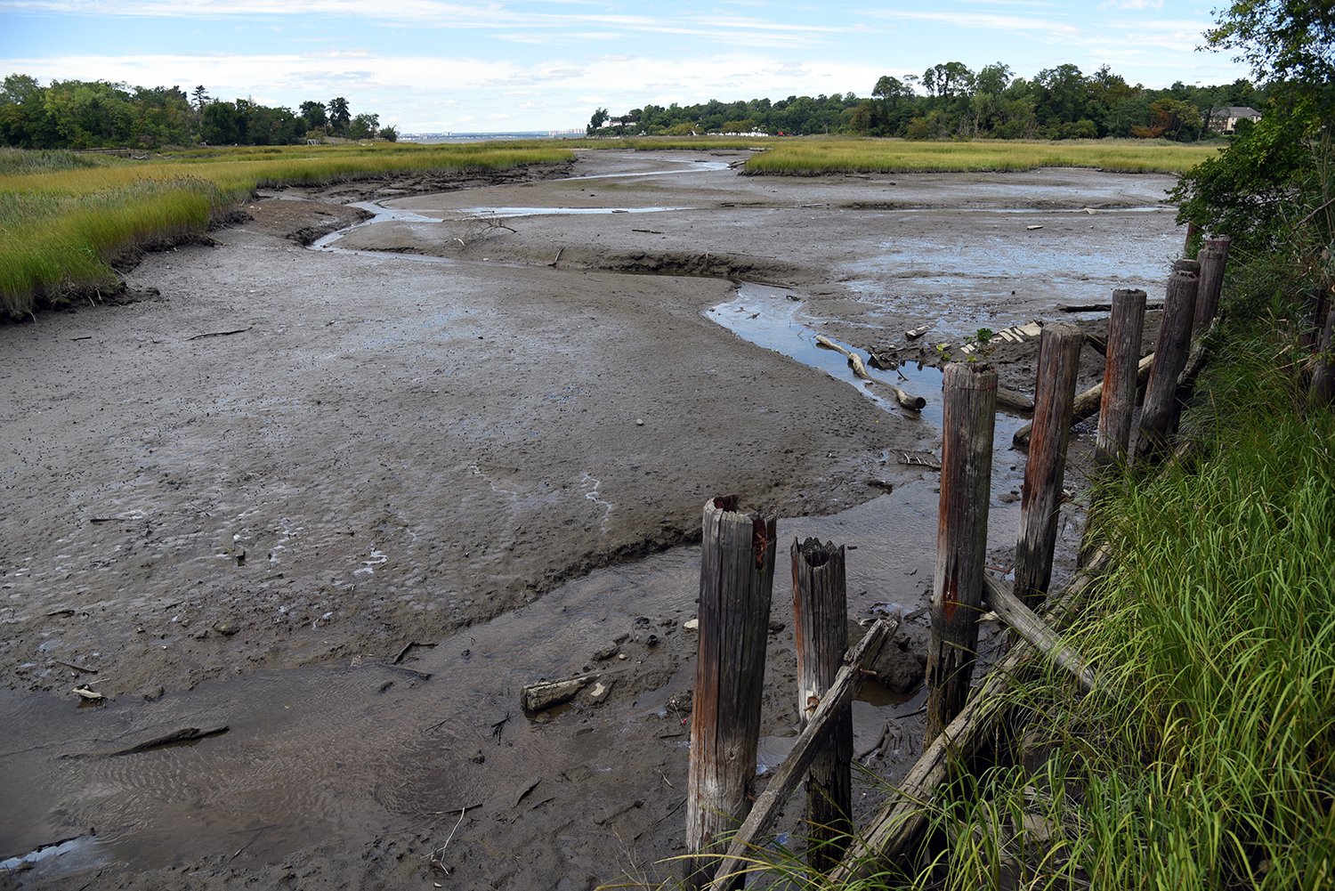
Though the Udalls Cove Preservation Committee was founded in 1969, the park did not officially open until 1990. At low tide, the narrow flow of Gabler’s Creek runs past the old pilings at Virginia Point, which was named after Virginia Dent, one of the main UCPC organizers who helped the park become reality.
The course of the creek continues to the south, past several homes built at the very edge of the waterway. "During a big storm, their first floor will be under several feet of water," says Mudgan. This entire area suffered serious flooding from Hurricane Sandy’s storm surge.
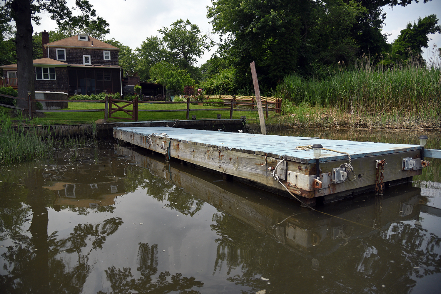
Several of the homes here have docks in their backyards leading out into Gabler’s Creek, which is a popular destination for boaters. "I’ve got a kayak that I take out there," says Mugdan.
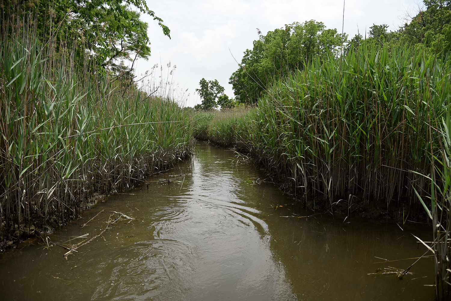
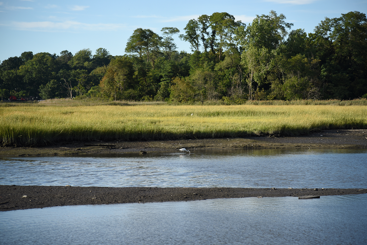
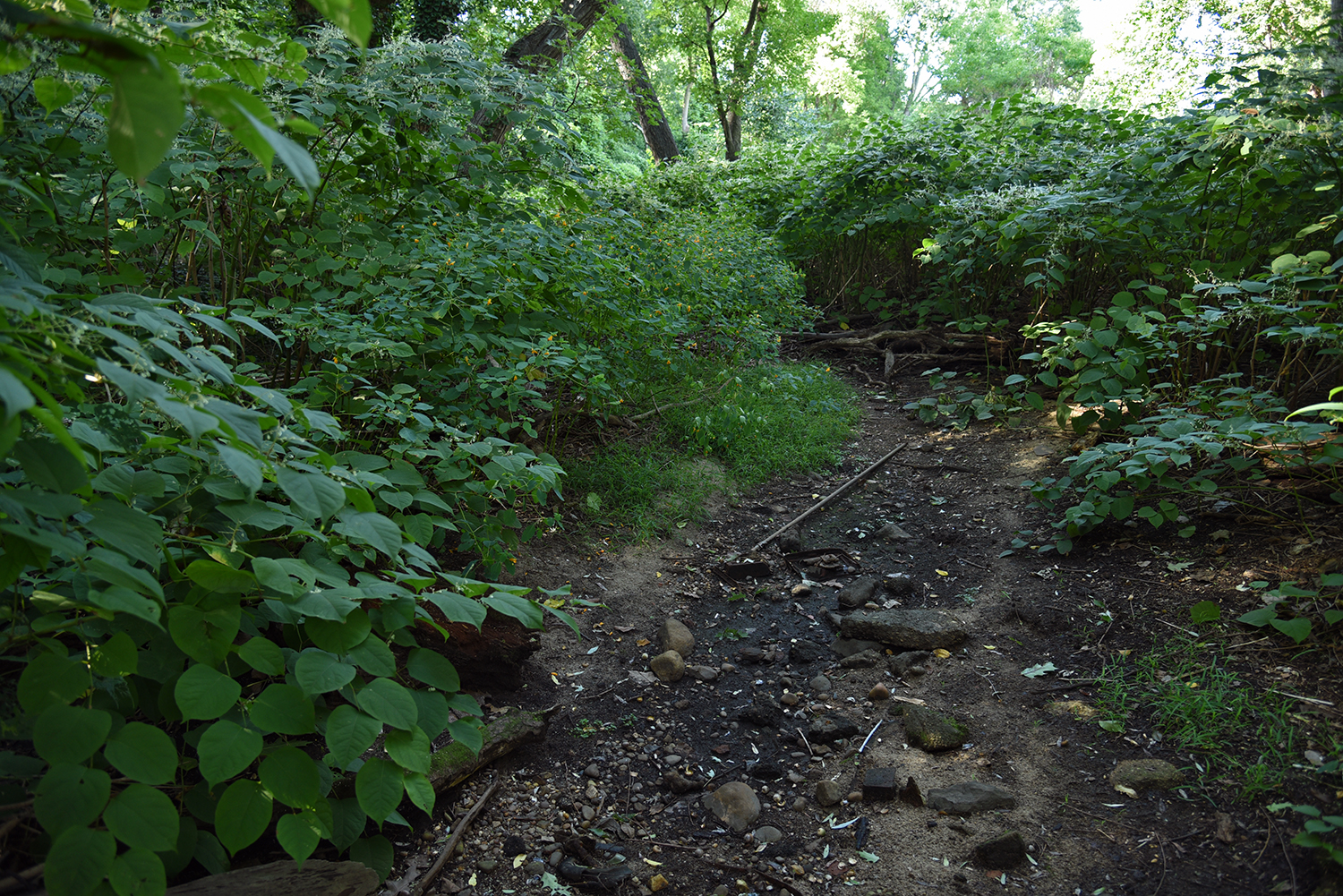
Further upstream, the creek narrows as it travels through invasive phragmites. Despite appearances, "it’s a healthy marsh," says Mugdan. "We have a lot of spartina."
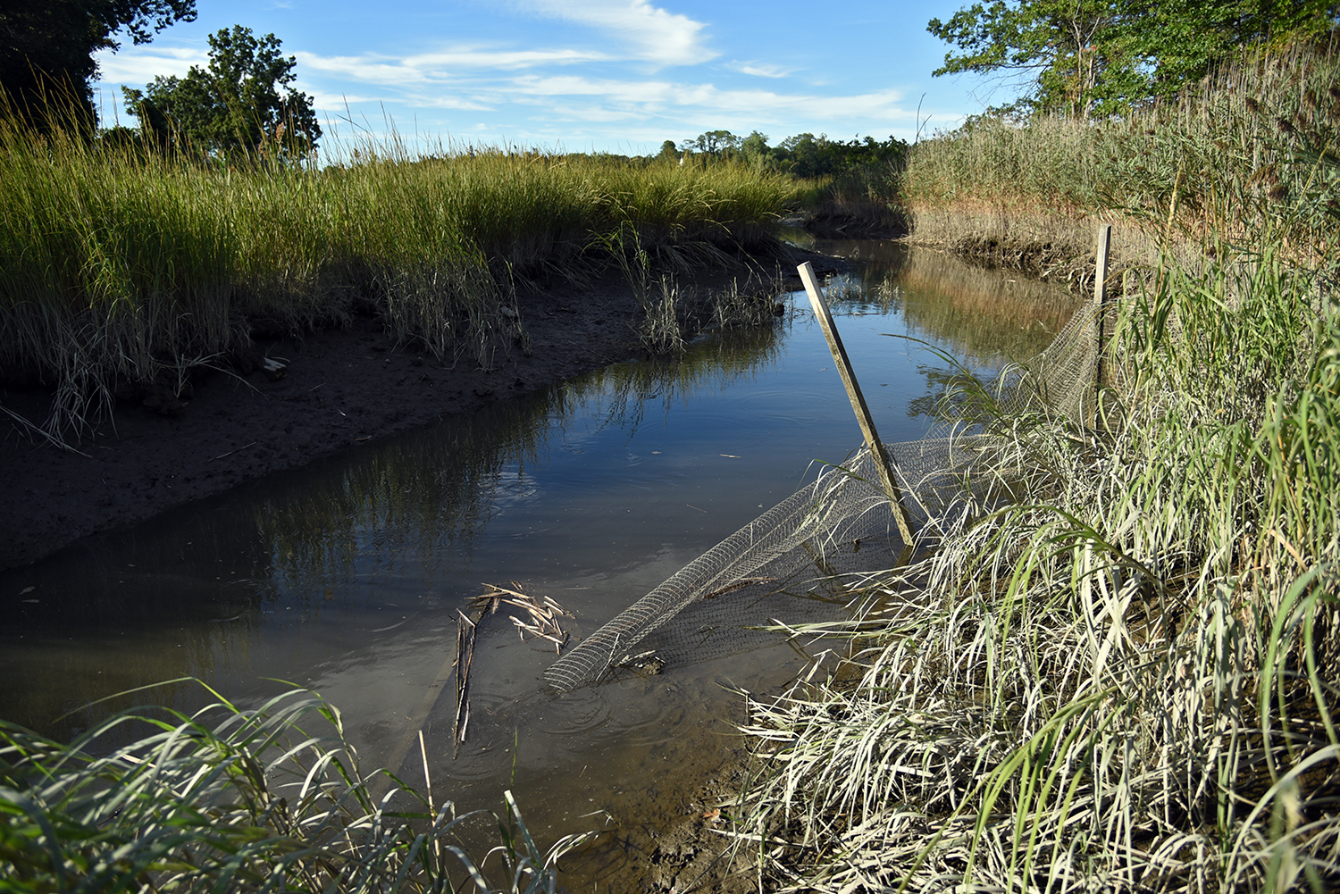
A city restoration project along the creek helped replant a large section of marsh grasses here, as part of a larger green infrastructure project improving stormwater outflow. "They built a stilling basin, took out a pile of concrete, and did a wetland restoration," says Mugdan.
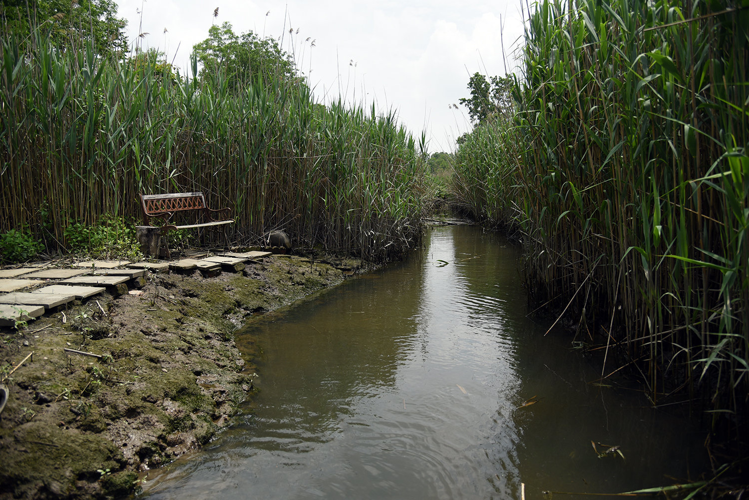
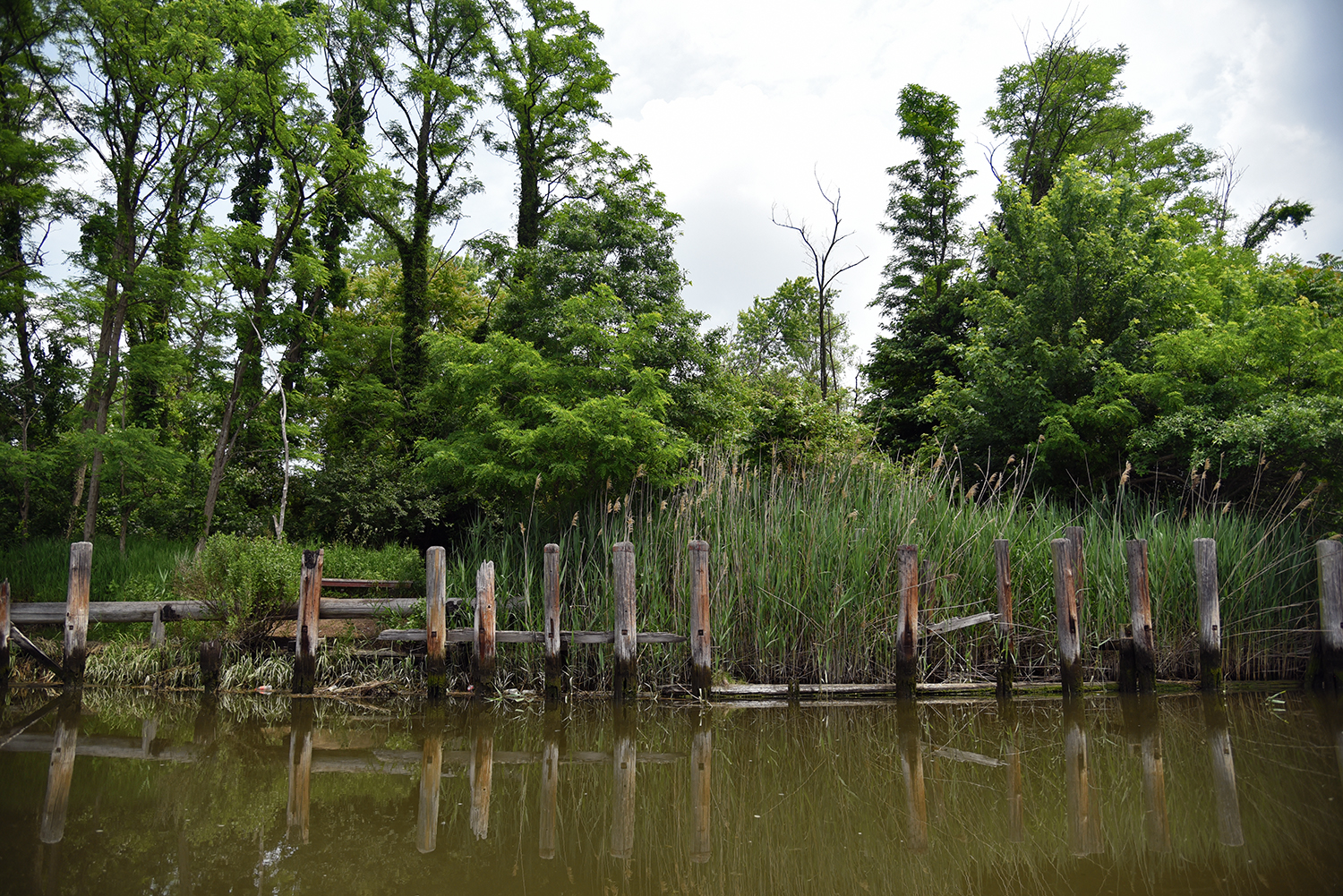
Further upstream, the creek passes by the backyard haunts of local residents. Benches and small pathways are perched at water’s edge.
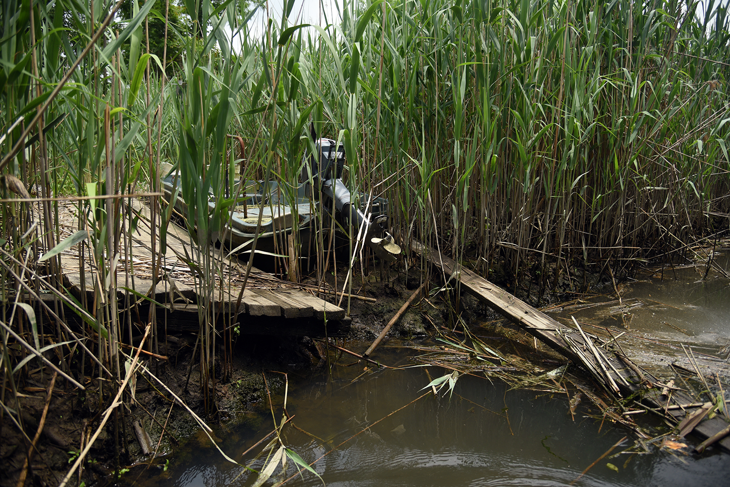
An abandoned motorboat and a collapsed pier block the creek off from further exploration, deep in the phragmites.
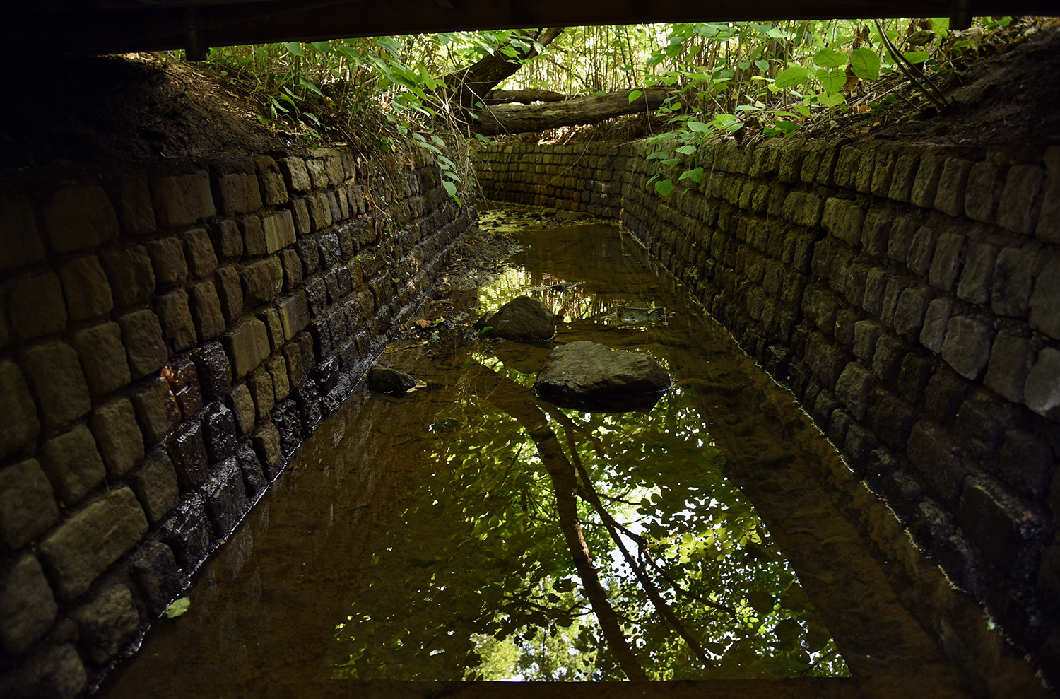
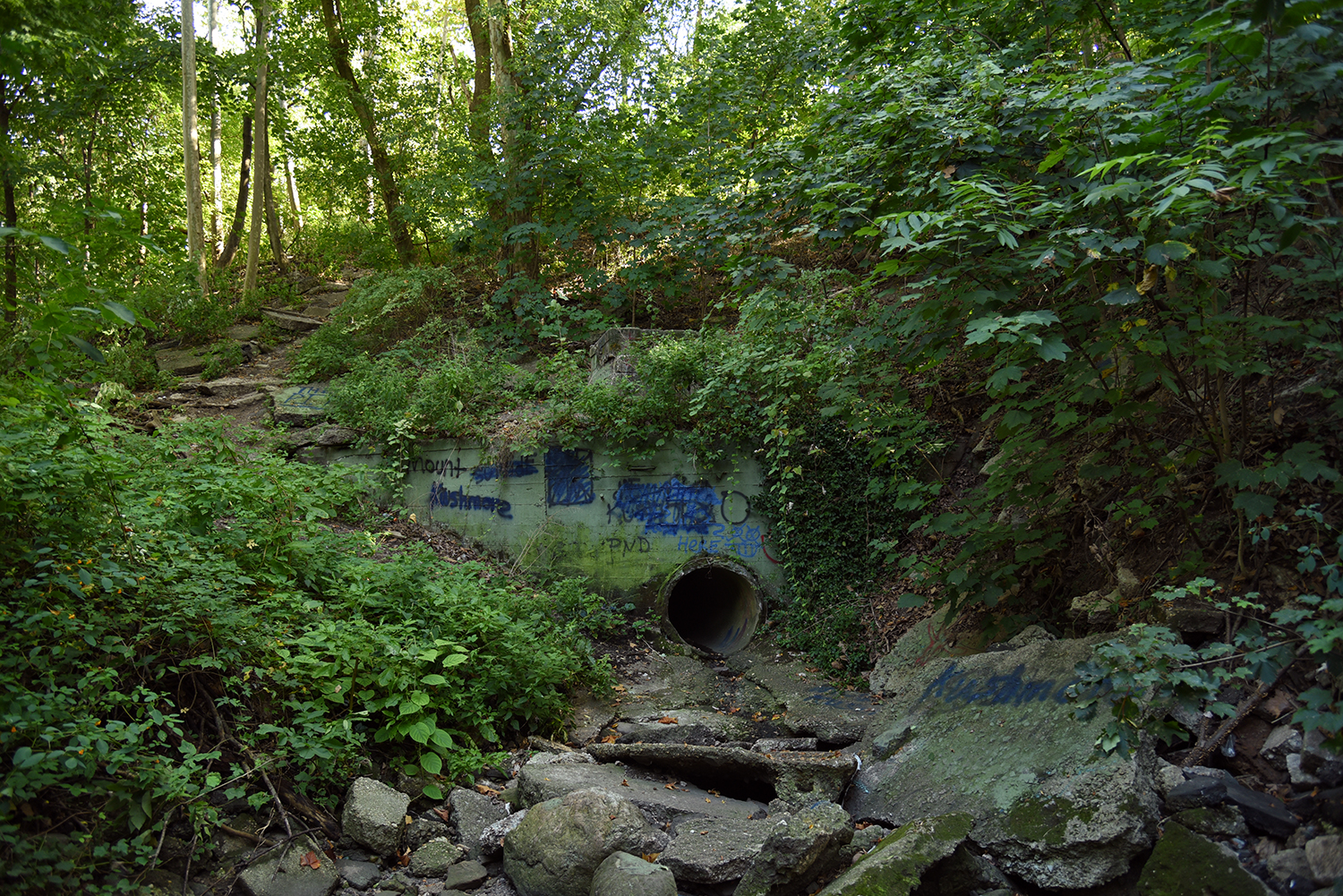
The next appearance of the Gabler’s Creek is inland at Sandhill Road, along a new culvert surrounded by an overgrown patch of porcelainberry. Sandhill Road, known to locals as the Back Road, is not an official New York City street. When paved and elevated in the 1930s, it effectively dammed the creek, according to Mugdan.
This culvert was built as part of a city restoration project at Aurora Pond that began in 2004. The pond was named after Aurora Gareiss, the co-founder of the Udalls Cove Preservation Committee.
When completed in 2006, the $1.26 million restoration had rerouted Gabler’s Creek into the pond, while also dredging its depths and returning wildlife to the area. "The pond had filled in with sediment," says Mugdan. "We have turtles in here now, and killifish."
A system of trails was also expanded and improved around the edges of the pond. "This was where I played as a kid. Most of these trails were made by kids," remembers Mugdan. "The pond has only existed since the 1930s. It used to freeze over, and kids would play hockey or go ice skating on it."
Further upstream, Gabler’s Creek flows through an older section of culvert built by the Civilian Conservation Corps in the 1930s.
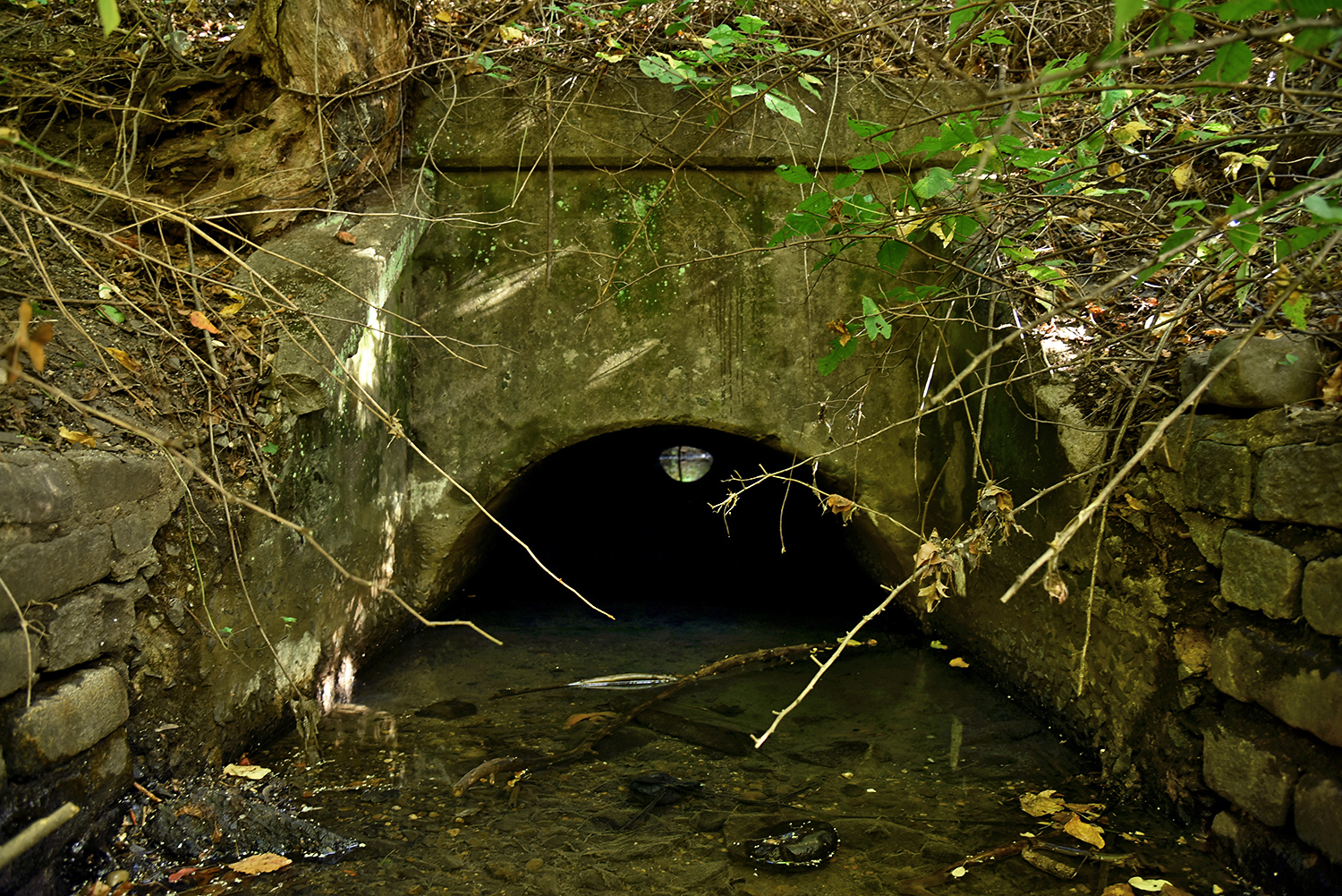
The culvert brings the creek underneath the Long Island Rail Road train tracks, which have been in operation here since the late 1800s. Upon construction, the tracks divided the Black oystermen community into two parts. "The community predated the railroad," says Mugdan.
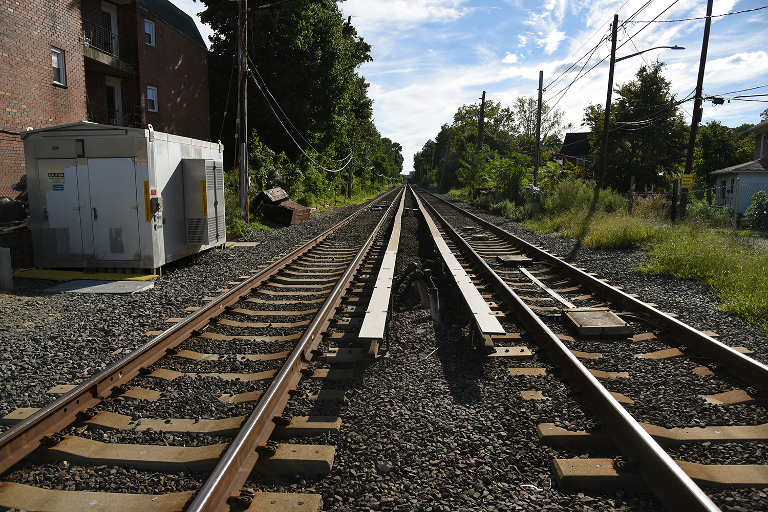
Little Neck Station opened in 1870, and is one of the last remaining street level train crossings remaining in New York City. The tracks here pass above the ravine containing Gabler’s Creek on a 20 foot high embankment.
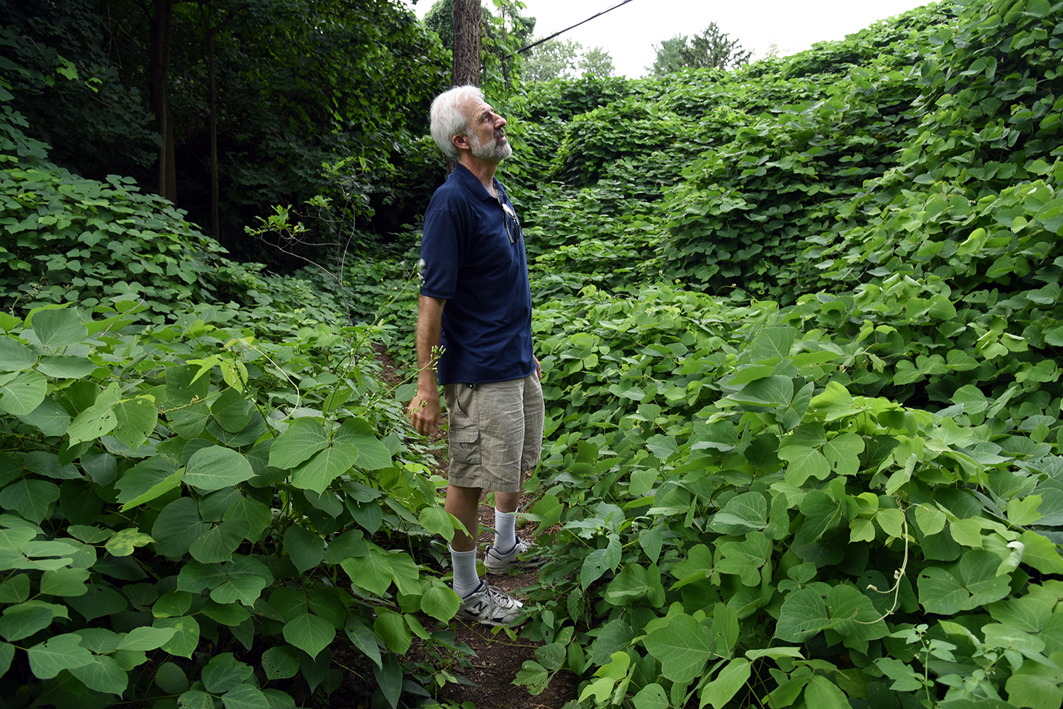
On the south side of the tracks, Kudzu, an invasive species known as "the vine that ate the South," has completely overgrown the embankment and part of the ravine. "It grows a foot a day," says Mugdan.
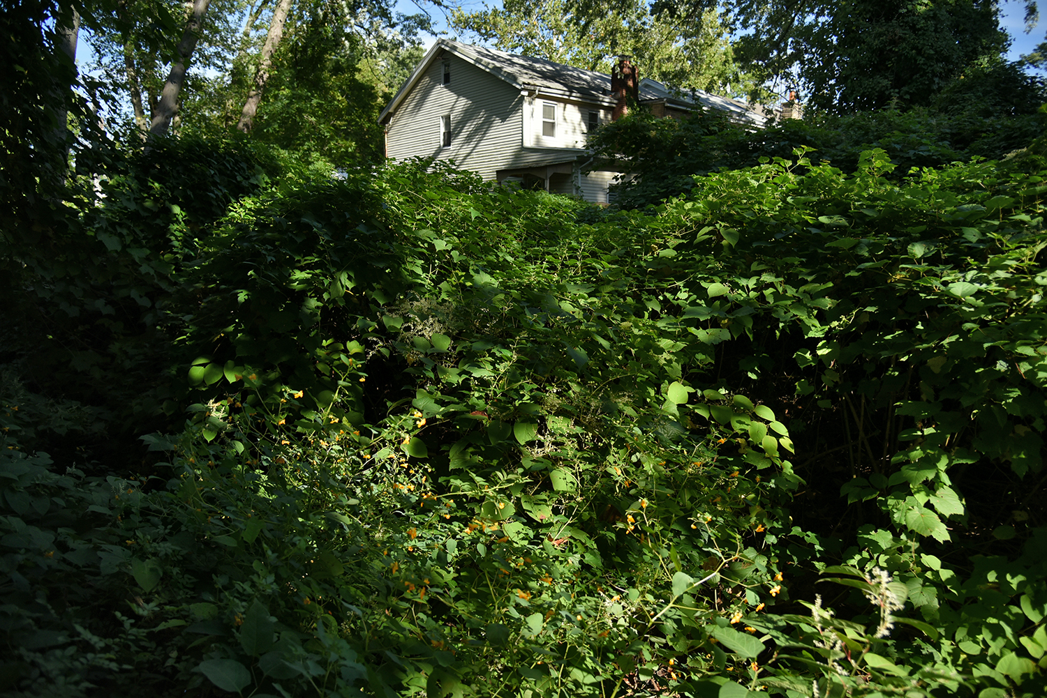
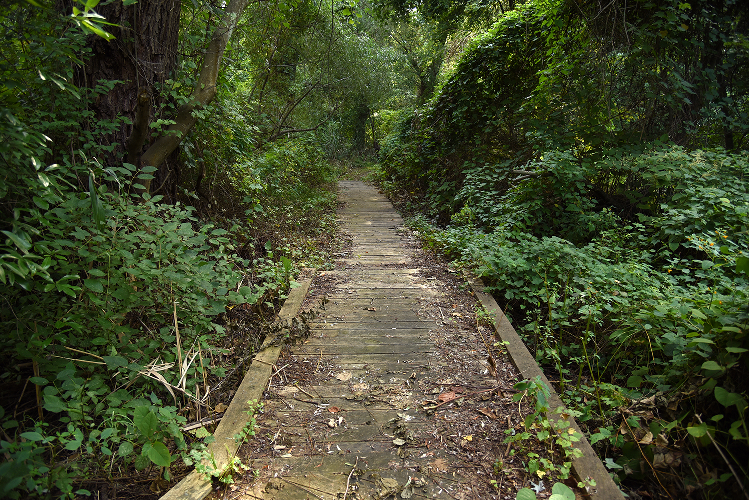
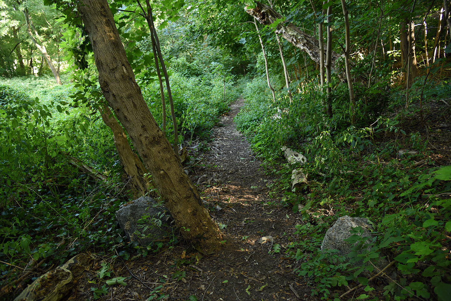
Some houses in this area were built at the same level as the creek, and look out onto a new trail system built by the UCPC. "The trail here was built two or three years ago. Prior to that, it was literally impossible to get through here. It was tons of invasive, thorny rose bushes," says Mugdan.
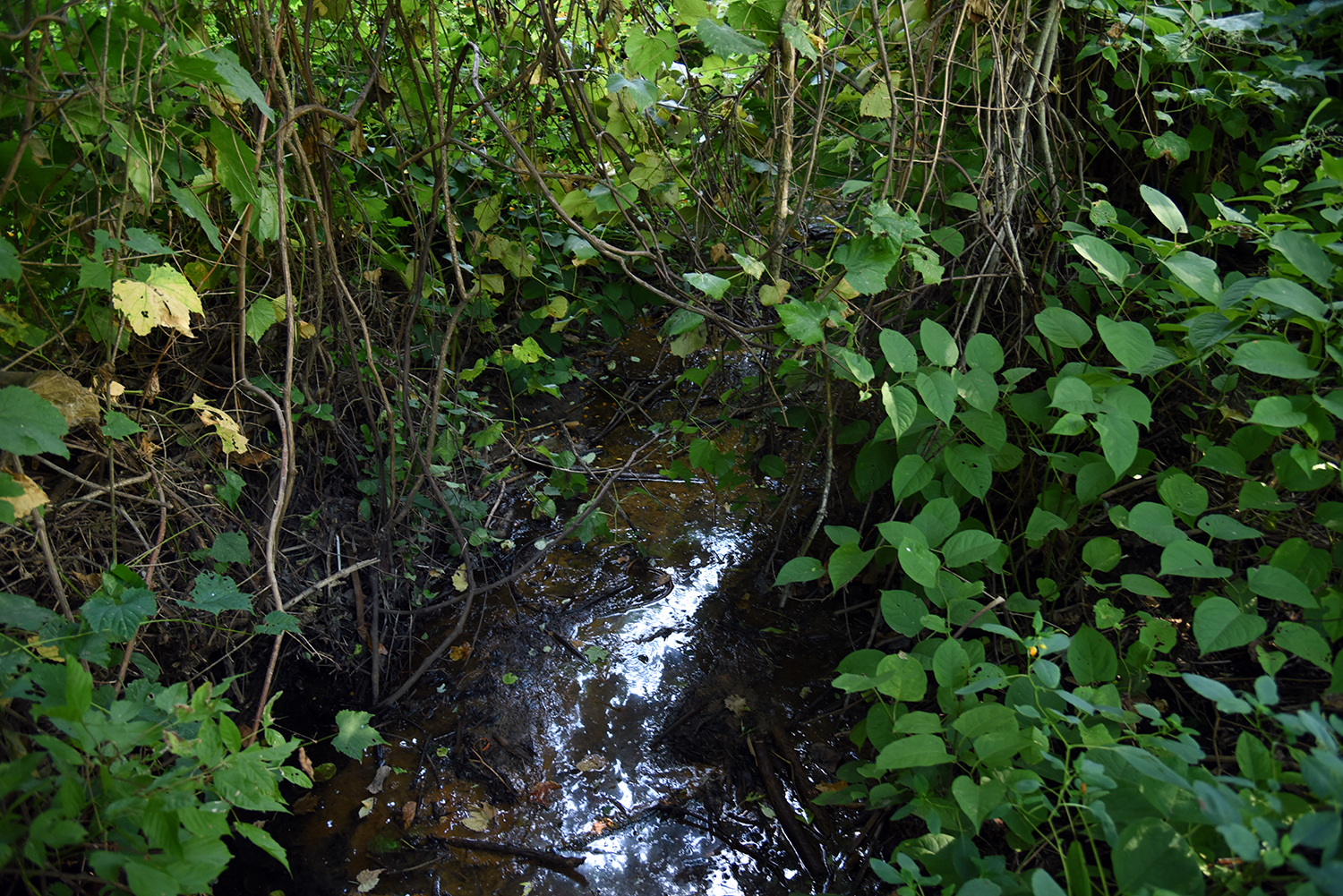
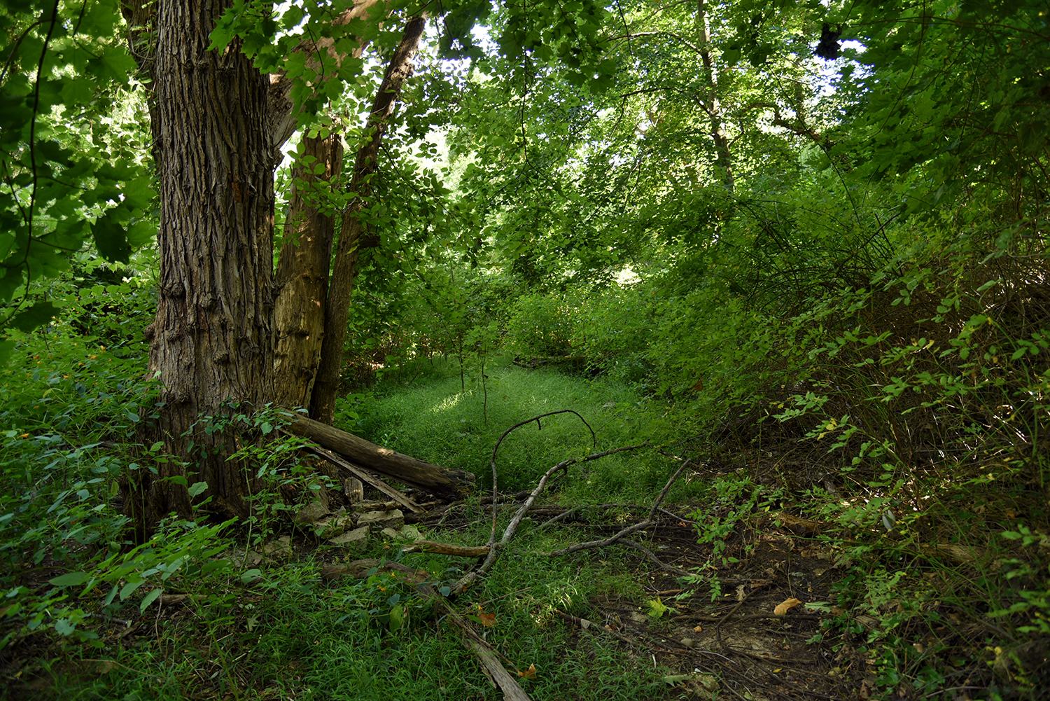
The creek appears again in the overgrowth, as a much-reduced flow. Silt and erosion flowing into the ravine have filled in much of the creekbed here.
One of the new trails following the edge of the creek. This area was where Gabler’s Creek found its name, according to Mugdan. "Gabler owned the property and had a field there called Gabler’s Field that the creek ran through," he says. "Up into the 1960s, there was a small group of houses here. It was part of the African-American community."
The flow of the creek makes one final appearance nearby, before its course vanishes underground, buried by sand, dirt, and silt.
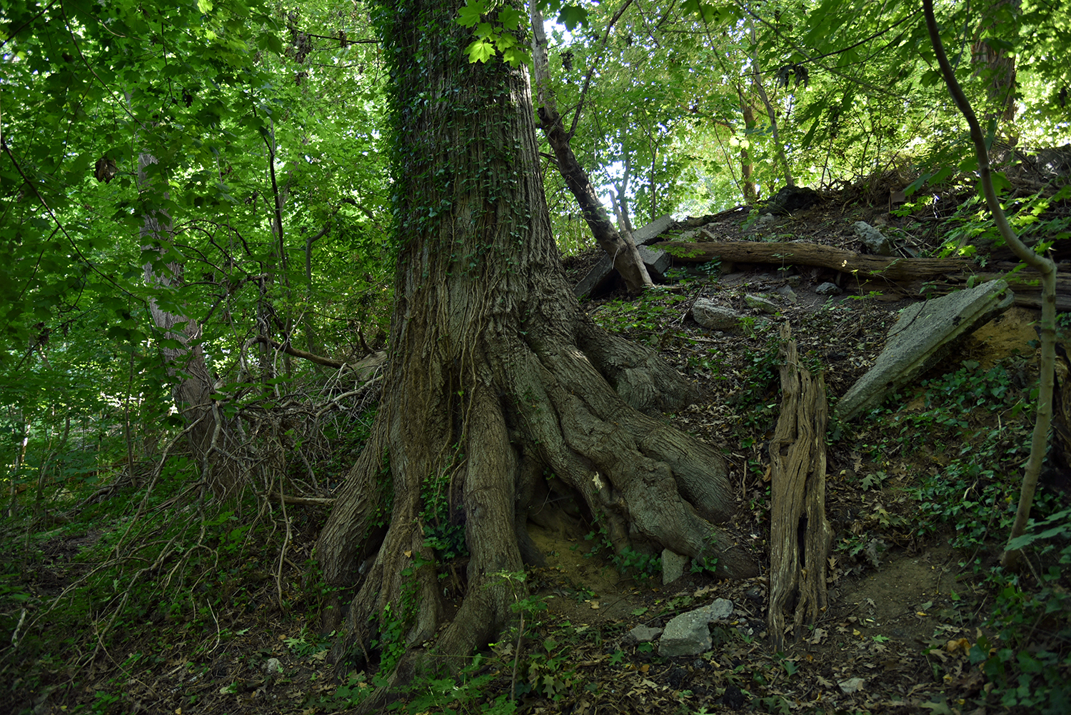
One of the oldest and largest trees still remaining along the creek. A number of mature trees were knocked down by Sandy, Irene, and other recent storms. "This has got to be hundreds of years old. You can see quite a bit of concrete dumped around it," says Mugdan.
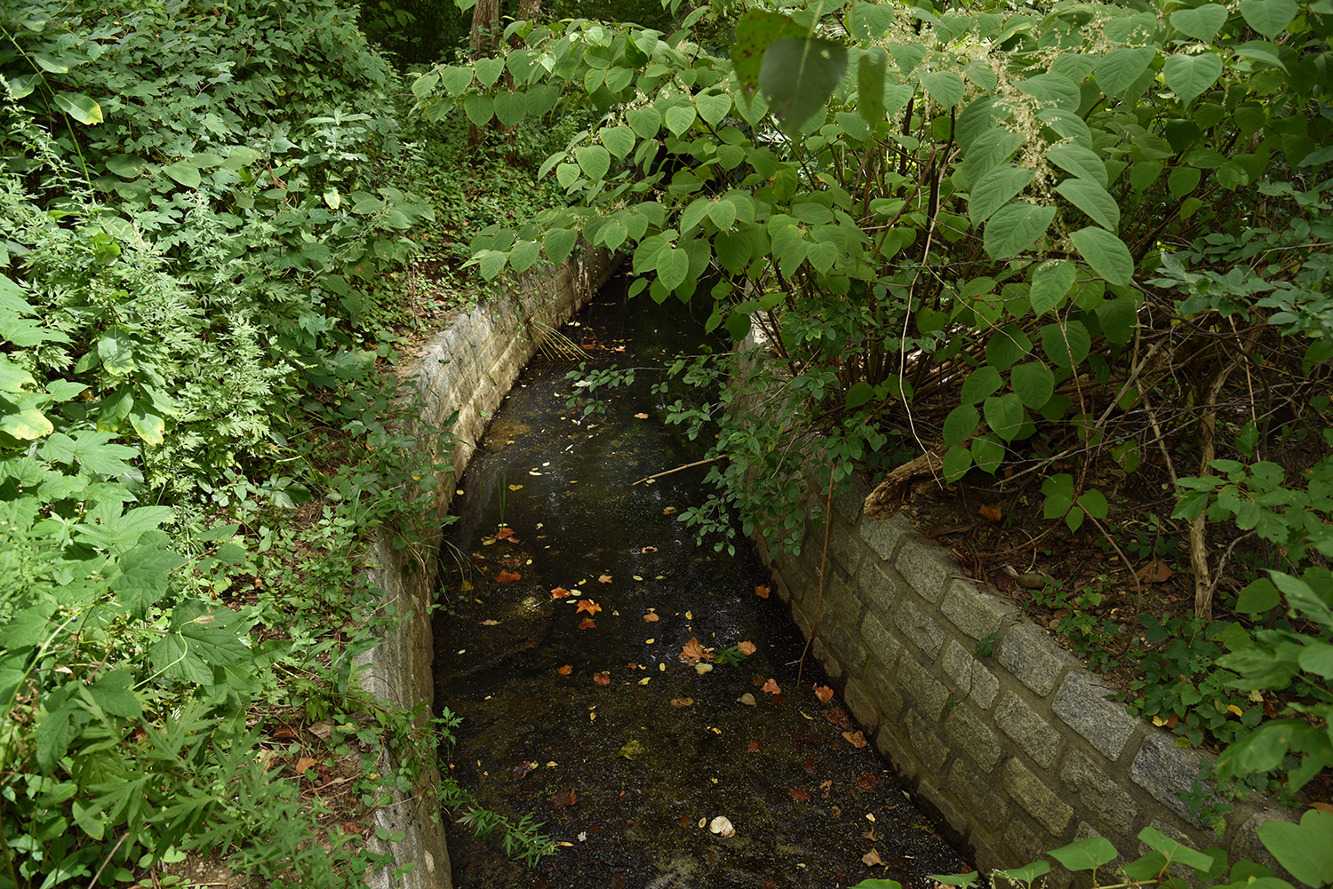
A moist riverbed is the only indication that Gabler’s Creek still flows through this area. "When it would rain, it would erode all the dirt," says Mugdan. Several larger UCPC projects have sought to slow rainfall and erosion in the ravine.
The underground course of the creek travels through this green glen. Even when flowing underground the creek provides an important habitat. "A family of foxes lives near here with two cubs," notes Mugdan. "We see blue jays, cardinals, mockingbirds, scarlet tanagers."
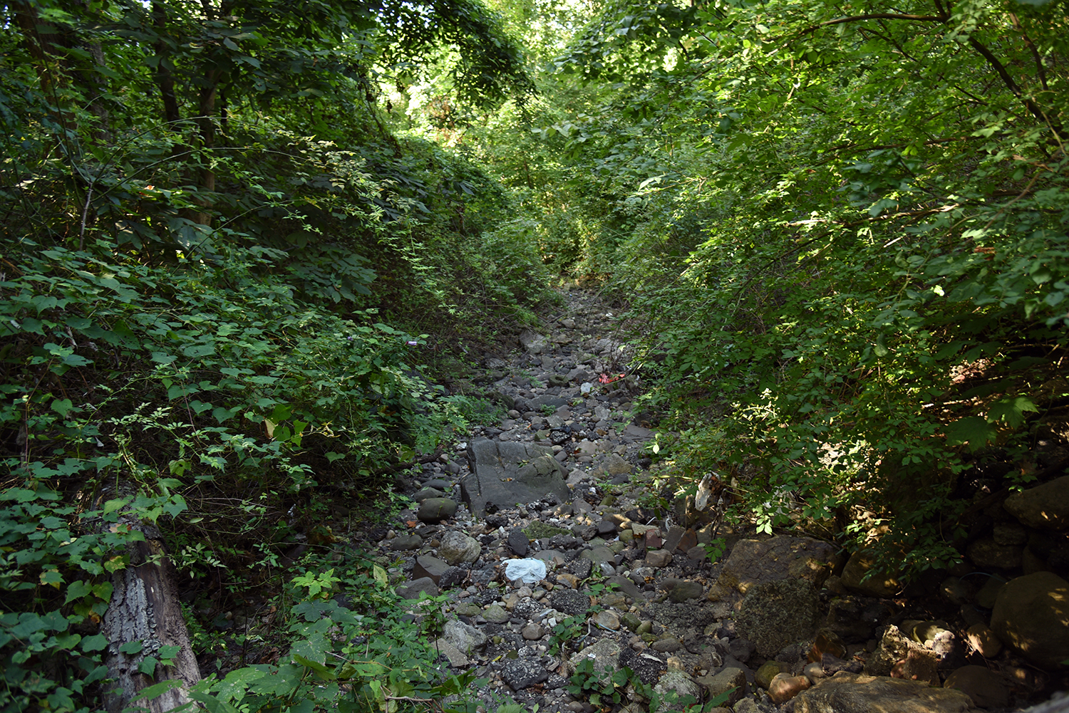
Further upstream, a rocky riverbed awaits rainwater at the bottom of the ravine. "In the 1960s and ’70s, the city intended to continue filling in this area, all they way up to the railroad, for residential development. This area would have been 246th Street," says Mugdan.
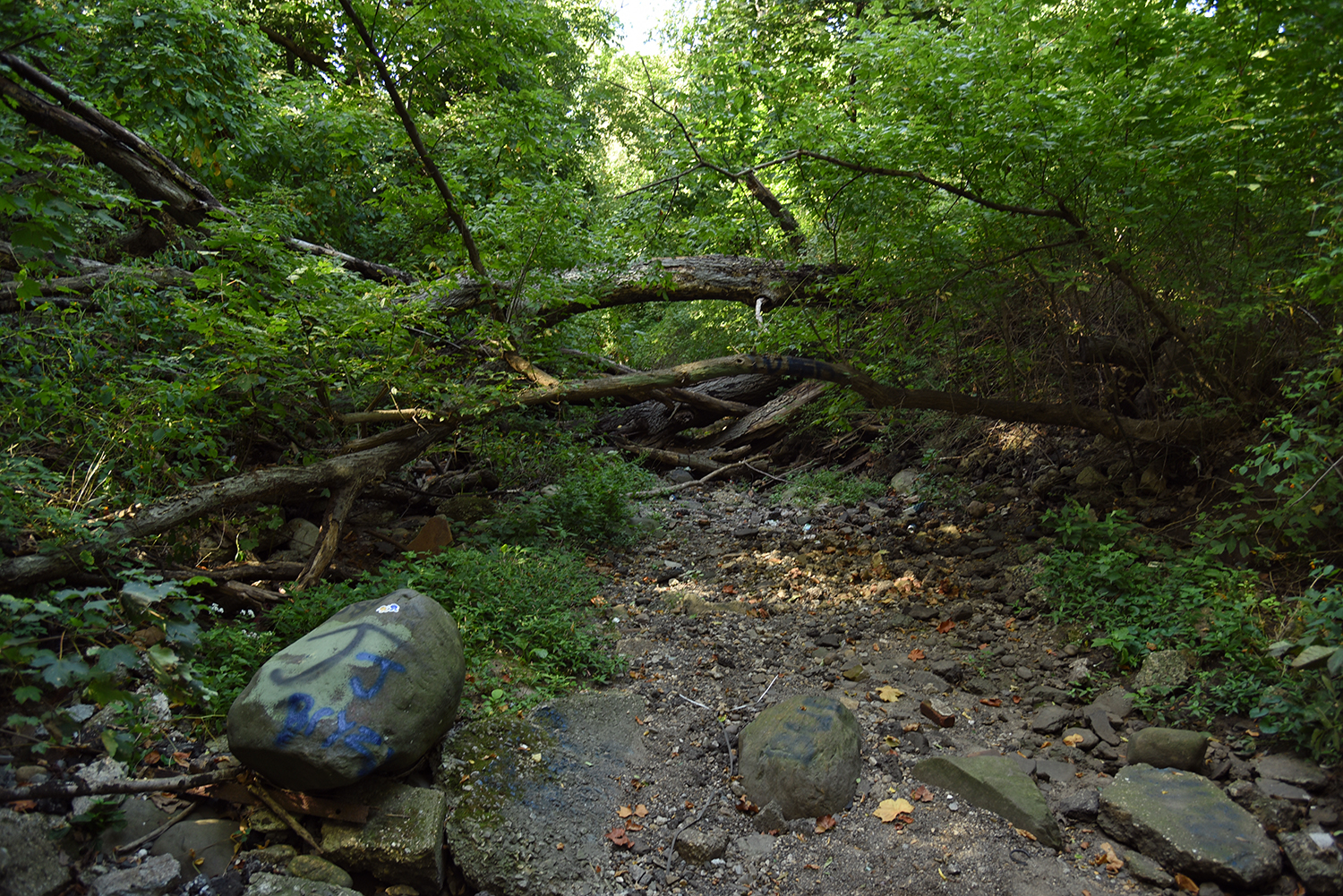
Fallen trees block off the creek’s path. "A sewer line was laid, and you can still see manholes along the east side of the ravine," says Mugdan.
Some of the headwaters of Gabler’s Creek emerge from this culvert, which is situated under a mountain of construction debris dumped here in the 1960s. "It was a six-acre field. They dumped all the junk on it," says Mugdan. A forest has since grown above the pile of debris.
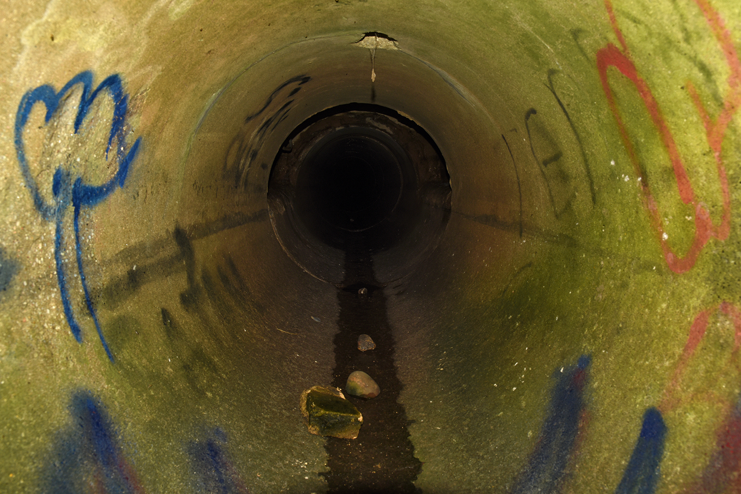
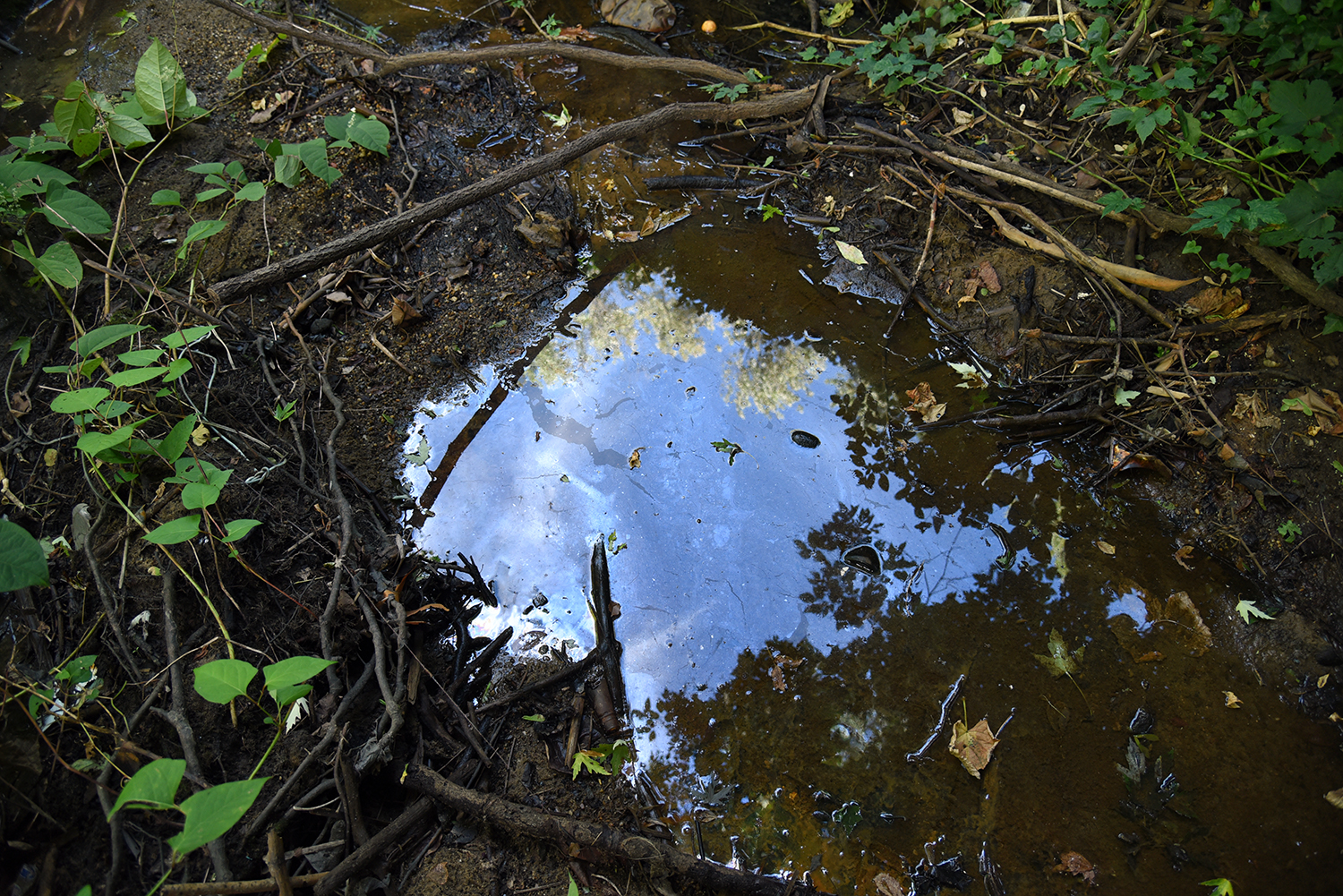
Inside the culvert, a small trickle of water flows out to the creek bed from the source of Gabler’s Creek, which is buried somewhere to the south, underneath city streets and homes. "When it rains, this is a roaring brook," says Mugdan.
The sides of the ravine here are actually a steep pile of rubble. "Up until the ’90s, the area was still a moonscape," says Mugdan. "This area was covered with concrete chunks, with nothing but trash growing on it." Removing this enormous pile of rubble would be extremely difficult. "We have to live with it, and allow it to remain here."
Nathan Kensinger is a photographer, filmmaker, and curator who has been documenting New York City's abandoned edges, endangered neighborhoods, and post-industrial waterfront for more than a decade. His Camera Obscura photo essays have appeared on Curbed since 2012. "Industrial Twilight," an exhibit of Nathan Kensinger’s photographs of Brooklyn’s changing waterfront, opened last week at the Atlantic Avenue subway station in Downtown Brooklyn. Curated by the MTA Arts & Design program, it includes images from Admiral’s Row, the Domino Sugar Refinery, the Greenpoint Terminal Warehouse and other landmarks lost during the last decade.
from
http://ny.curbed.com/2016/9/15/12923374/photos-queens-waterway-gablers-creek
No comments:
Post a Comment