Down at the edge of Jamaica Bay, beneath the subway tracks and next to the airport, flows one of the most-seen but least-known creeks in New York City. It meanders past 100-year-old boat clubs and bungalows, travels underneath the AirTrain and the A train, and is the main reason that most of the nearby communities exist.
But to millions of visitors who look out over its waters while on their way to JFK, it has no name. And for many of the residents who live along its shoreline, its path remains a mystery, though its waters flood their streets during nearly every full moon.
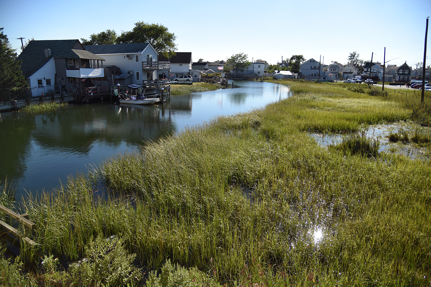
This is Hawtree Creek, which passes through a pocket of New York City that feels like it belongs to a different century. Families living near this waterway still take "the boardwalk into town" like their grandparents once did, still keep a boat or two in the dock out back, and still navigate gravel roads through marshlands to get to their homes, which are built on pilings out over the water.
"We’re in the largest city in the country, really, and yet it’s like a small town," says Betty Braton, who grew up swimming and boating in the waters of Hawtree Creek during the 1950s. "We are the city we are because of the waterfront we have."
Most of Hawtree Creek’s length was filled in long ago to create residential areas, and today, it wanders aboveground through just a handful of unique Queens neighborhoods, including Hamilton Beach, Old Howard Beach, and the tiny enclave of Ramblersville, the smallest neighborhood in New York City, which is also the oldest part of this community. "That’s the origins of Howard Beach and Hamilton Beach—the original settlements were fishing communities around Hawtree Basin," says Braton, who is the chairperson of local Community Board 10. "When they were built, they were basically summer places, and then over the years, they grew into year-round communities."
We are the city we are because of the waterfront we have.
Although Hurricane Sandy washed away many of their old maps and photos, the two historic waterfront boat clubs that remain along Hawtree Creek today are still lively places to trade stories about the area’s colorful past. At Rileys Yacht Club, tales of Rat Island and Flynn Canal—two local landmarks in the club’s backyard—are traded over a friendly, private bar. Over at the Howard Beach Motor Boat Club, which was incorporated in 1916, a rollicking crowd offers up various interpretations of Hawtree Creek’s course, with some claiming it as a canal and others calling it a river. Stories of rumrunners and sunken boats are common among older residents of the community, who take an evident pride in the creek and its history.
"It was a lovely place to grow up," says Braton. "That was our playground, the water. We would go swimming, and if it floated we made a boat out of it. That was part of the joy in living in a community that was on the waterfront." The charming isolation of Hawtree Creek has largely managed to survive into the present day, and several of the streets and homes along its shoreline don’t appear to have changed all that much in the past 110 years. And though people no longer swim in its waters, according to Braton, they do fish, boat, jet ski, and catch crabs. "This was a place where the waterfront played an important role in people’s lives. Today, it still plays an important role, but kind of in a more negative way, given the ramifications of Sandy."
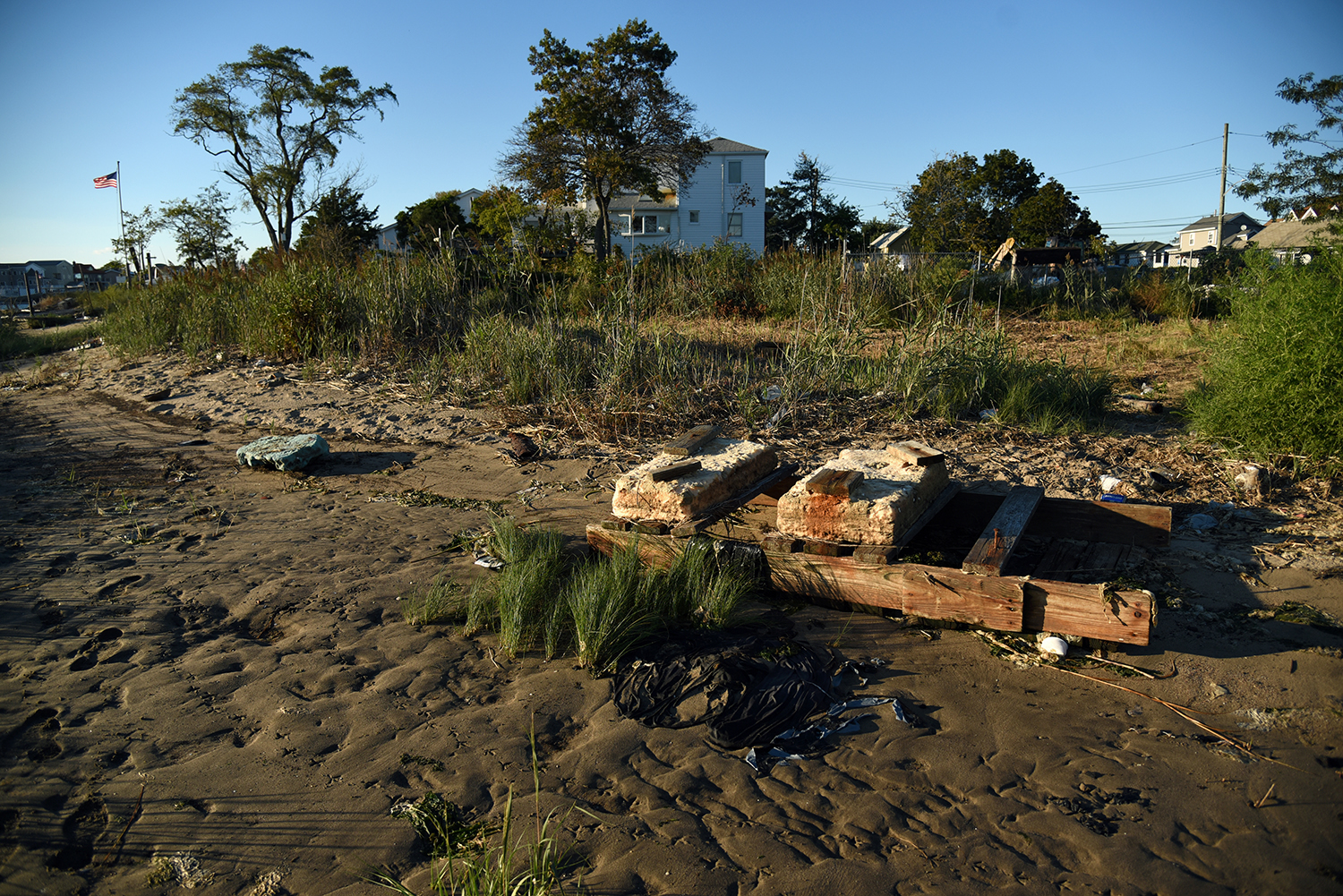
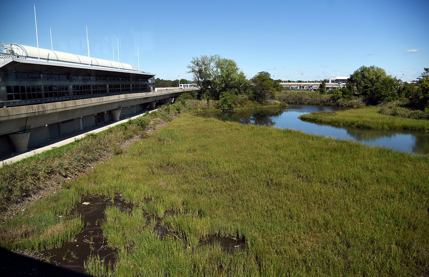
Like Broad Channel Island, Edgemere, Meadowmere, and other waterfront communities situated along the edge of Jamaica Bay, the neighborhoods along Hawtree Creek are sitting at the frontlines of climate change in New York City. During Hurricane Sandy, a huge storm surge pushed up the creek, flooding practically every home in the area. Eight feet of water swamped the Howard Beach Boat Club, and the water almost reached the second floor windows near Coleman Square, at the head of the creek. For a community so intertwined with the water, the challenges ahead are self-evident.
"My constituents are extremely worried about flooding," says New York state senator Joseph Addabbo Jr., who represents Senate District 15. "They still want to remain on the waterfront, but they are very aware of not only high tide and surge, but also of the next storm that may come about." Hurricane Sandy resulted in major damage throughout the area, but even "sunny-day flooding" can lead to serious problems, something that Senator Addabbo knows well. His offices are located just a block away from Hawtree Creek, near streets that flood regularly during high tides. On a recent afternoon, a manhole cover had been left propped open nearby, allowing a waterfall of saltwater to return to creek and flow back out to the bay.
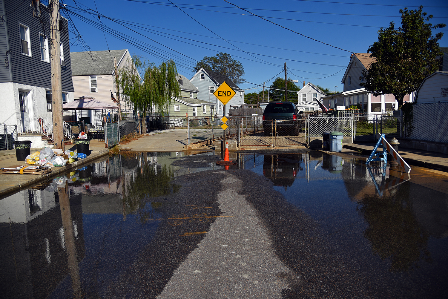
"I understand it because I witness it myself," says Addabbo, whose staff is often unable to get to work because of flooded streets. "We frequently deal with the high tide." Regular tidal surges have ruined cars, swamped basements, and caused a number of other headaches for local residents, who have implemented a variety of small-scale solutions to combat the problem, from bulkheads and berms to raising houses up above flood level. Still, the waters keep pouring in, and the situation has only gotten worse over the years.
"There are some pockets that flood every time the moon is full," says Braton, who has seen a significant increase in flooding over the last 70 years. "There are times when you have to know the tide cycle, because you would not be able to walk across the street without walking through a foot and a half of water."
And yet, since Hurricane Sandy, no major new storm mitigation projects have been completed here. "We are now four years removed from Sandy, and we are still in the planning stages of most of these projects," says Addabbo, who has been working to cut through the governmental red tape. "The bigger projects, which should certainly stop flooding and protect the shoreline, are years away."
In the future, the landscape around Hawtree Creek and Jamaica Bay will be radically different. As sea levels continue to rise, and as the bay’s salt marshes continue to be threatened by pollution and erosion, drastic solutions are being considered to protect both residents and nature. "I think the largest idea is a gate that they are looking to do along Jamaica Bay, that would stop any kind of major surge," says Addabbo, referencing a recently announced set of proposals by the US Army Corps of Engineers (USACE). "That is a huge endeavor, putting up a gate like that, which basically opens and closes based on the storm."
The proposal that the USACE seems to be leaning towards is Storm Surge Barrier Plan C-1E, which would place an enormous gate across the mouth of Jamaica Bay, just east of the Marine Parkway Bridge. This structure would include seven 100-foot vertical lift gates and two 200-foot sector gates, and would permanently impact 130 acres of habitat around the bay, from maritime forests to intertidal mudflats.
We are four years removed from Sandy, and we are still in the planning stages of most of these storm mitigation projects.
The USACE has also put forward an alternative approach, named the Jamaica Bay Perimeter Plan, which would build 13 smaller flood gates at the mouth of each tributary on the bay, including Hawtree Basin. No matter which proposal is adopted, the scale of these projects would be staggering, both in expense and physical size.
"We may not live long enough to see any of them built," says Braton. "But the main barrier, combined with smaller barriers, would solve, to a great extent, a lot of the flooding problem." And despite the looming specter of larger storms and more frequent floods, there has not been an exodus among those living around Hawtree Creek.
"This area is a little different than other areas of the city," says Addabbo. "Most of the residents have been here for generations. And they want to be near their community. They didn’t want to run after Irene or Sandy, they worked hard at staying here … But they know they have to deal with issues of water quite frequently."
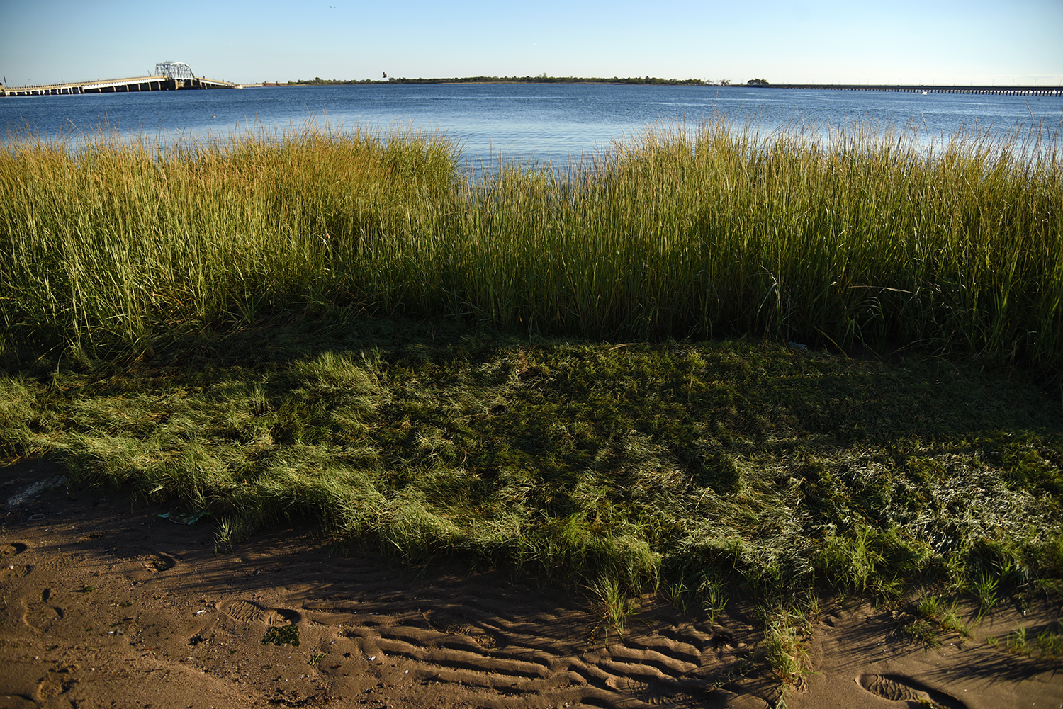
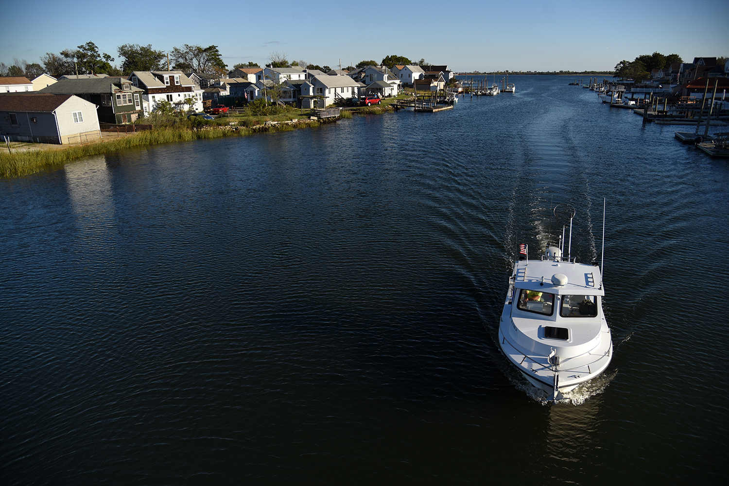
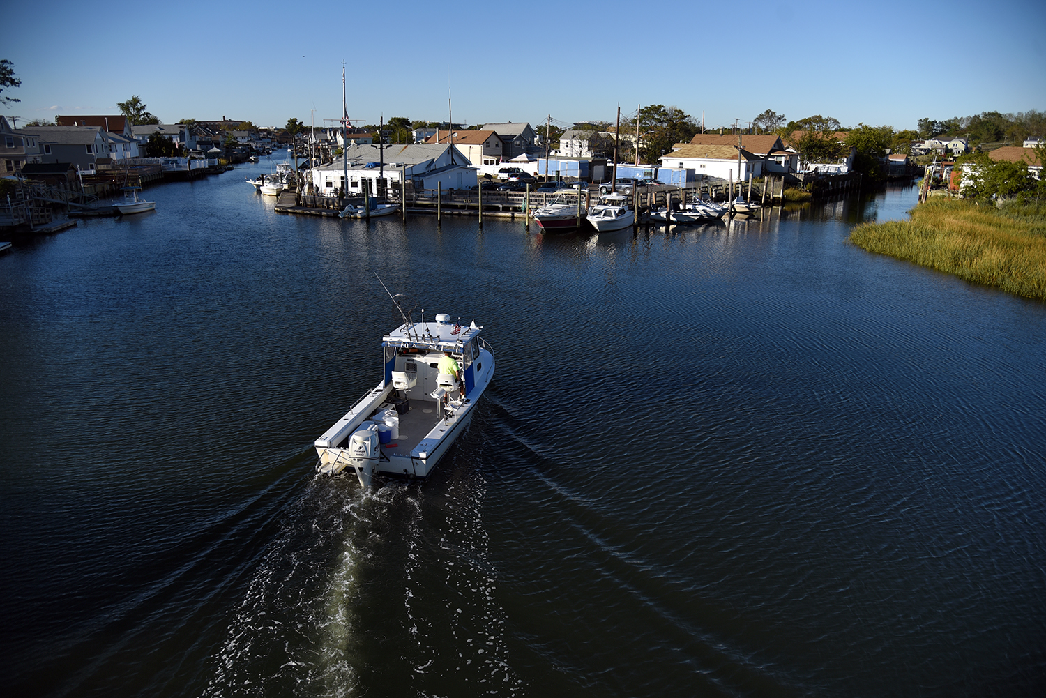
The mouth of Hawtree Creek is located on the northern shoreline of Jamaica Bay, between the Joseph P. Addabbo Memorial Bridge and the MTA’s North Channel Bridge, looking out onto Broad Channel Island.
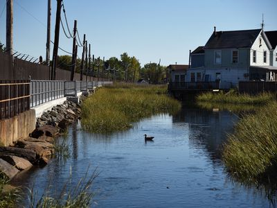
The shoreline here, on both sides of the creek, is part of the Gateway National Recreation Area, and is bordered by the several homes at water’s edge.
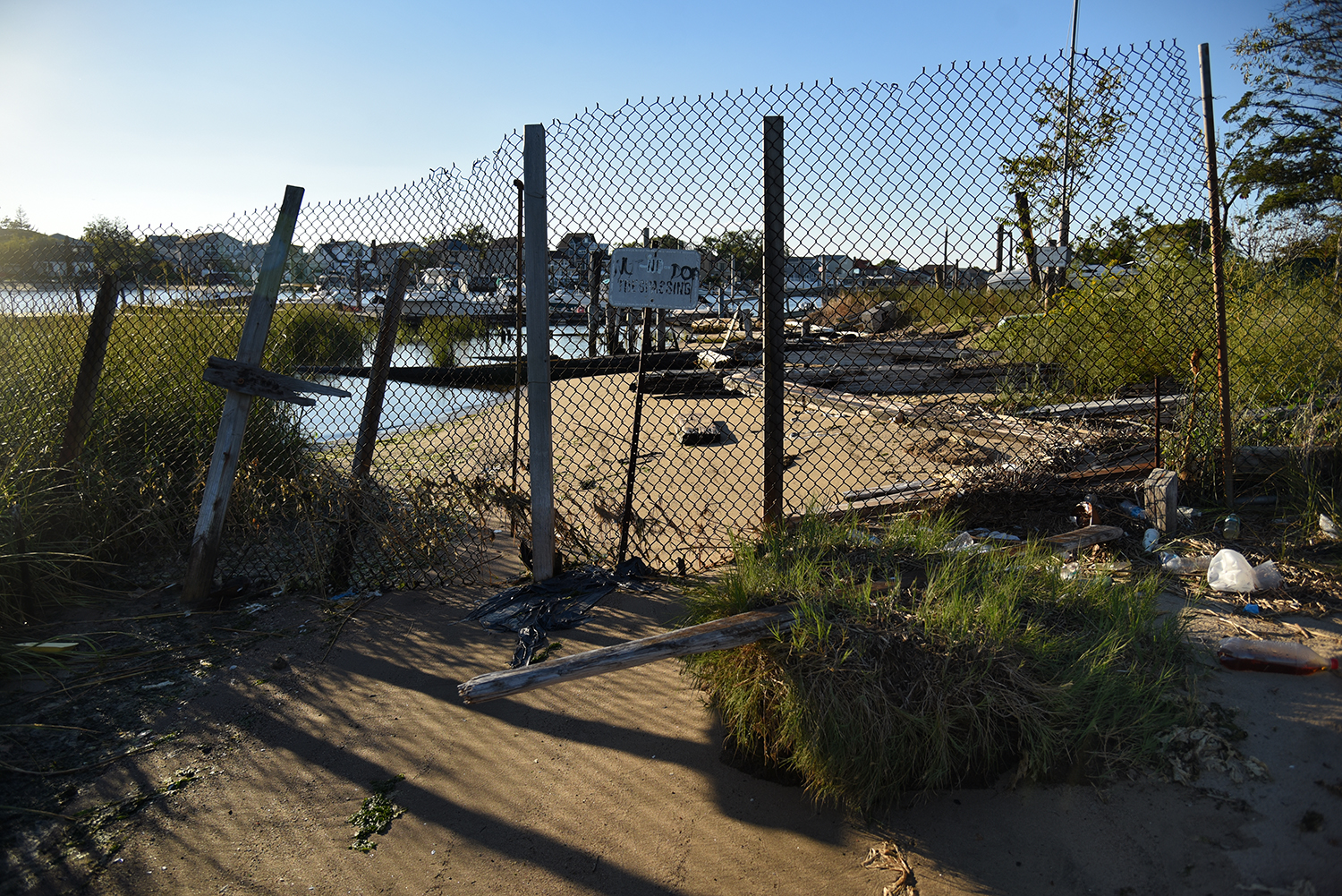
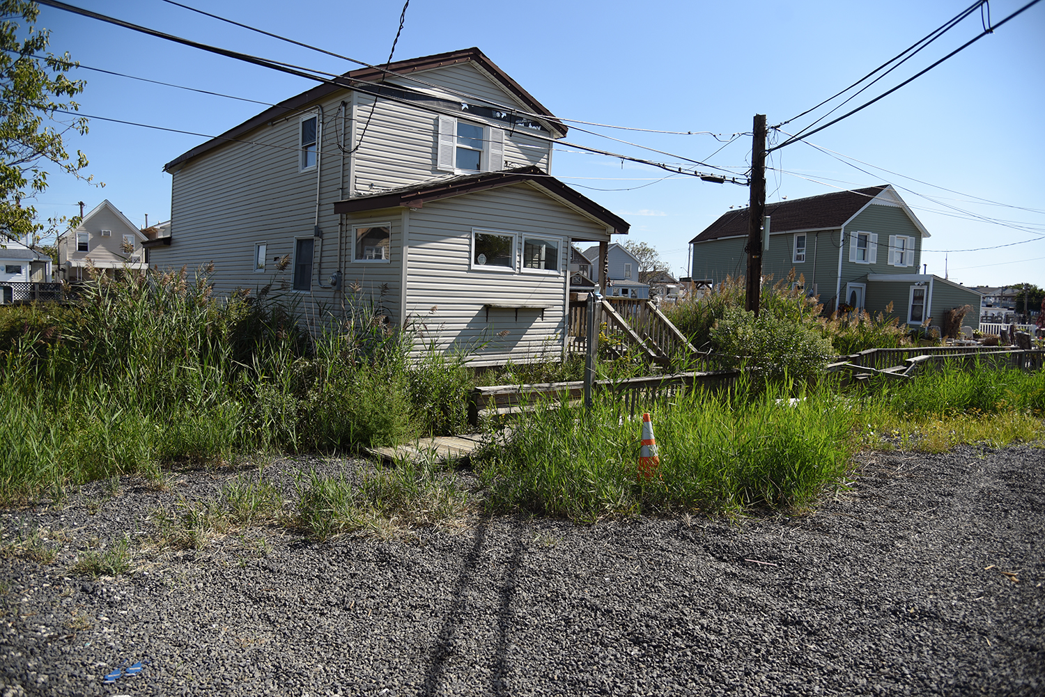
The first glimpse of Hawtree Creek, on the Hamilton Beach side of the waterway, is through a chainlink fence, blocking off access to a local dock. Much of the creek’s shoreline is inaccessible, and lined by private homes and piers.
The creek was widened in the early 1900s to help create the Hawtree Basin, a canal used by fishing boats, though its history is much older. "Hawtree Creek meandered northeasterly for centuries before the first fishermen's squatter shacks were built upon its banks in the years after the Civil War," according to a history published at the Howard Beach Motor Boat Club website.
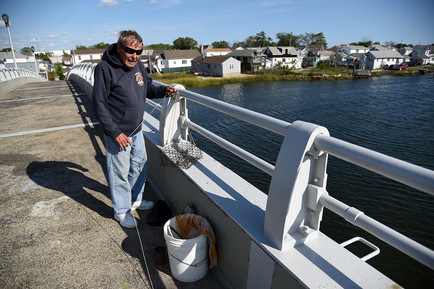
The Hawtree Basin Bridge, a pedestrian overpass connecting Hamilton Beach and Howard Beach, is a popular spot for fishermen and crabbers. "I’ve been doing this probably 30 years," says Charlie Kirchner, a retired fireman. "I’ve caught a lot of crabs—ate a lot, too."
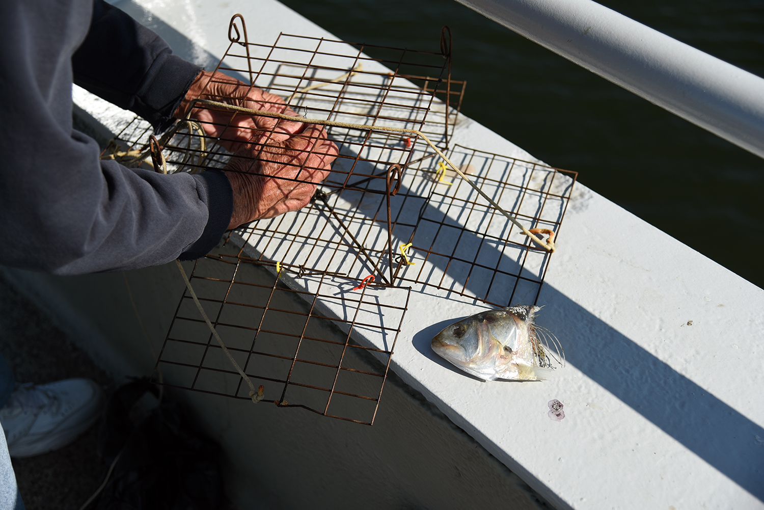
Kirchner’s bait is bunker, a common fish in this saltwater estuary. "I don’t know of any freshwater feed here," says Kirchner. "This is all saltwater from the bay."
Underneath the bridge is one of the rare public access points to the creek’s waters. "Just at high tide, the water is sometimes three or four houses in, here," says Kirchner. "These communities are very temporary, in the eons of time."
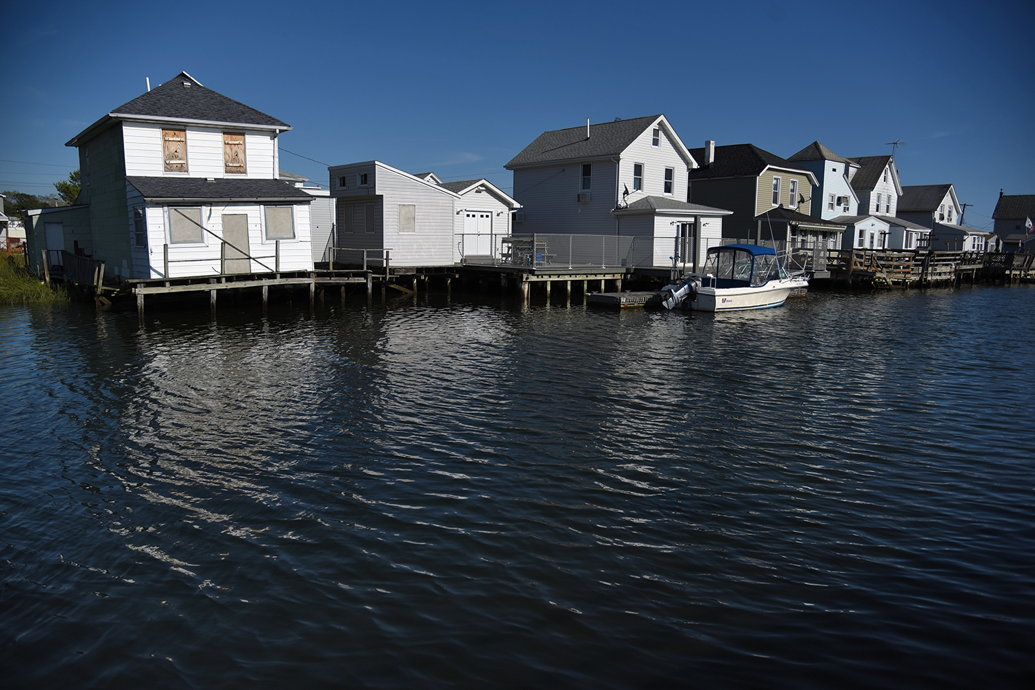
Looking north from the bridge, the path of the creek splits into three directions. To the east is Flynn Canal and Rileys Yacht Club, and to the west, the creek passes the Howard Beach Motor Boat Club before splitting in two. "We had eight feet of water here during Sandy. Fuhgeddaboudit. We had to repair the whole building," said one motor boat club member.
Flynn Canal, as some locals call it, is an offshoot of the creek that flows past Rat Island. "We see water rats and raccoons here," says one member of Rileys Yacht Club, which looks out over the island and canal. As the tide changes, water at the head of the canal almost reaches the sidewalk along Russell Street.
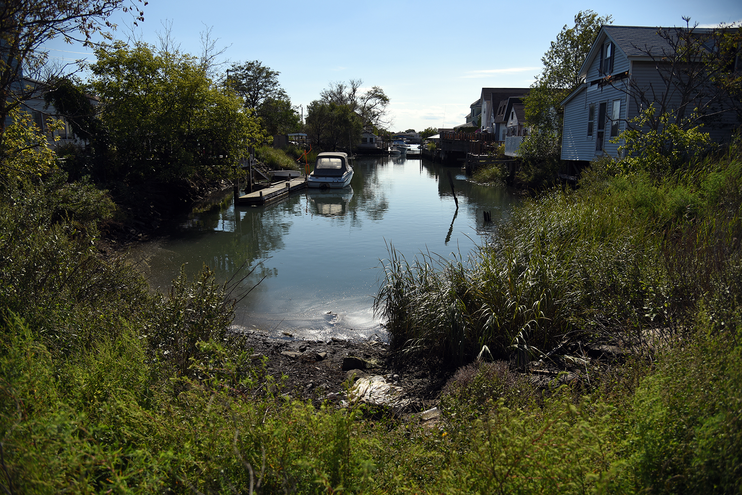
On the Hawtree Basin branch of the creek, the older homes of Ramblersville look out towards Howard Beach. In some ways, this area has not changed much in the last century. "By the 1890s it was known as ‘Little Venice,’ a summer and weekend resort community which by then had year-round residences," according to the Howard Beach Motor Boat Club website.
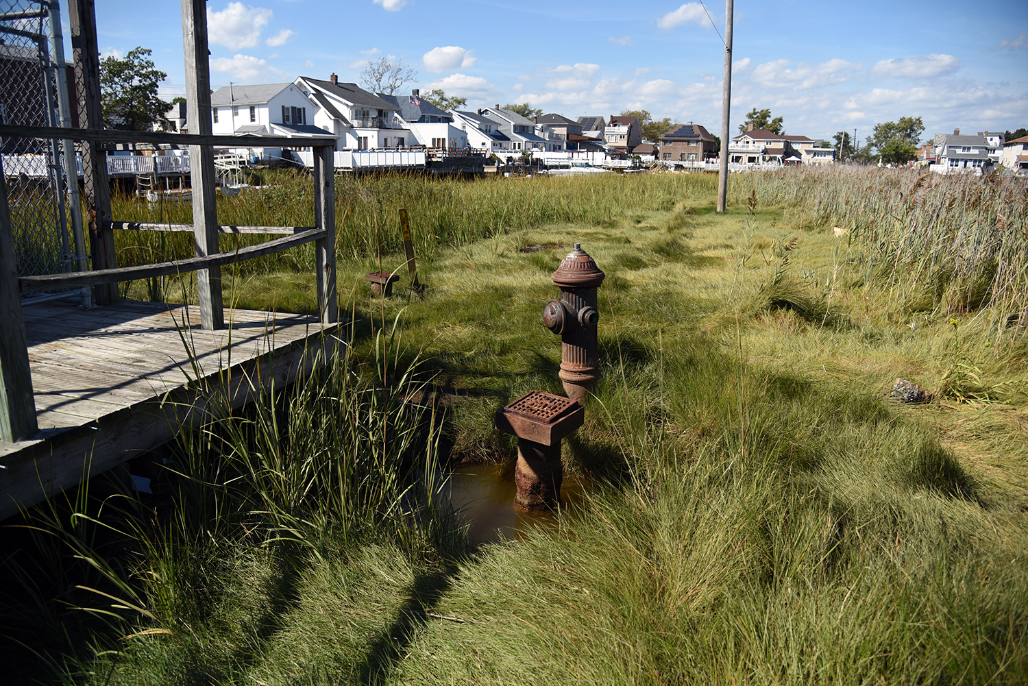
In Ramblersville, fire hydrants are sunk into the marshland, or placed on gravel roads, and the boardwalk passes over the spartina. This undeveloped section of the peninsula is surrounded by Hawtree Creek’s waters on three sides.

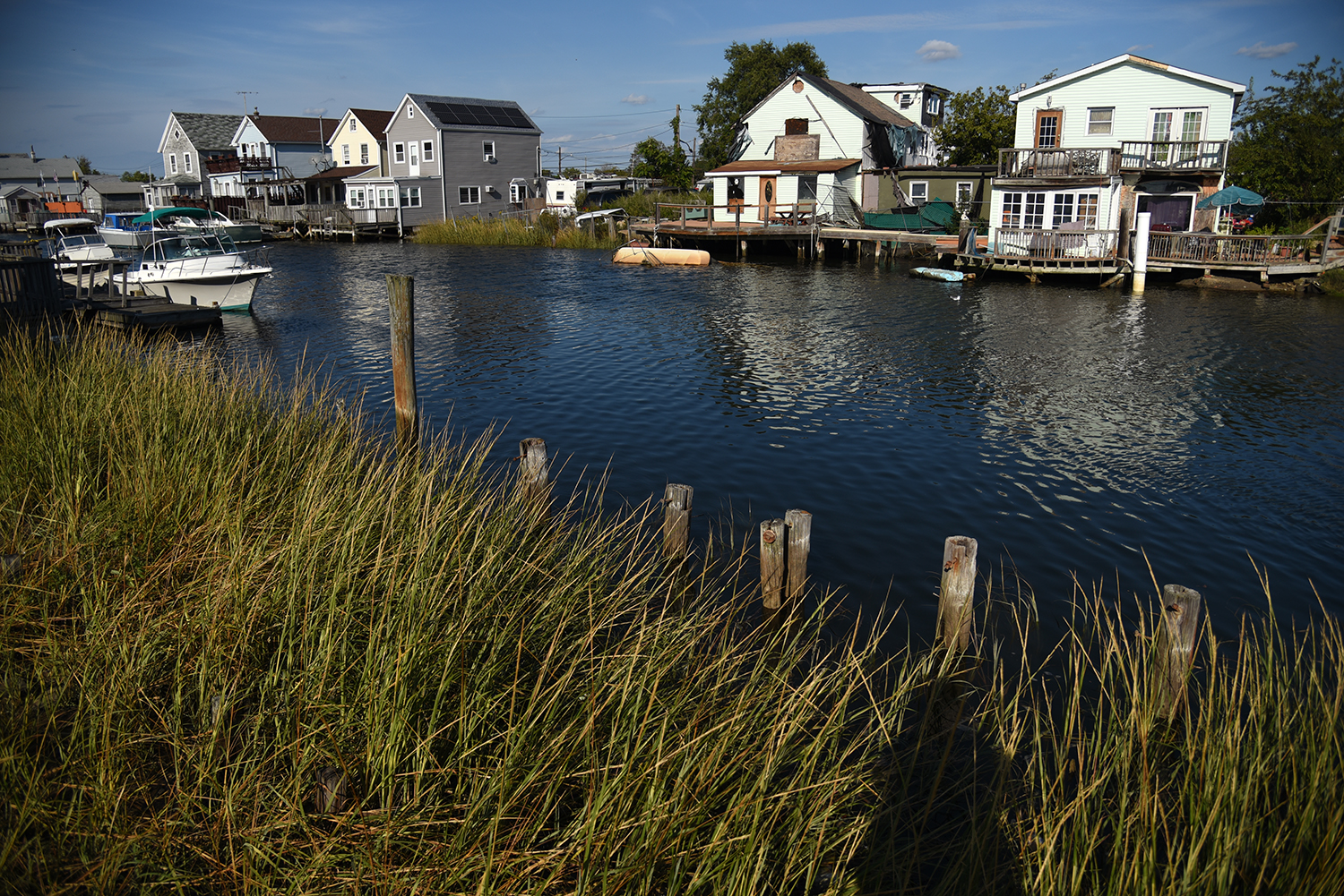
Most of the homes here have boardwalks out front, each maintained in its own style by the property owner, and a boat in the backyard. Originally, almost all of the buildings along the creek were private boat clubs, with names like Frolic Fishing Club and Idle Hours Boat Club.
Gravel roads are not uncommon in this section of Hawtree Creek, though boardwalks and boats were once the only form of access. "In 1899 the Long Island Rail Road added a stop at Ramblersville. There was no station; the train simply stopped at Russell Street and the passengers disembarked. If the tide was high they stepped from the train into a foot of sea water," according to the Howard Beach Motor Boat Club website.
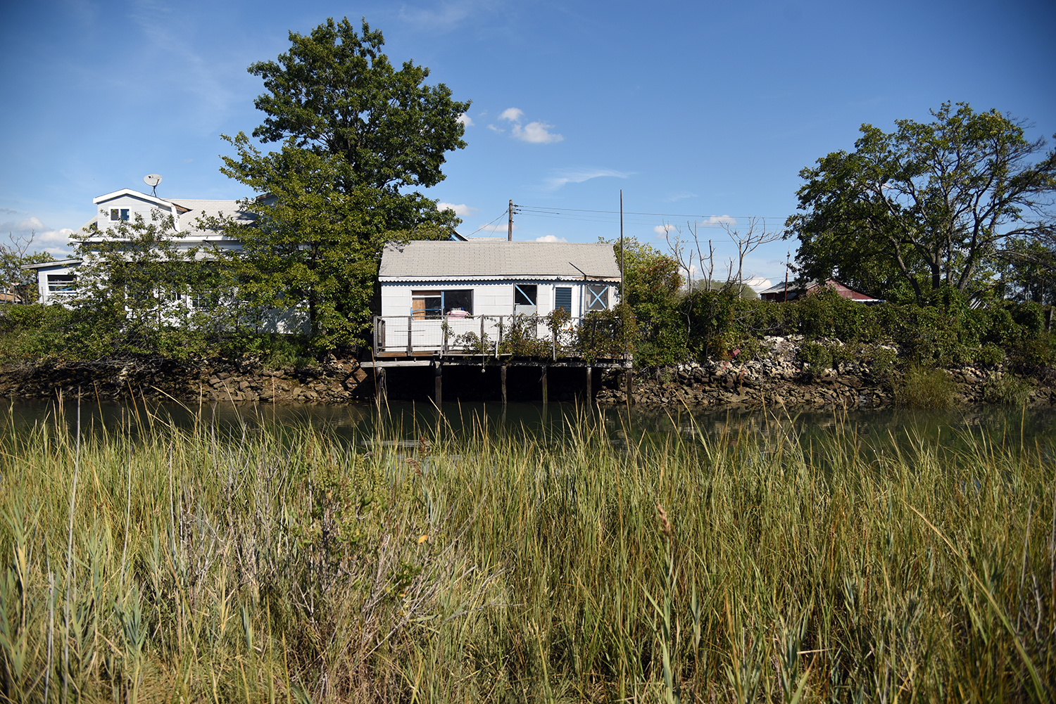
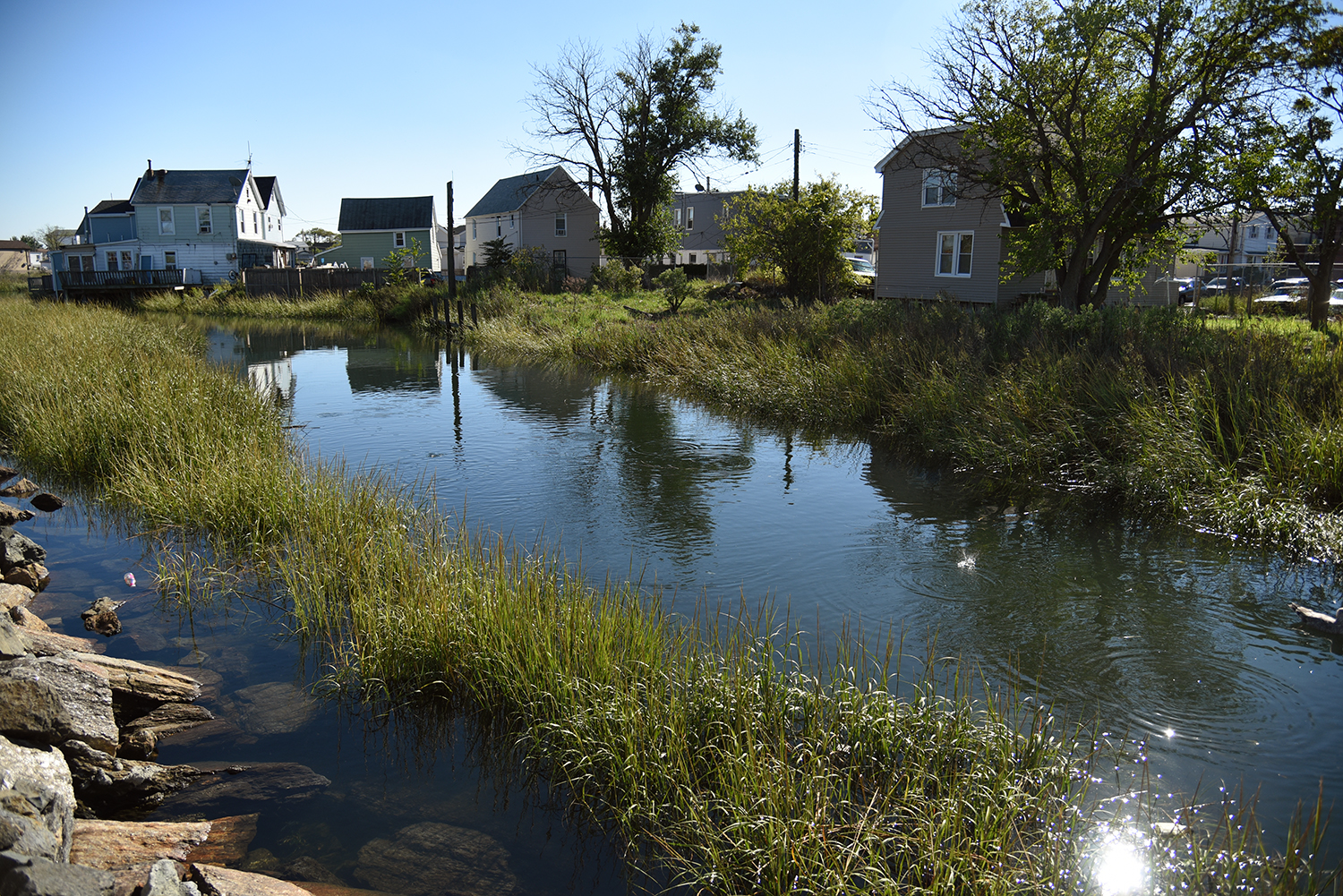
As the creek continues inland, it cuts between Ramblersville and Hamilton Beach, through another section of undeveloped marshland. "When I was a kid, if you found a sunken rowboat somewhere, if you could get it to float, that was an afternoon’s escape," remembers Braton. "We built rafts out of all kinds of things. If it could float, we made a boat out of it!"
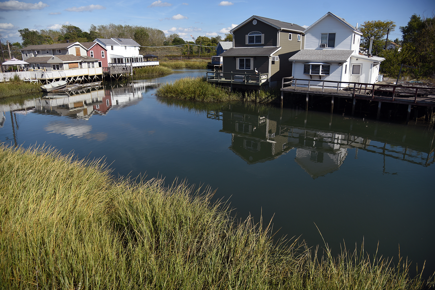
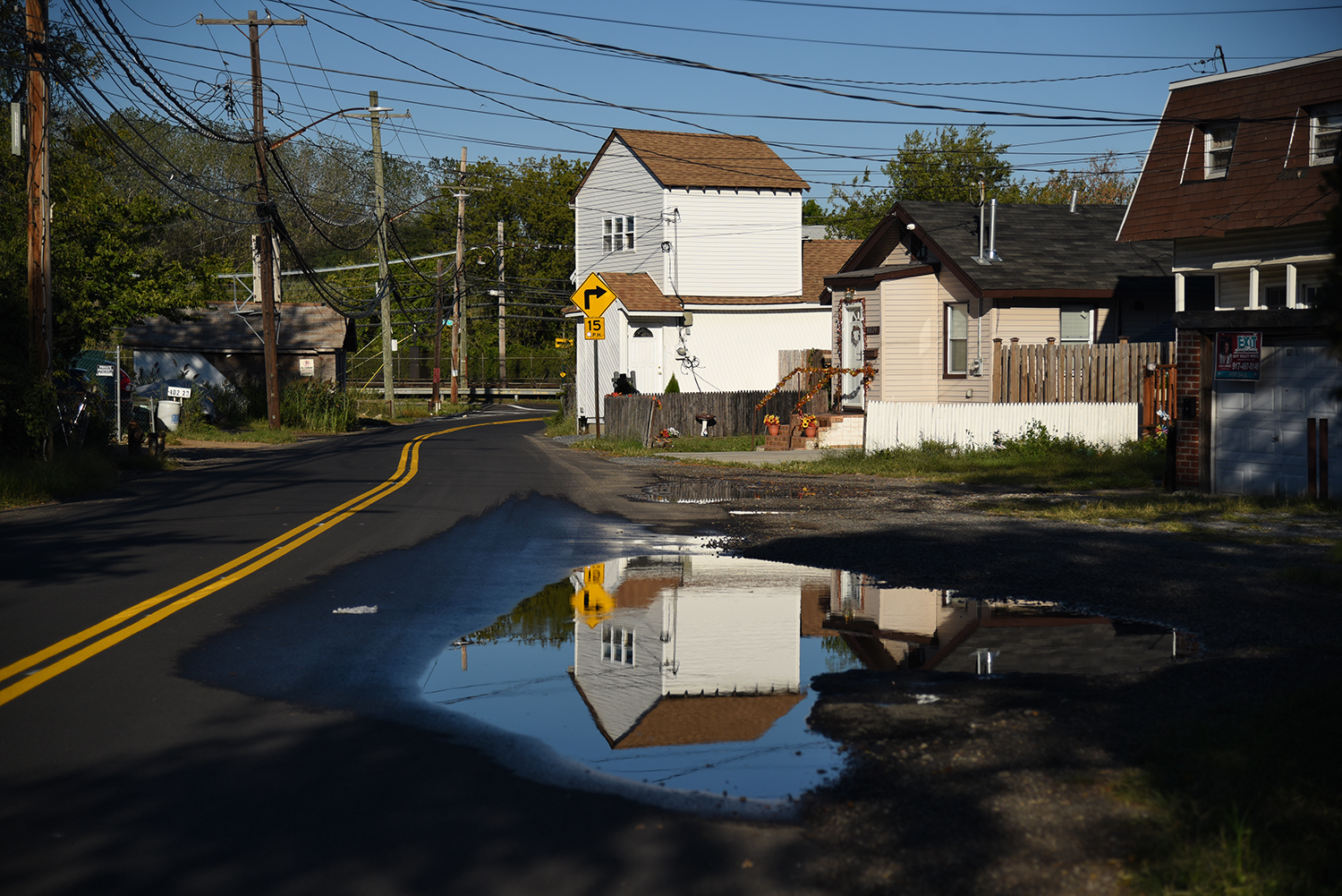
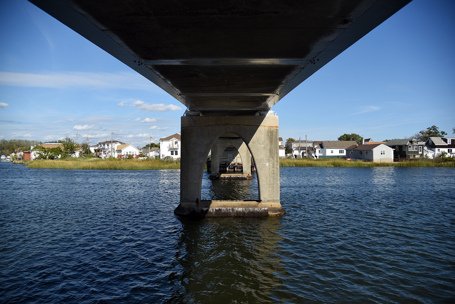
Looking out from the Ramblersville-Hawtree Memorial Bridge. A number of the houses here are built on pilings sunk into the marshland. "Those homes there date back, many of them, to the 1920s," says Braton.
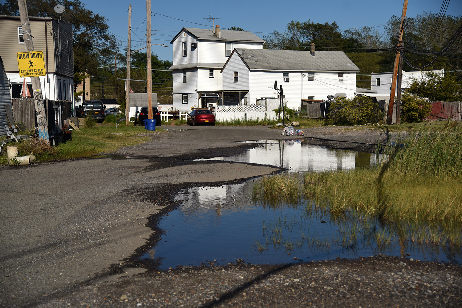
The streets in this area flood frequently, according to neighbors. "It happens all the time, like every two weeks. You get used to it," says one local resident. "This is nothing - at high tide, it comes up into the front yard."

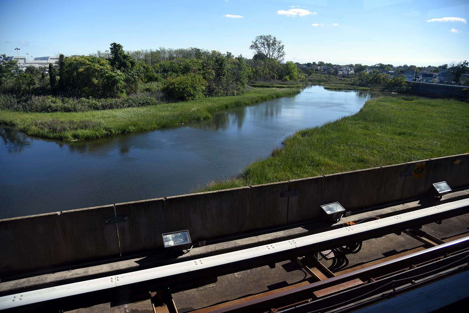
As the creek continues through these waterfront residential areas, it also supports a number of marshland areas, where birds and fish have found refuge.
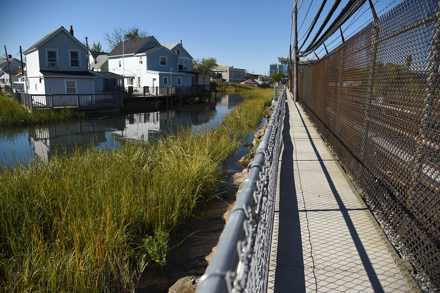
The old boardwalk into town, which is now a 2,000 foot concrete path. During a visit to the area in 2000, Kevin Walsh at Forgotten New York described the original wooden boardwalk as rickety, precarious and treacherous, and noted that it was replaced with concrete in 2003. Another renovation was done in 2015.
From the boardwalk, a bucolic view of Hawtree Creek, as it flows past several isolated country homes. If not for the A train immediately adjacent to the walkway, this would feel like a rural backwater.
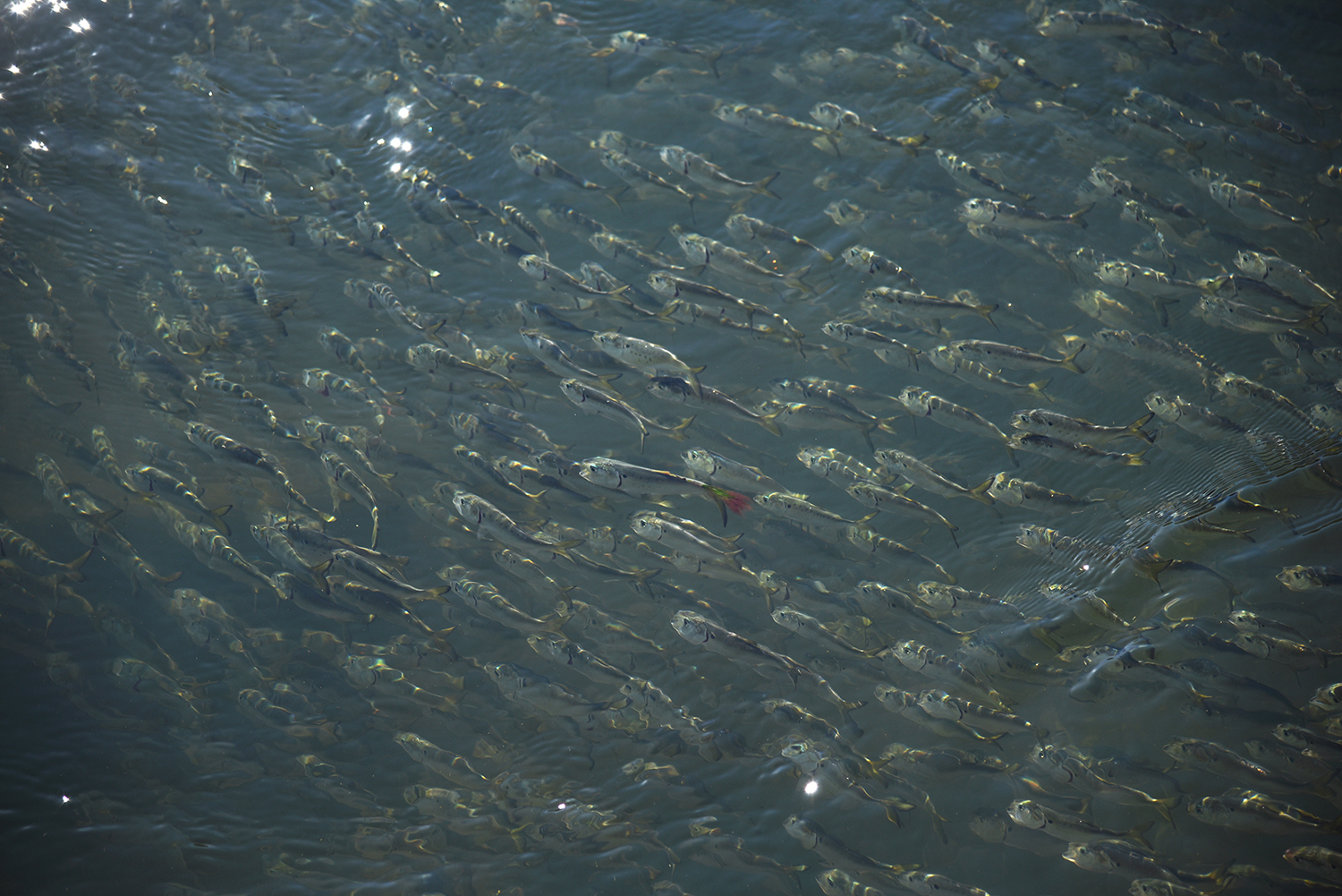
Enormous schools of fish swirl in this shallower part of the creek. "We call them peanut bunker, or baby bunker," said Kirchner. "I think their technical name is menhaden."

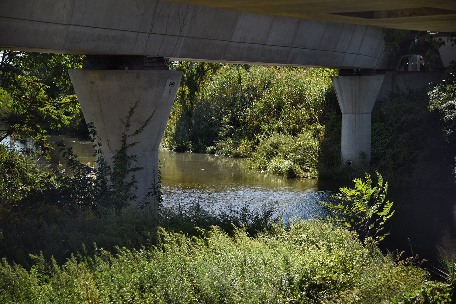
The menhaden gather at a culvert where Hawtree Creek travels underground, beneath the MTA train tracks. Abandoned boats and debris clog the creek’s flow here, which changes direction depending on the tide.
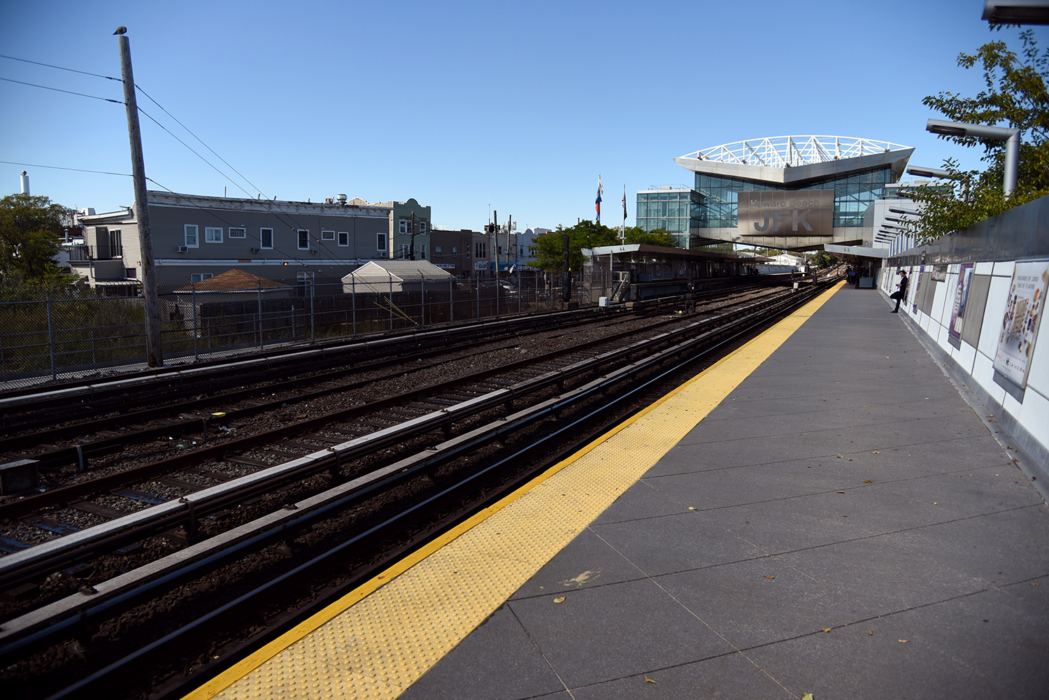
The creek passes underneath the Howard Beach train station, which was originally the Ramblersville train stop. Today it is a transfer point to the AirTrain, providing access to JFK Airport.
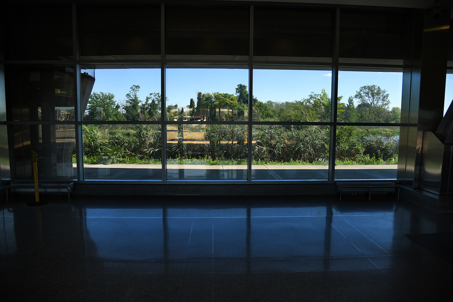
The glassy new station looks out over a section of the creek that is largely off limits to the public, surrounded by train tracks, train stations, and long term parking lots.
For many visitors to New York City, this station provides the only view of the creek they will have. This section of the creek is also a haven for birds and fish.
As seen from the AirTrain, Hawtree Creek is quite wide here, perhaps because it serves as the drainage and runoff area for a large part of JFK Airport.
Flowing underneath the stanchions of the AirTrain, the creek is better known to the Port Authority as Drainage Area A, which "covers approximately three percent (160 acres) of the airport drainage area," according to a 2009 report.
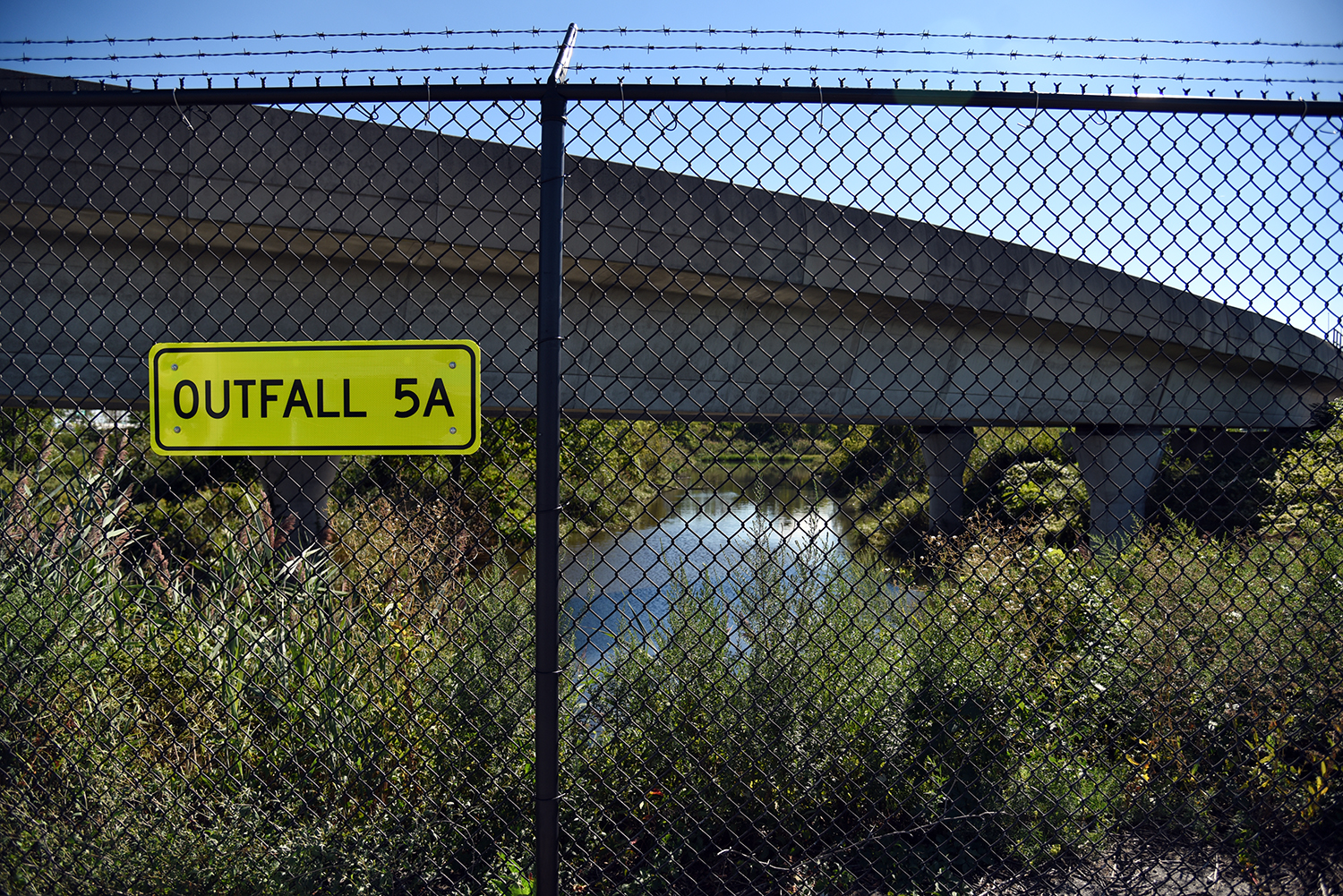
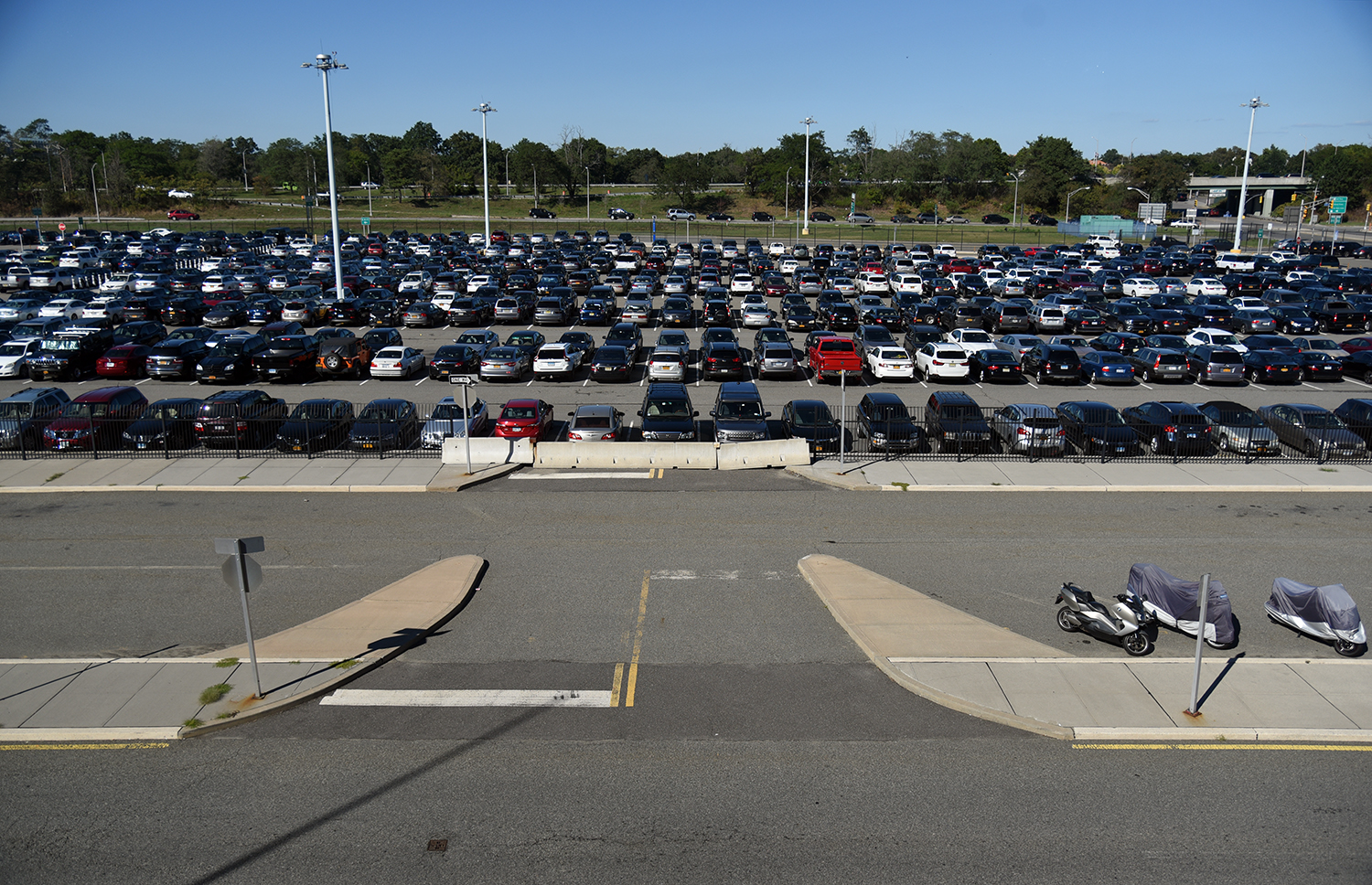
Numerous outfalls discharge into the creek here, from a surrounding area of long term parking lots. This is the last aboveground view of the creek, before it disappears beneath a field of concrete.
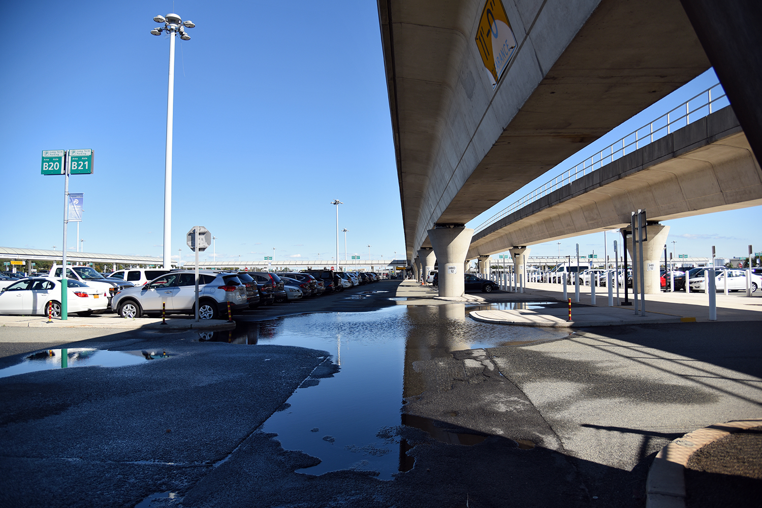
Despite efforts to control runoff, these parking areas have several large pools of standing water, perhaps tracing out the original path of the creek.
Hawtree Creek once flowed much further inland, but has been buried under highways, streets, and residential neighborhoods. The only reminder of its former reach is Hawtree Creek Road, which continues to the north for another 1.5 miles.
Nathan Kensinger is a photographer, filmmaker, and curator who has been documenting New York City's abandoned edges, endangered neighborhoods, and post-industrial waterfront for more than a decade. His Camera Obscura photo essays have appeared on Curbed since 2012. "Industrial Twilight," an exhibit of Nathan Kensinger’s photographs of Brooklyn’s changing waterfront, opened last week at the Atlantic Avenue subway station in Downtown Brooklyn. Curated by the MTA Arts & Design program, it includes images from Admiral’s Row, the Domino Sugar Refinery, the Greenpoint Terminal Warehouse and other landmarks lost during the last decade.
from
http://ny.curbed.com/2016/9/29/13101524/photo-essay-nyc-queens-hawtree-creek
No comments:
Post a Comment