After three days in the wilderness, Alley Creek was still impenetrable. We had pushed a canoe through its dense marshlands, bottoming out in a narrow culvert underneath a highway. We had sunk knee-deep into its mussel-covered mudflats, losing shoes and socks, and bled from a hundred cuts in the disorienting briar patches along its banks. Along the way, there were surprising vistas of artesian wells and sewage overflows, on rarely-used trails traveling past newly-planted forests and countless freshwater tributaries. Sightings of other humans were rare, but rabbits, raccoons, ospreys, red-winged blackbirds and shy terrapins were constant companions on the journey upstream. Yet the creek stubbornly hid much of its course, while flowing inexorably on, as it has since the last Ice Age.
Alley Creek has undergone a remarkable recovery since its nadir in the 1970s, when it was a neglected dumping ground suffering under a legacy of industry and pollution. Today, the waterway, which flows through Alley Pond Park in eastern Queens, has been returned to life. "There were factories everywhere, and raw sewage stinking to high heaven," said Yochanan D. John, a Queens resident who has extensively explored the creek. "Now, anywhere you go in the park, you can see wildlife." The restoration of the creek has included many different projects, from new sewer overflow tanks to a popular environmental center, and its waters are now teeming with wildlife (such as horseshoe crabs to swans), while 300 other species of flora and fauna thrive along its shoreline. And the remediation efforts are still ongoing. "You see plantings by the thousands," said John, who visits the creek almost every day. "In a few short years, this whole place is going to be completely transformed from what you see here today."
Even after decades of improvements, Alley Creek’s health still depends on the continued support of governmental and parks groups, and two major restoration projects are currently underway along its banks. At the mouth of the creek in Little Neck Bay, the Natural Areas Conservancy (NAC) is currently working to reclaim and restore a salt marsh habitat, which is eroding at an alarming rate. "Alley Creek has lost 30 percent of its marsh—13 acres—from 1974 to 2012. That’s two feet a year," said Jamie Ong, who manages coastal wetlands restoration for the NAC. "If nothing happens, it will continue to erode." To help restore this ecosystem, the conservancy has brought in teams of volunteers to haul away debris, chop down invasive phragmites (otherwise known as common reeds), and plant native cordgrass. This fall, they will begin to fill in several ponds that are eroding the marshland from the inside. "We are experiencing loss along the shoreline, but we are also experiencing it in the middle," said Ong. "As sea levels are rising, the marshes are being flooded more often."
A second major restoration project is also underway in a 30-acre site on the east side of Alley Creek, where invasive species and illegal dumping have endangered a coastal forest. "We pulled hundreds of tires out of the northern part of the site—tires, metal, car parts," said Kristen King, the Director of Forest Restoration for the NYC Parks Department’s Natural Resources Group (NRG). "The entire area was dominated by non-native invasive plant species." The NRG’s restoration began in 2010, and will enter its final phase this summer, creating a system of new vernal ponds in a freshly planted native forest. A hike through the site reveals the extent of the work being done, with green trails lacing through fields of wildflowers and young trees, watered by an extensive irrigation system. The forest here, once choked by vines, will soon be supplemented by a new growth of maple, birch, hickory, oak, hackberry, sweetgum, and tulip poplar.
At 636 acres, Alley Pond Park is one of the largest parks in New York City, yet despite the impressive scope of its restored forests, wetlands, and fields (which have largely been given over to other species), its green spaces are just a small part of the city’s 20,000 acres of natural areas. This fact is highlighted by the Natural Area Conservancy’s most recent project, an interactive map that recently launched after a two-year-long study. It details the numerous ecosystems and species found in the 10,000 acres of natural areas that are controlled by the Parks Department, and points out that 11 percent of New York City is occupied by these types of spaces, a seemingly enormous figure for the real-estate obsessed denizens of the most populous city in the United States. "It’s really impressive to see the scale of it," said Ong, reflecting on the map. "There’s been a lot of investment in habitat restoration."
As climate change continues to wreak havoc on both the natural world and on human society, and as global temperatures and sea levels continue their relentless rise, the percentage of space given over to other species will take on an increasingly important role in determining the future of the planet. "Unless humanity learns a great deal more about global biodiversity and moves quickly to protect it, we will soon lose most of the species composing life on Earth," writes the esteemed biologist Edward O. Wilson in his latest book, Half-Earth, a dramatic treatise proposing that, in order to offset soaring extinction rates, humans must commit to a radical expansion of natural areas throughout the world. "I am convinced that only by setting aside half the planet in reserve, or more, can we save the living part of the environment and achieve the stabilization required for our own survival." Perhaps the shores of Alley Creek will be part of this salvation.
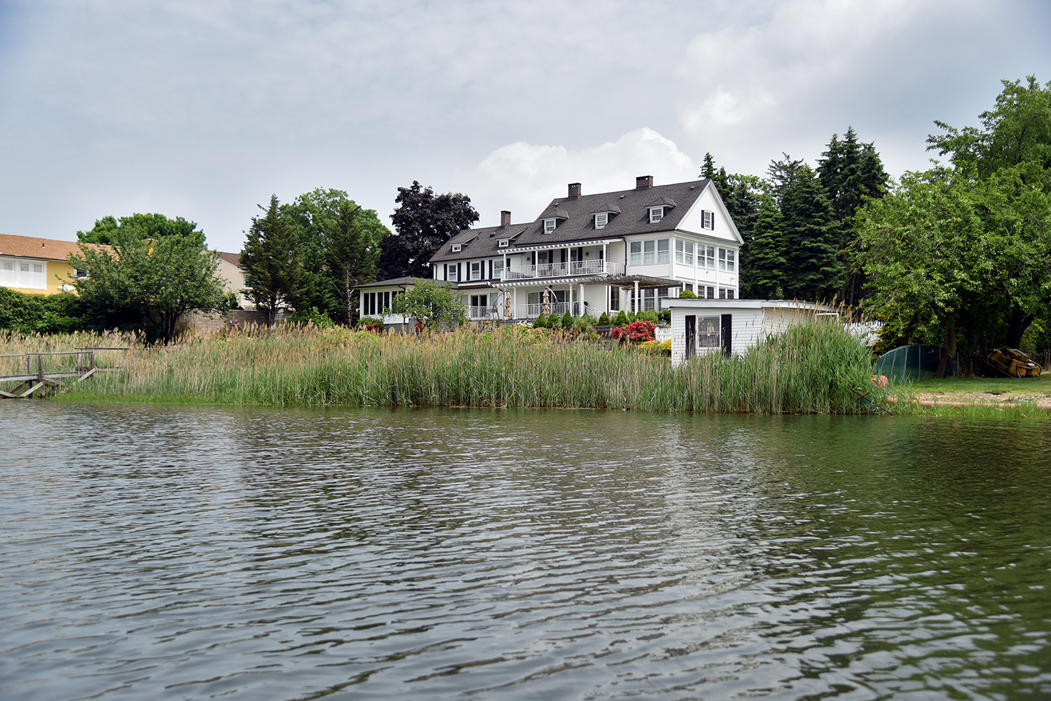
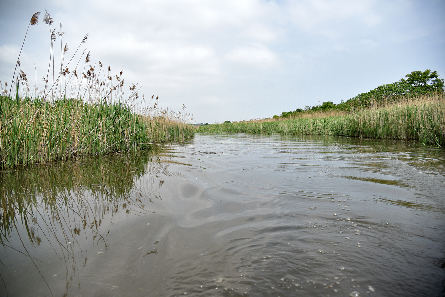
At the mouth of Alley Creek in Little Neck Bay, the stately shorefront homes of Douglaston, Queens are situated at the very edge of a salt marsh habitat.
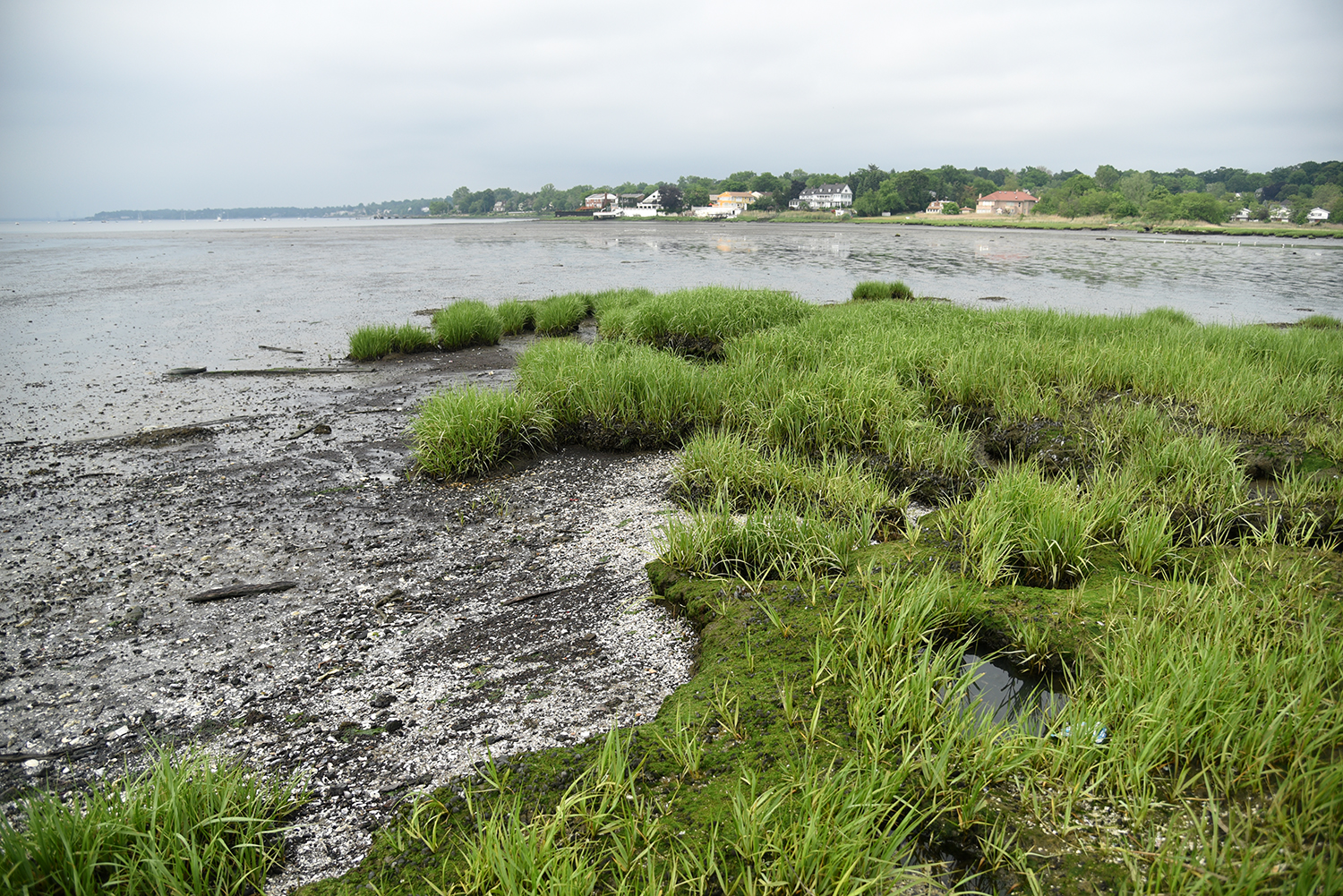
The marshland here has been eroding for decades, creating a greater risk of flooding for both the natural areas and nearby homes. "At lower tide, you can see the erosion that’s happening," said Jamie Ong. "All of this tidal mud flat used to be salt marsh."
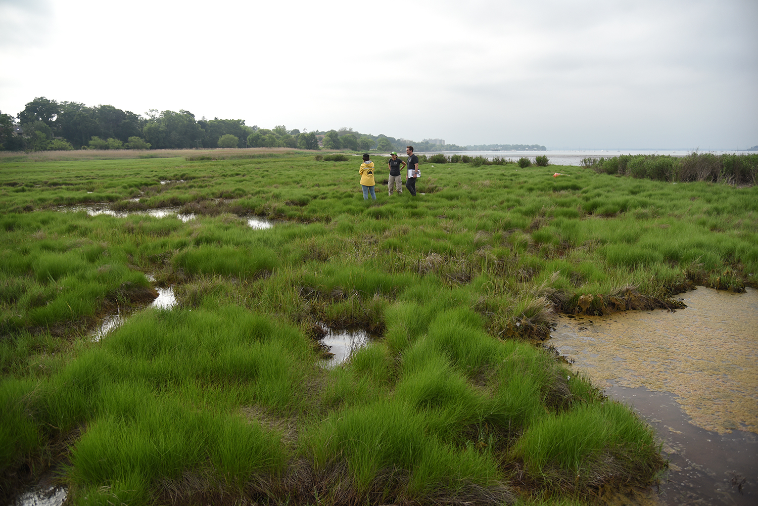
The Natural Areas Conservancy is currently working to restore the marshlands here, and is studying several different options. "We are trying to develop a new technique," said Ong. "We want to build an edge in the salt marsh, and within that edge, we would fill with clean sand."
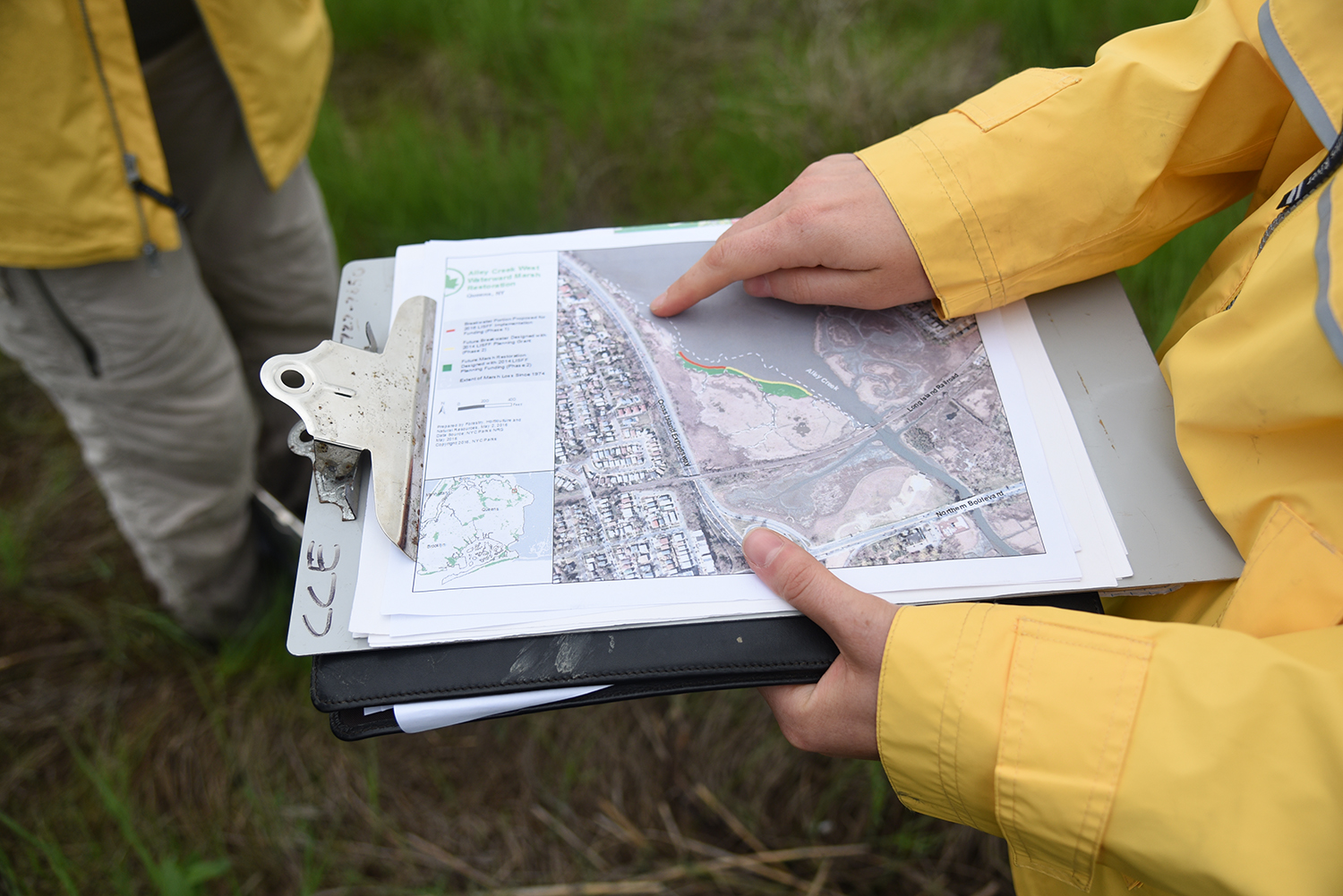
A map showing the extent of erosion at the mouth of Alley Creek. "When it is lined with roadways and houses, the marsh can’t migrate," said Sara Donatich, an assistant to the NRG’s restoration project. "We have to build out the marsh because it’s receding so much."
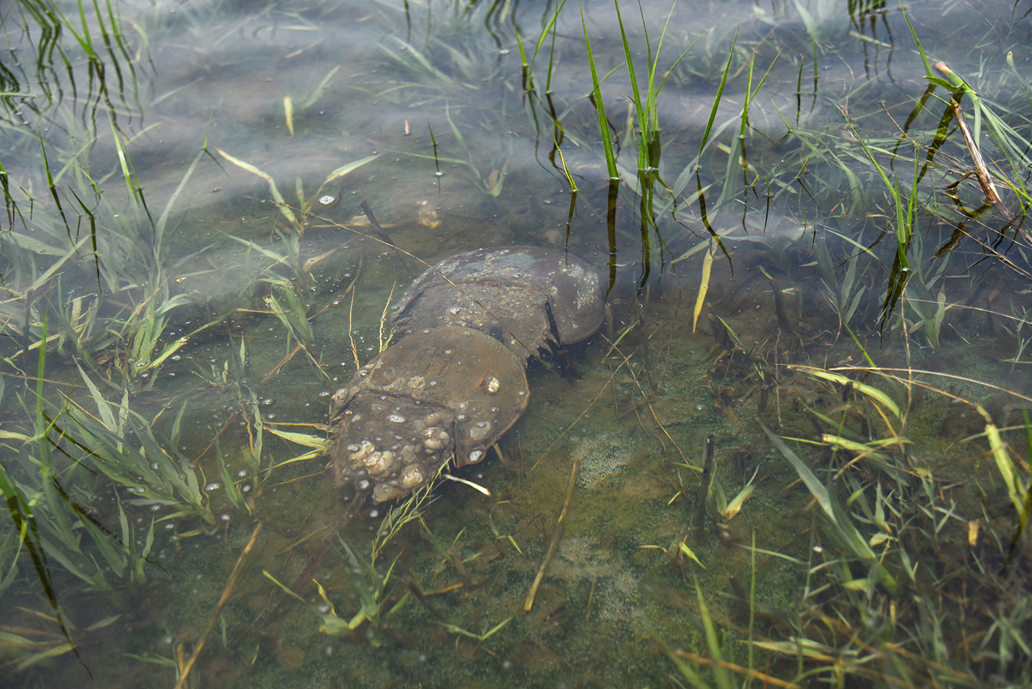
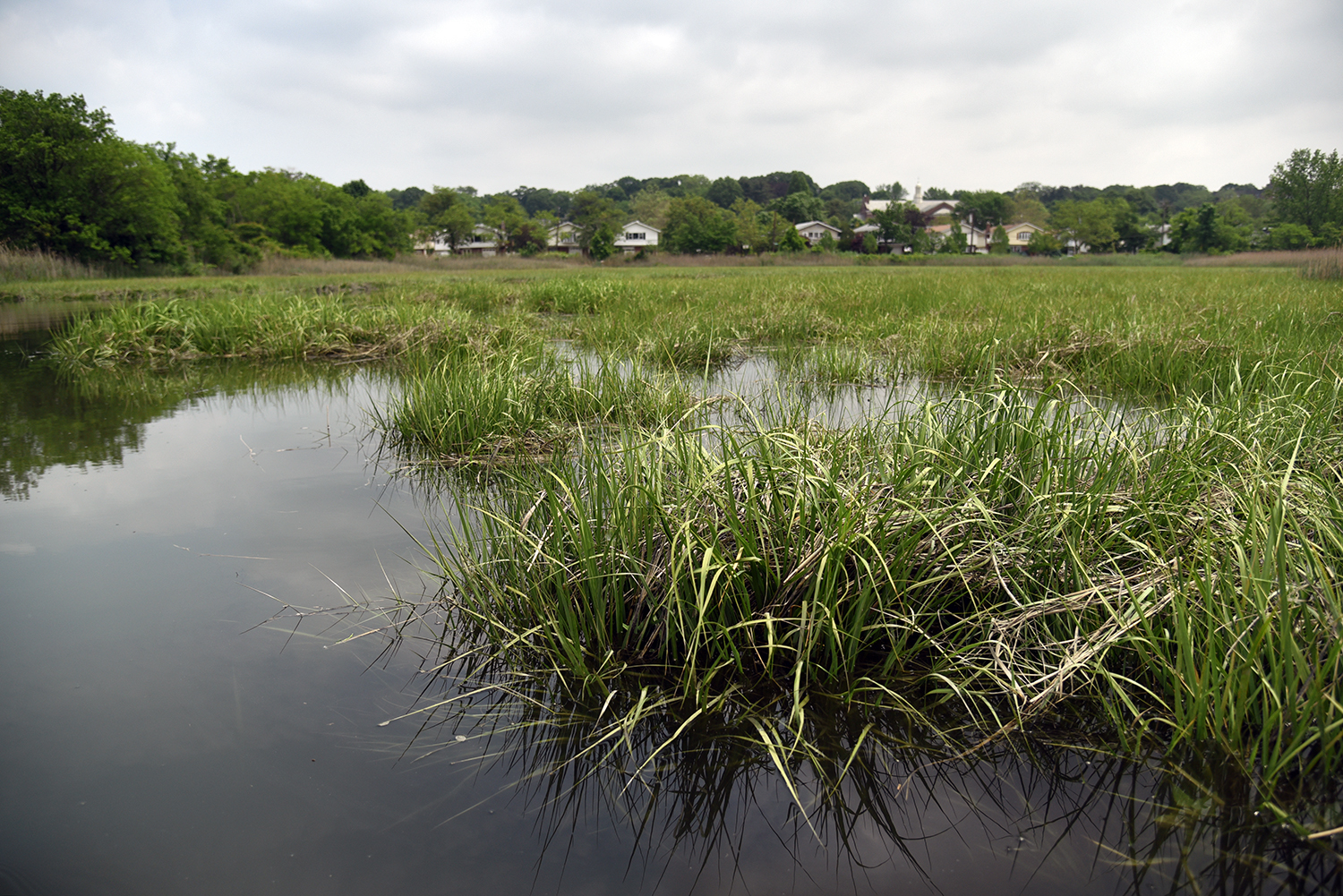
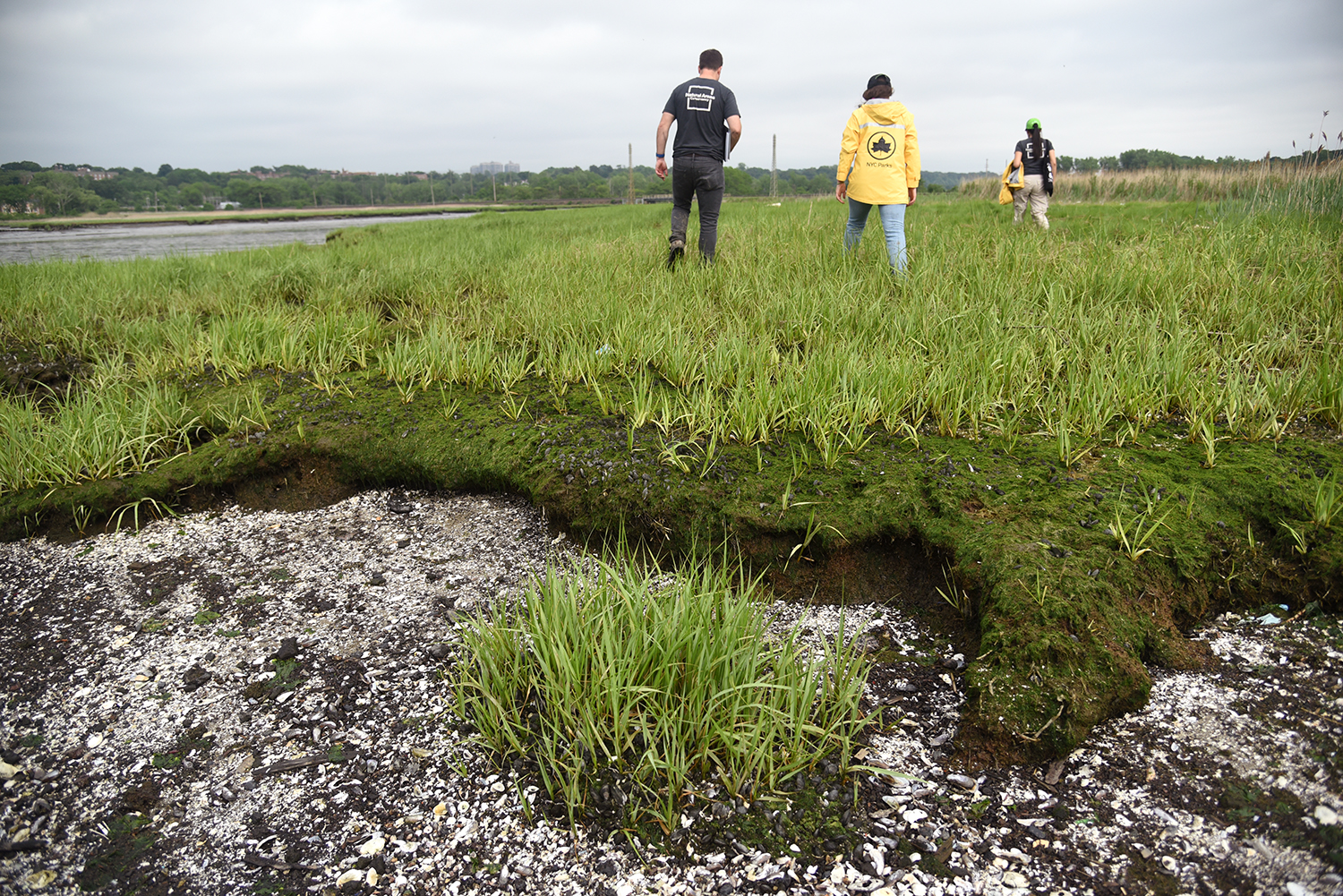
Out in the hummocky landscape of the salt marsh, native grasses and shrubs create an uneven ground cover, filled with mussels and clams. "It looks healthy, but not compared to 40 years ago," said Ong, who will be leading a walk through these wetlands on June 11.
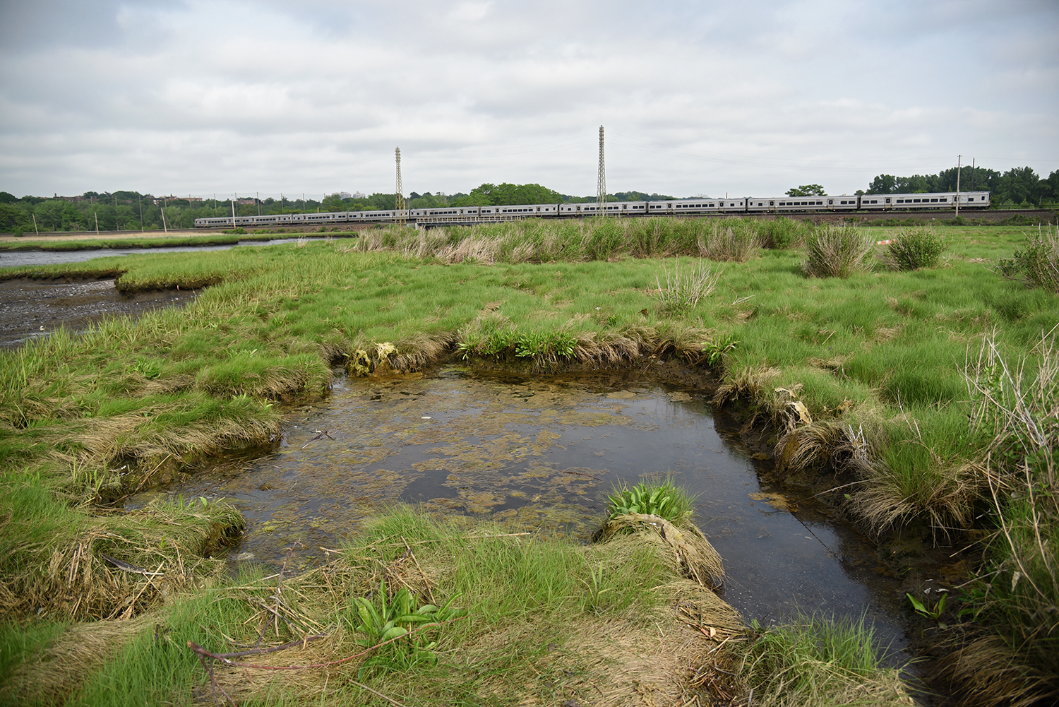
The Long Island Rail Road cuts through the landscape, which is also being eroded by several large ponds. "We are determining what ponds are new ponds, and will be returning them to marshlands. We want to keep the original pools," said Ong. "If we didn’t do anything, these pools would continue to grow and erode the marsh."
On the other side of the LIRR tracks, a clearer view of Alley Creek emerges, as it flows past eroded piers and the scant remains of Kiddy City, a long-vanished amusement park. "They told me it was like Coney Island, but the stench was horrible," said Yochanan D. John. "But now it’s beautiful."
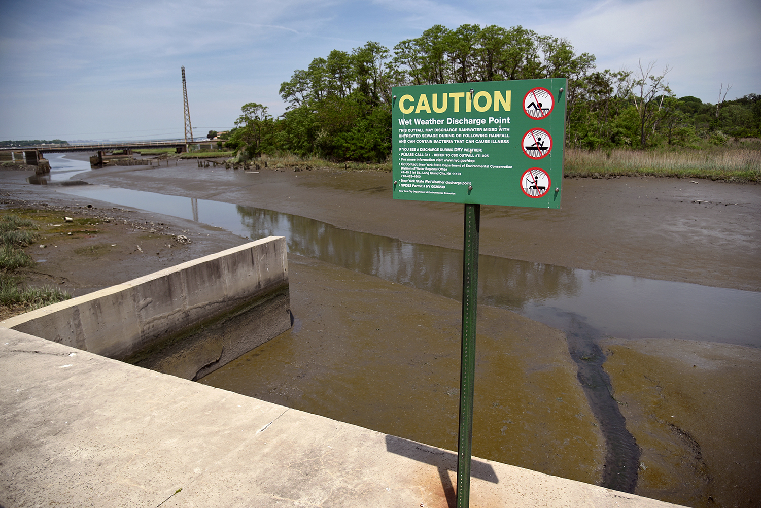
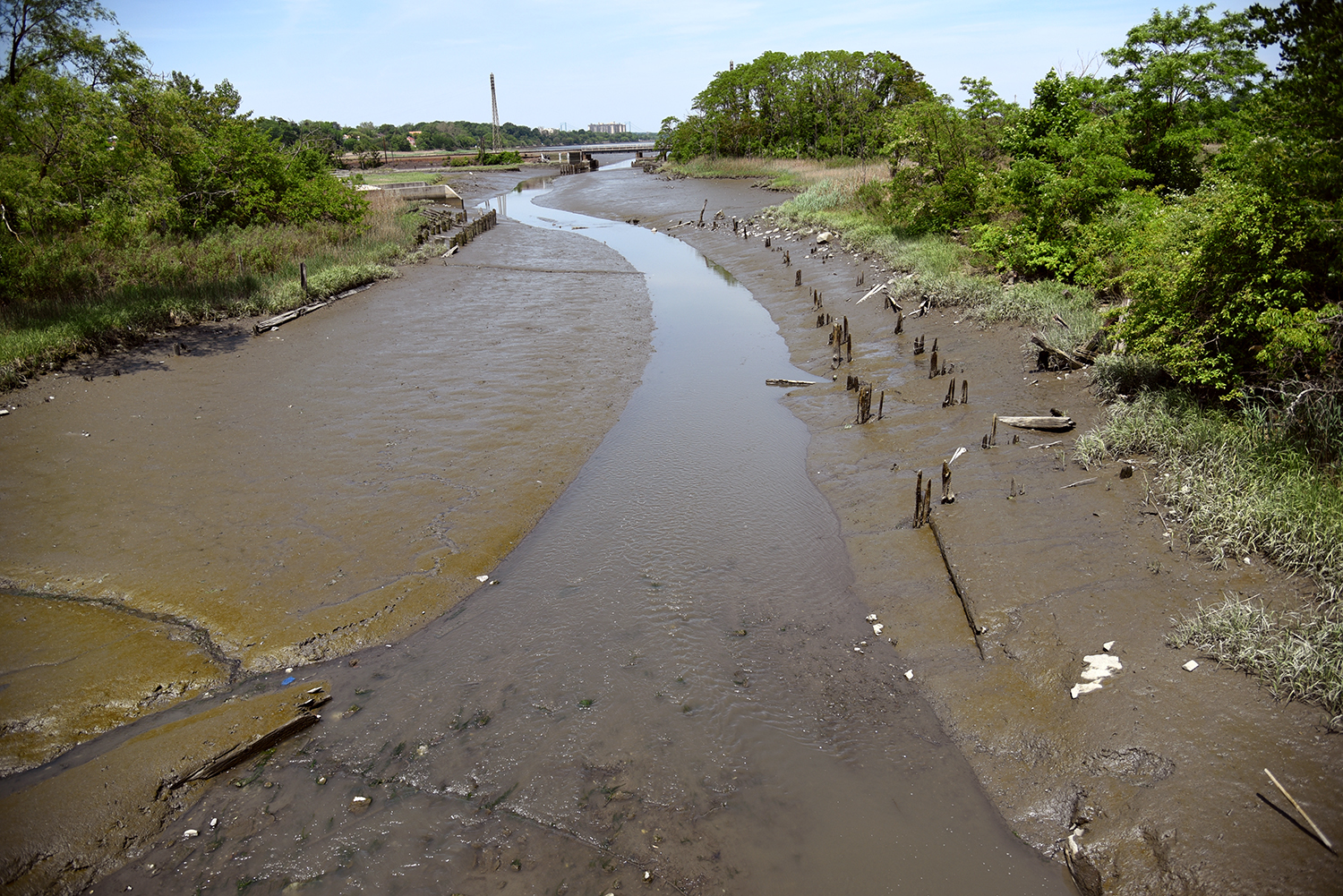
An enormous Combined Sewer Overflow (CSO) retention facility was completed in 2011 at the mouth of the creek, costing $130 million and holding 5 million gallons of sewage during rainstorms. The structure was built by the Department of Environmental Protection (DEP).
The water around the mouth of Alley Creek is murky with effluent, and at high tide, the CSO facility seems almost submerged. As part of this project, the DEP also undertook a $20 million wetlands restoration in a 16-acre portion of Alley Pond Park.
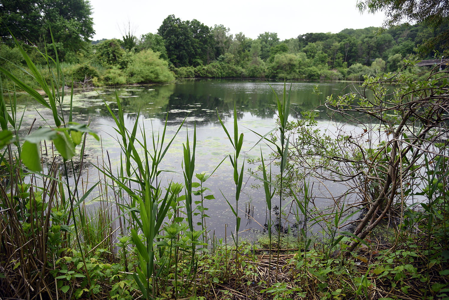
Further into the Alley Creek watershed, south of Northern Boulevard, the brackish tidal estuary opens up. "Into the early 1970s, this neglected area remained in horrific condition, subjected to a constant bombardment of dumping," according to the Alley Pond Environmental Center’s website.
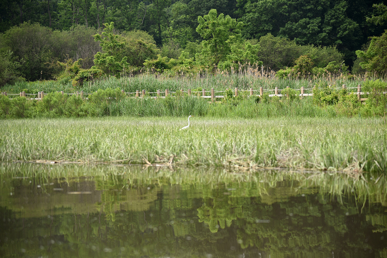
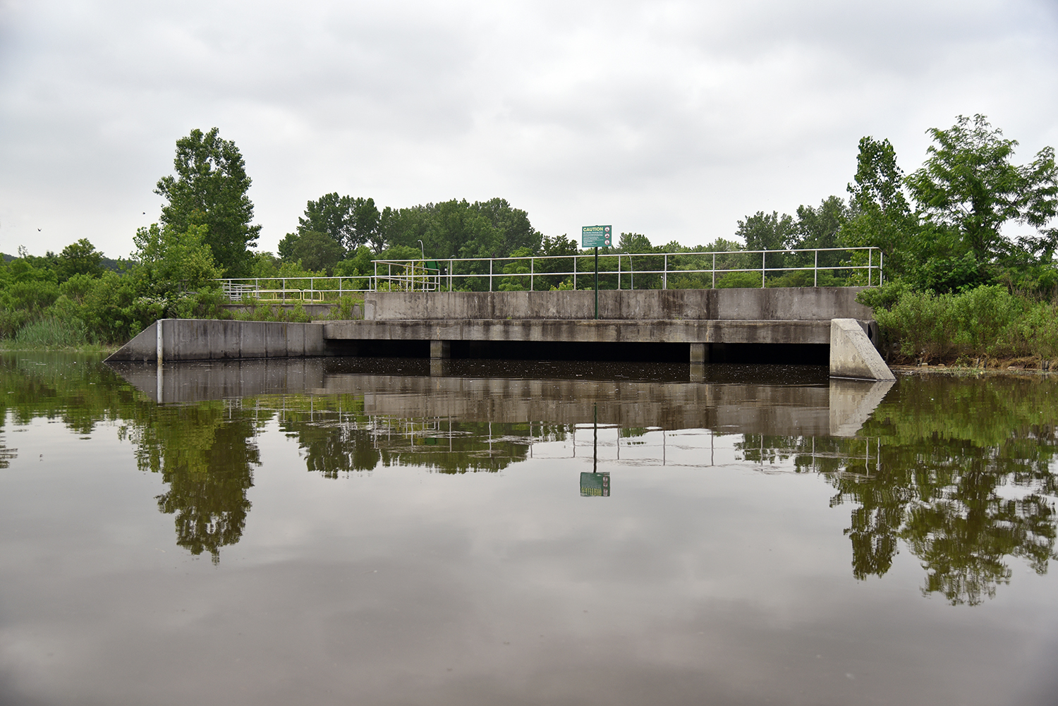
The environmental center was founded in 1972, and today, its boardwalk and trail system offers views of verdant forests, lively ponds, and numerous bird species who call the creek home. Another enormous sewer overflow outlet is located at the end of the boardwalk, and is used as a viewing platform by visitors.
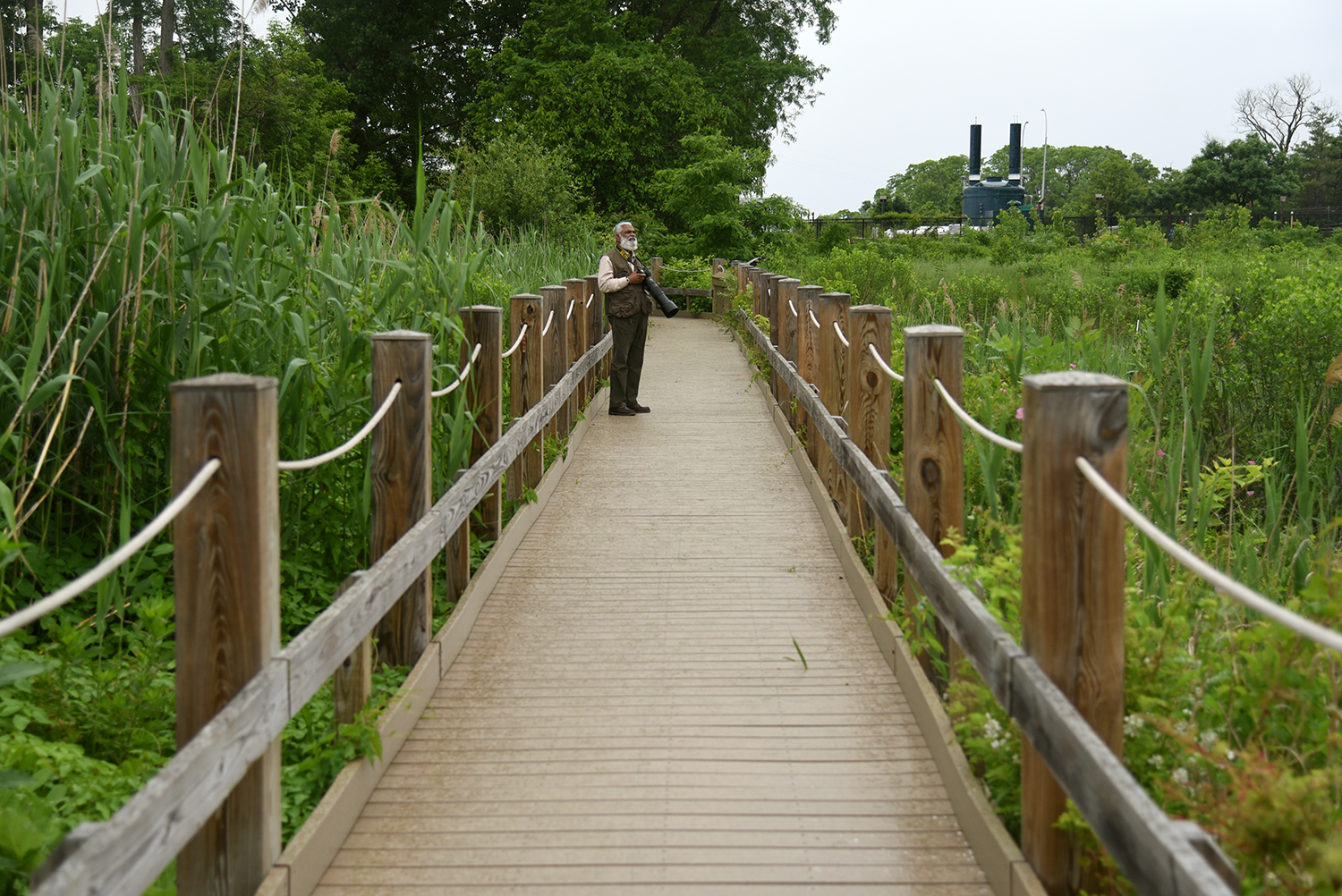
The boardwalk is popular with local birders and photographers. "I come here often—this is a favorite area," said John, who is a photographer and engineer. "Sometimes, I come here every day."
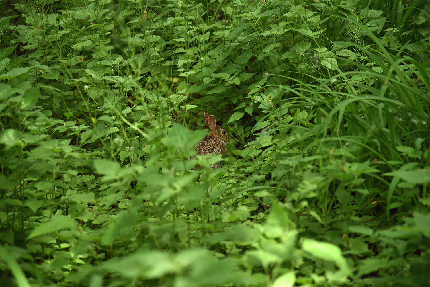
In the wildlife area near the boardwalk, raccoons, rabbits, and other animals have found a home. "We have cardinals, orioles, finches, bluejays, osprey," said John. "If you walk quietly, you will find turtles in the pond. And if you walk even quieter, muskrats."
Across the creek from the nature center, a forested area is being restored by the Natural Resources Group. "Our goals are definitely to increase biodiversity, and to introduce native trees and shrubs that can start a trajectory toward a healthy multi-story native forest," said Kristen King.
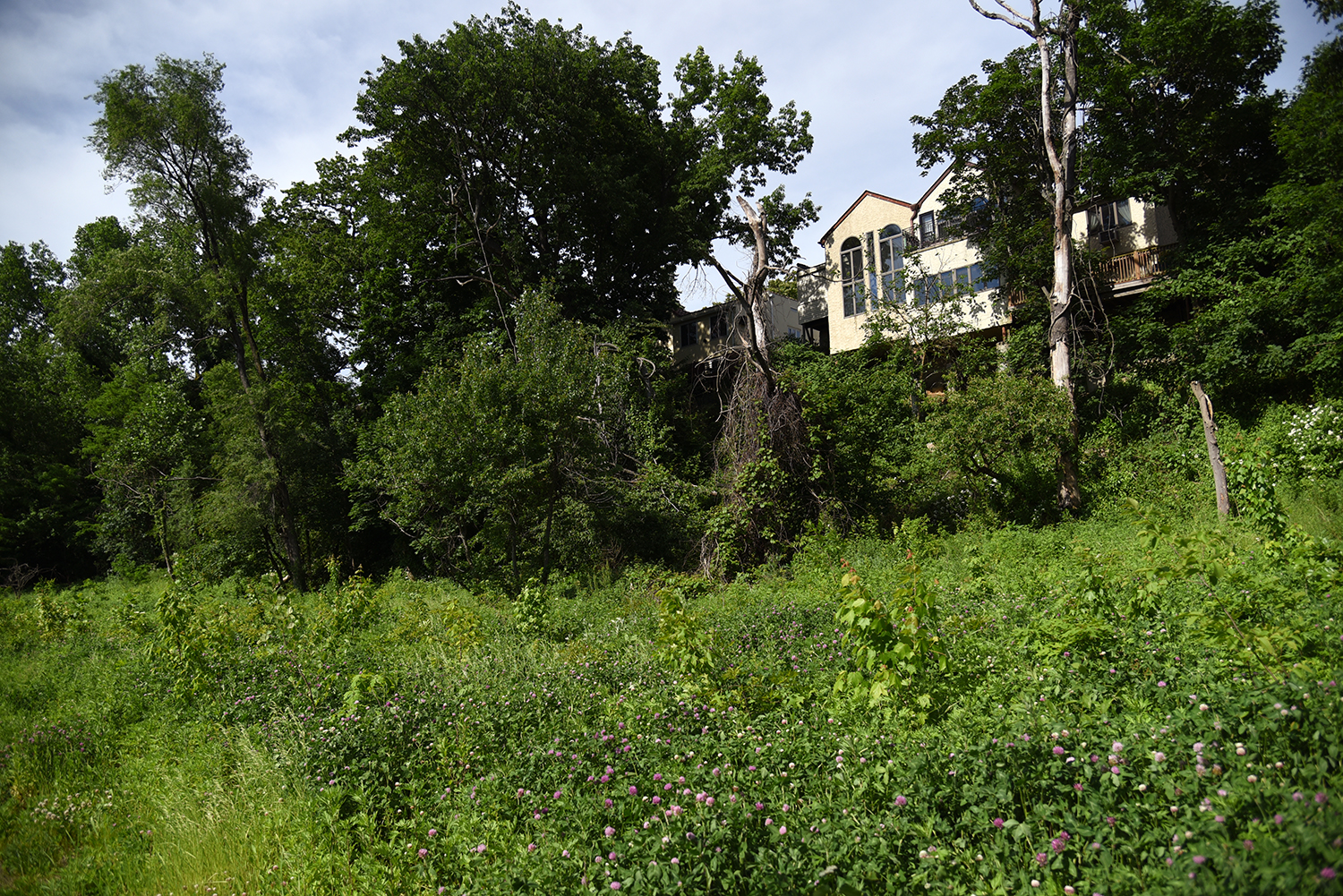
Several homes look out over Alley Pond Park here, and have stairways into the forested area. "I feel pretty strongly that people should feel comfortable accessing our natural spaces, because access leads to appreciation," said King. "Some of the neighbors of the park are stewards of the natural area, which we welcome."
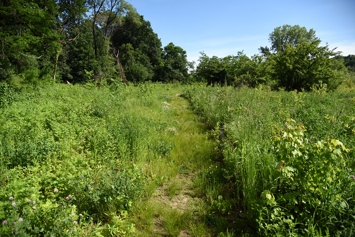
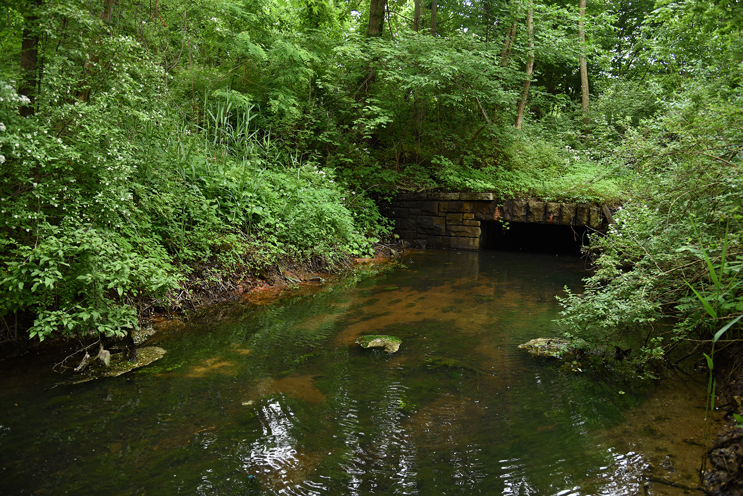
Back down at the watershed, the freshwater flow of Alley Creek is hidden among several different tributaries, and obscured behind invasive phragmites, seemingly impenetrable. However, the further upstream you travel from the sewage outlets, the less murky and pungent the water becomes.
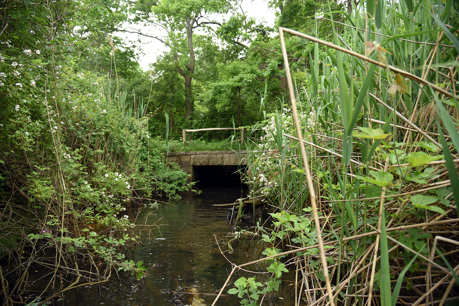
Pushing through the dense overgrowth, the source of Alley Creek’s flow into the tidal estuary suddenly appears: a three-foot-high culvert that travels underneath the Cross Island Parkway. The water flowing here is fresh, clear, and cool.
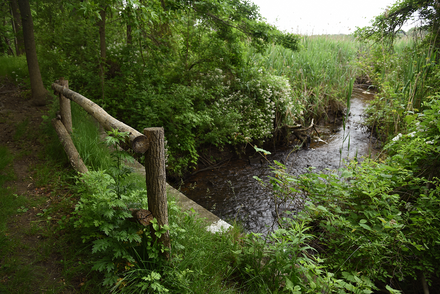
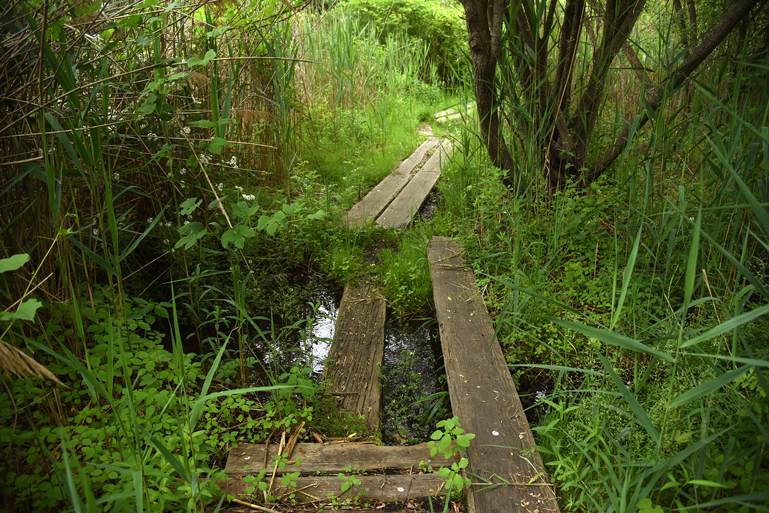
A grassy footpath also crosses above the creek and culvert here, leading hikers further into the Alley Creek watershed. It is part of the Douglas S. Mackay Wetland Nature Trail, a 1.3 mile hike created in 1992.
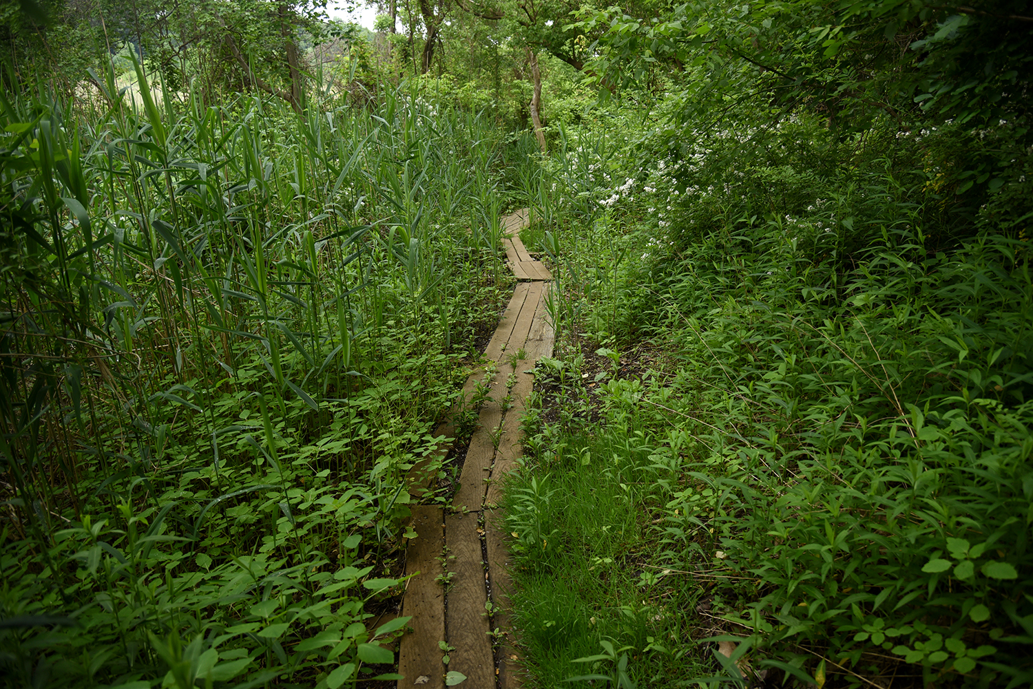
The trail is lined with fragrant wildflowers, and traverses the muddy terrain over rough-hewn board paths. It eventually connects to another obscure trail that leads hikers upstream towards the freshwater flow of Alley Creek.
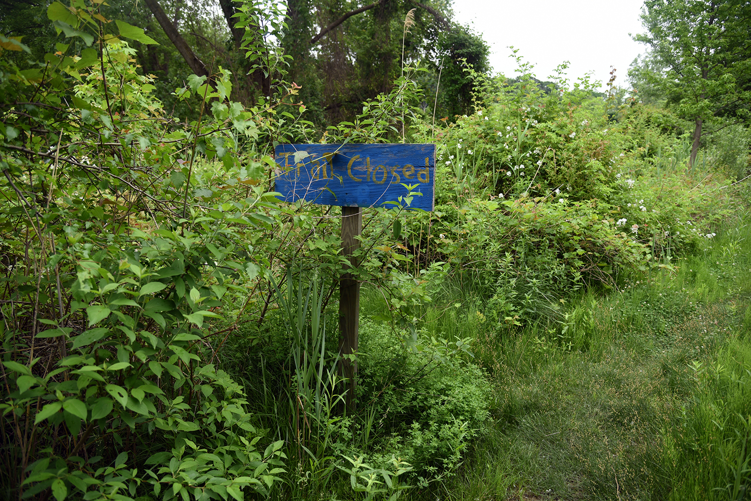
Deeper into the Alley Creek estuary, a handmade sign hints at an interesting detour. "This whole place is a huge, complicated network of water," said John. "But where is that water coming from?"
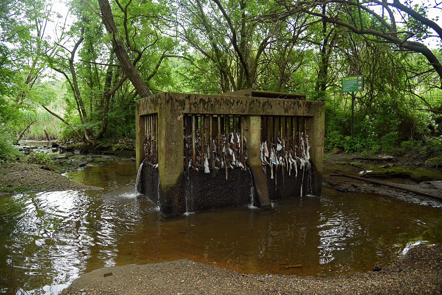
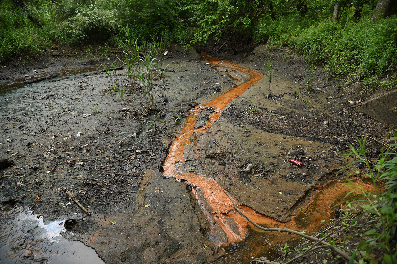
Down this side trail, a huge Combined Sewer Overflow outlet is situated in the freshwater flow of another Alley Creek tributary, with a constant stream of wastewater pouring out of its trash-filled cage, and flowing downstream towards Little Neck Bay. During a heavy rainstorm, a geyser of sewage must erupt here.
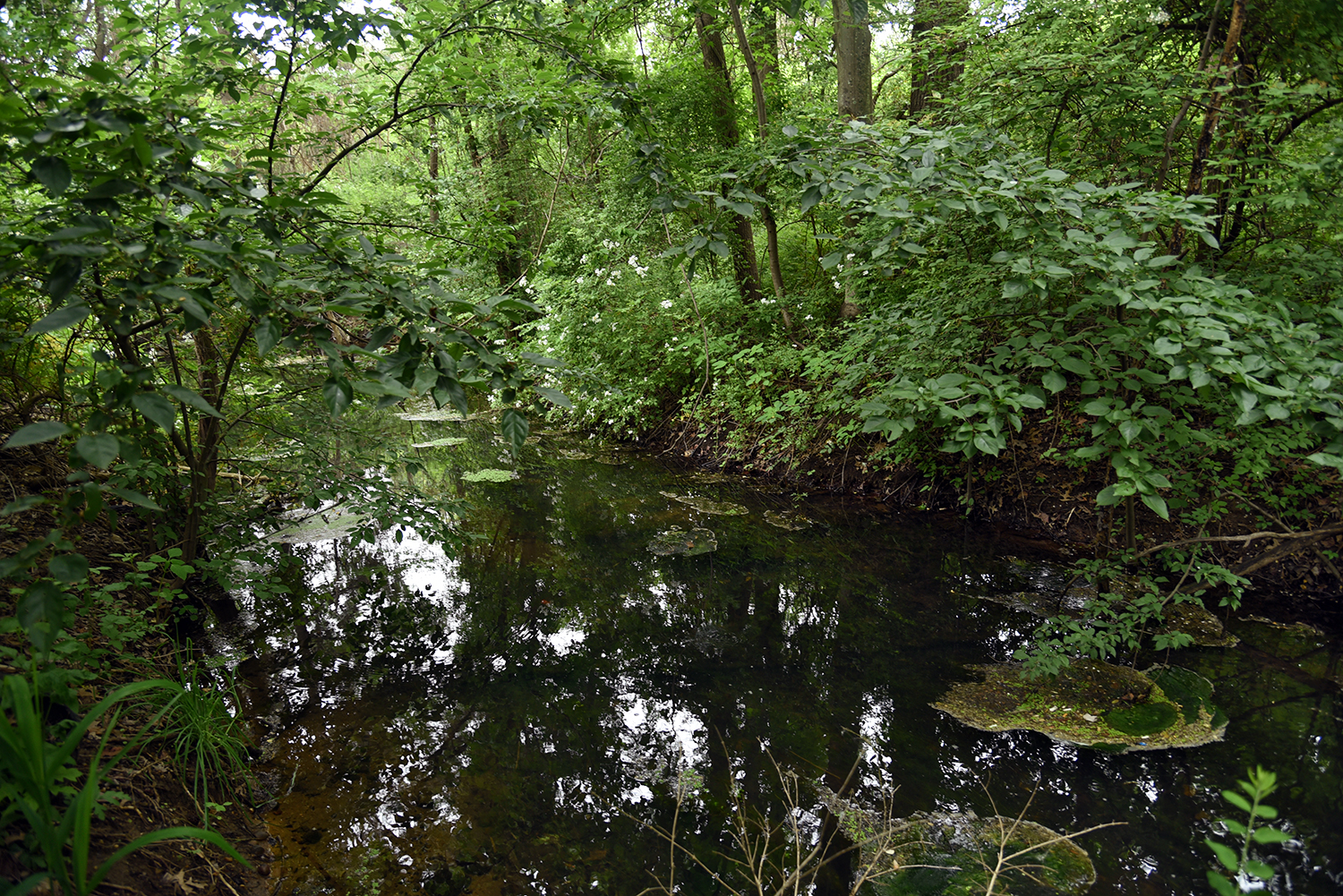
Upstream from this CSO, the freshwater tributary travels underneath board paths and through a seemingly healthy wetlands.
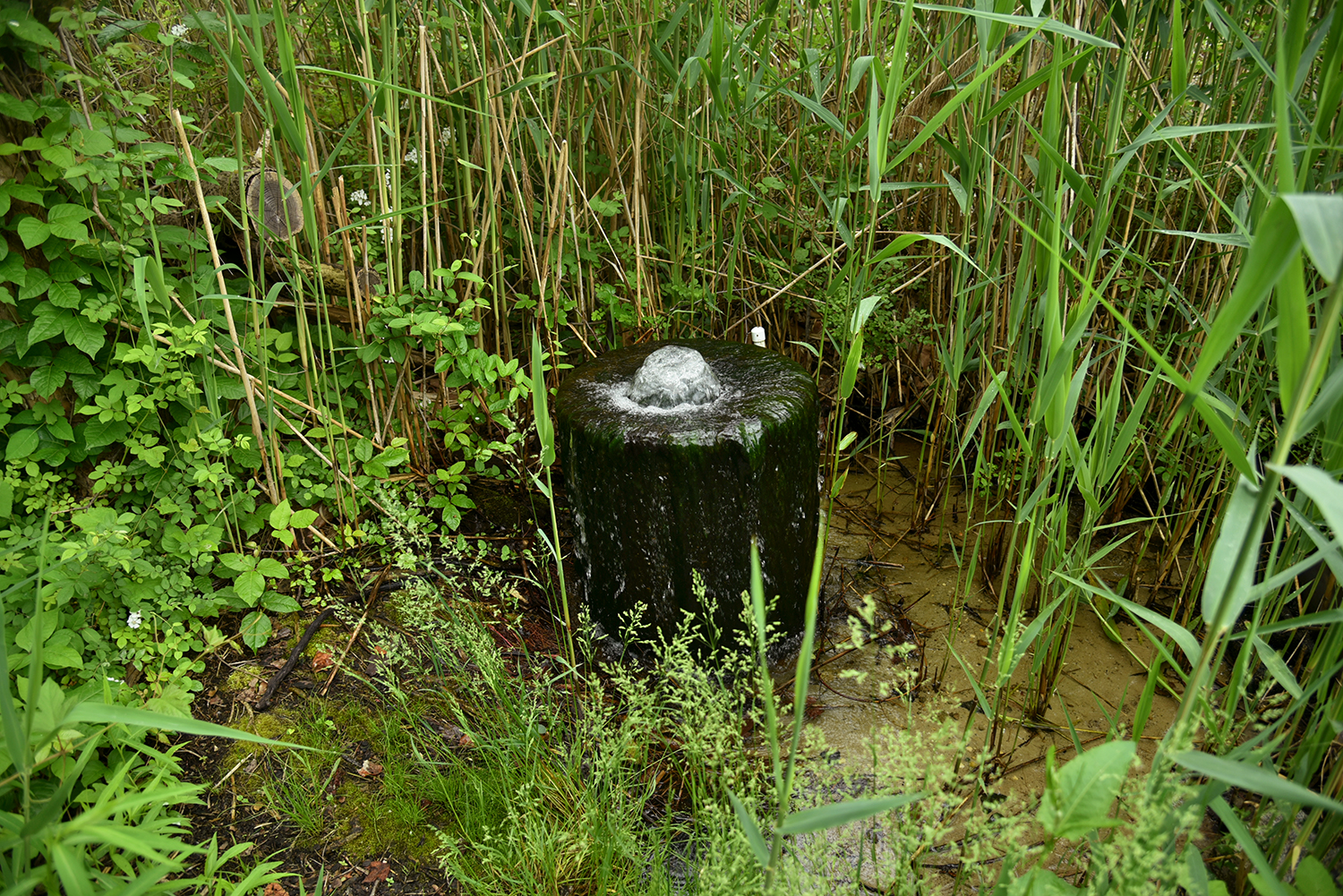
The source of this tributary of Alley Creek is an artesian well, bubbling over with clear, cold water. Several natural springs are located in Alley Pond Park, feeding into the creek’s watershed.
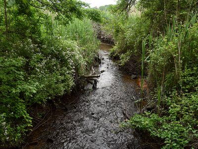
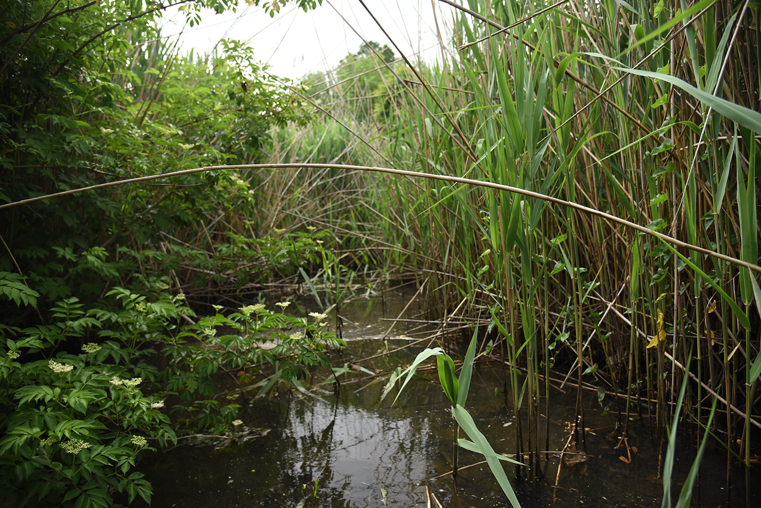
The main stream of Alley Creek, however, is hidden away in a densely overgrown area alongside the Cross Island Parkway. This seemingly natural landscape hides a system of storm drains and catch basins.
In the overgrowth immediately adjacent to the parkway, the main flow of Alley Creek finally appears, briefly, amid a thorny landscape not intended for human visitors.
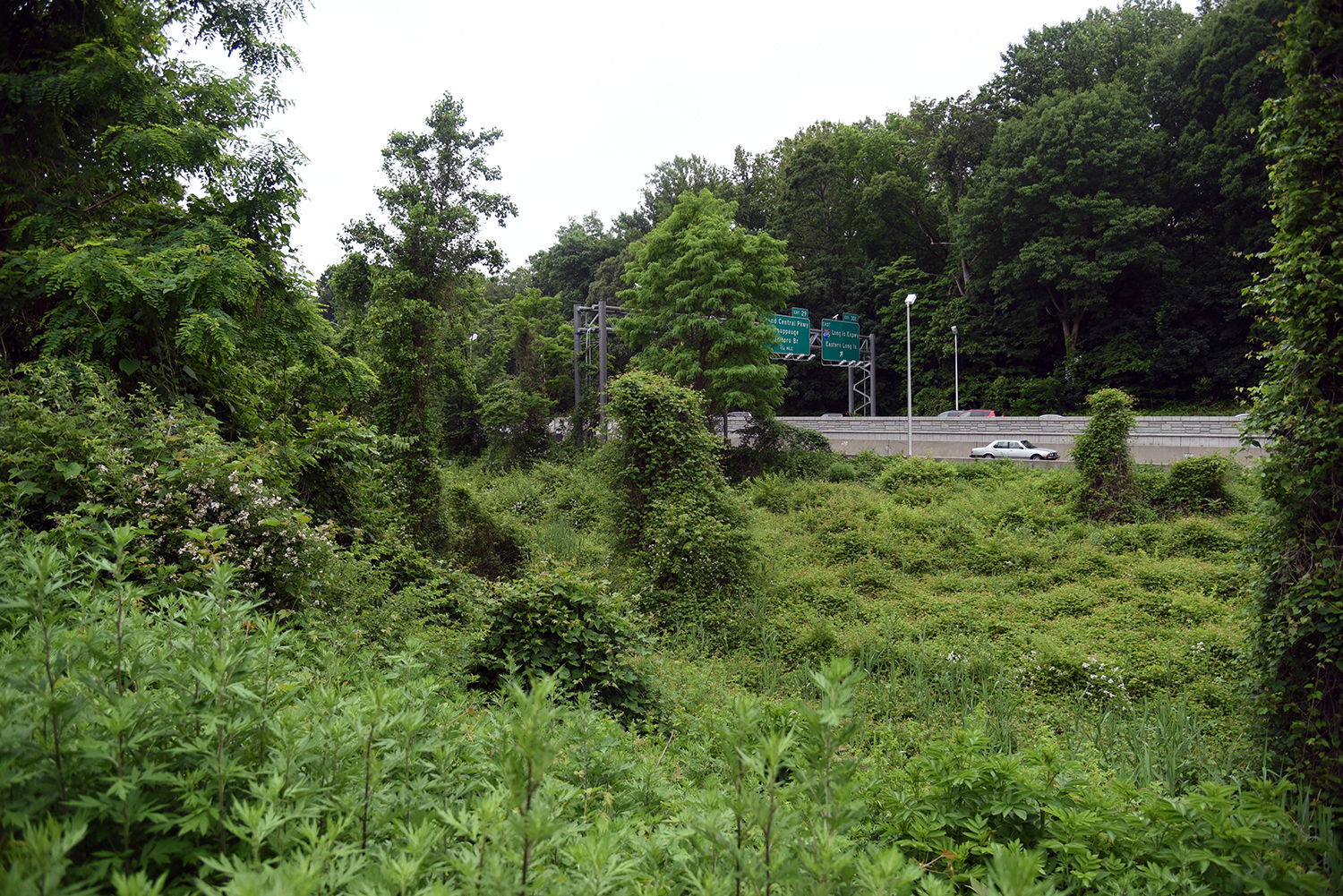
The creek’s upstream source is once again obscured by a culvert, this time traveling underneath the Long Island Expressway. Many sections of Alley Pond Park have been cut off and made unreachable by overpasses and off-ramps.
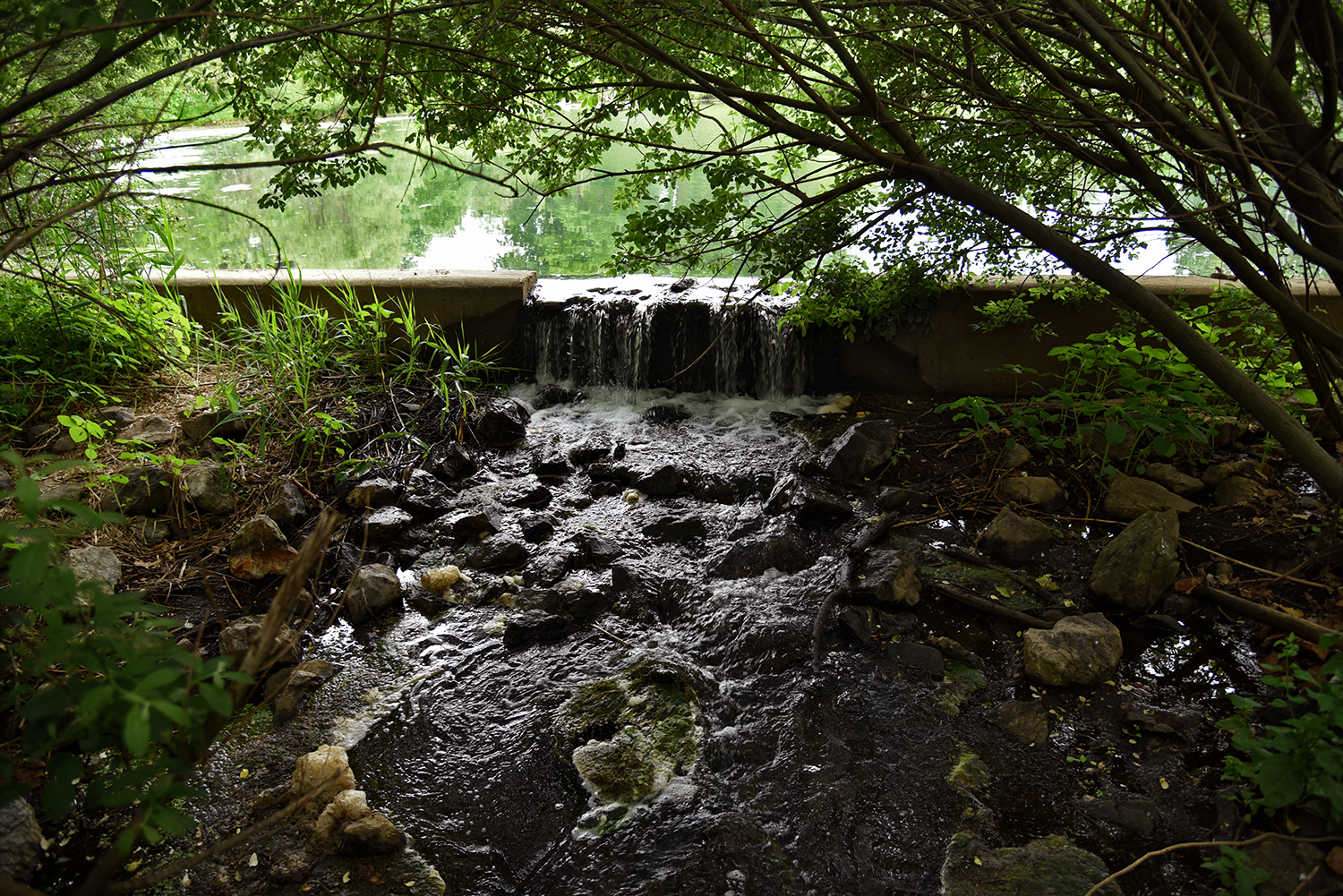
Tracking upstream, and back through Alley Creek’s long history, the main source of the waterway appears to be a waterfall flowing from Alley Pond itself. Up until recently, this once-natural pond had been completely filled in by sediment.
A restoration project by the NY State Department of Transportation dredged the pond in 2004, removing 65,000 tons of material and refilling it with water. The project also planted "over 40,000 native emergent species and bioremediation plantings" around its shores. The re-created Alley Pond still does not appear on many maps.
One of the upstream sources of Alley Pond is this small creek, which flows next to Douglaston Parkway, traveling through this catch basin before entering a culvert underneath West Alley Road and emptying into the pond.
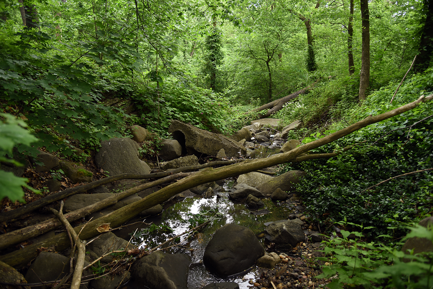
Tracking this creek upstream, it travels through a dry riverbed behind the Douglaston Pumping Station, and flows between a jumble of stones and downed trees parallel to the Douglaston Parkway, in another difficult-to-access natural area.
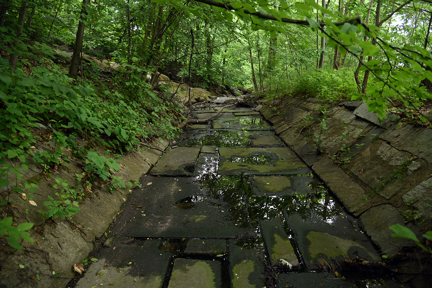
A gigantic stone streambed has been built in this upstream area, hinting at the massive flow that must come in rainstorms, although just a trickle of water was flowing this day. The creek’s main flow actually appears above this structure, in a rocky jumble emerging from the Cross Island Parkway.
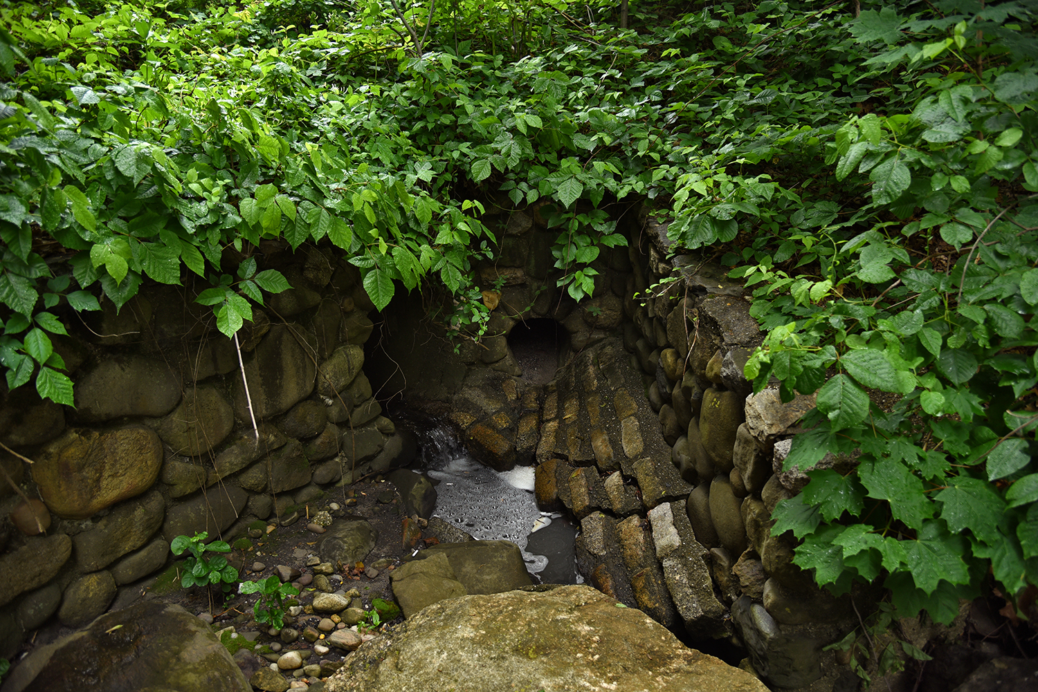
Here at the top of the rock pile, the source of this freshwater creek is once again obscured. A strong and steady flow emerges from an aging side tunnel, which again crosses underneath the Cross Island Parkway, perhaps flowing out from the ice-age kettle ponds of Alley Pond Park, a 15,000-year-old landscape shaped by the Laurentide ice sheet.
Nathan Kensinger is a photographer, filmmaker, and curator who has been documenting New York City's abandoned edges, endangered neighborhoods, and post-industrial waterfront for more than a decade. His Camera Obscura photo essays have appeared on Curbed since 2012.
from
http://ny.curbed.com/2016/6/9/11891372/nyc-parks-alley-creek-queens-photo-essay
No comments:
Post a Comment